MyTopo
Classic USGS Wildhorse Pass Nevada 7.5'x7.5' Topo Map
Regular price
$16.95
Regular price
Sale price
$16.95
Unit price
per
Couldn't load pickup availability
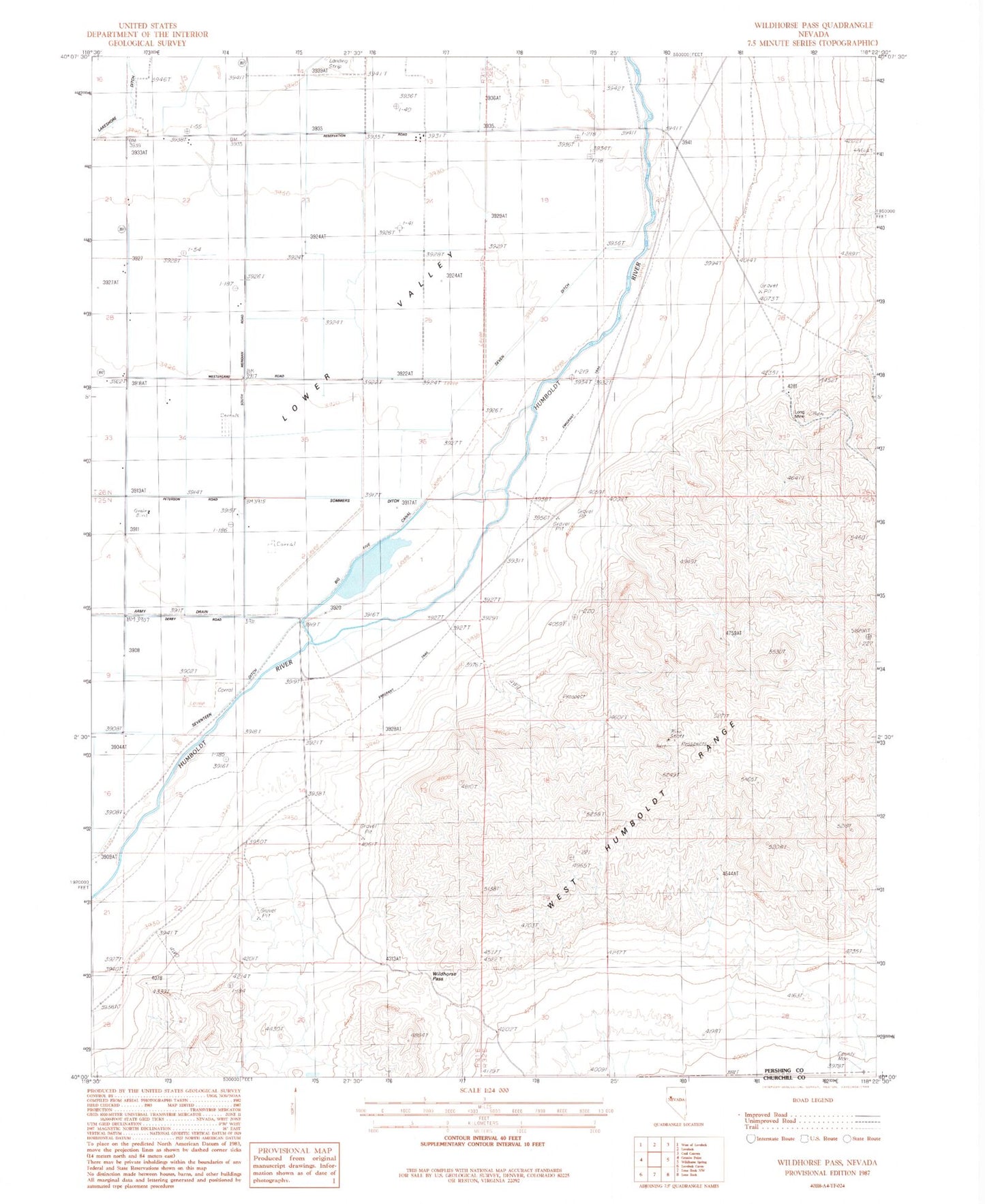
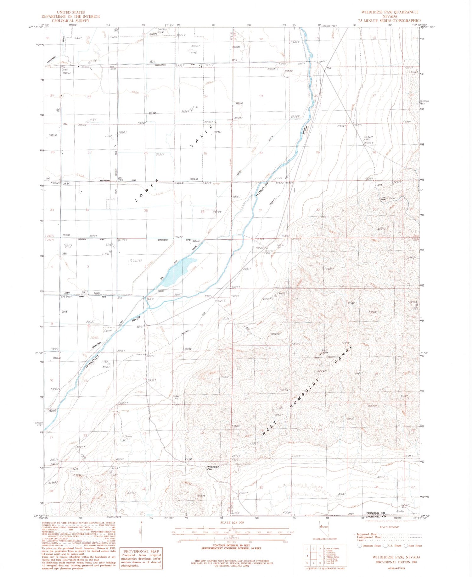
Historical USGS topographic quad map of Wildhorse Pass in the state of Nevada. Map scale may vary for some years, but is generally around 1:24,000. Print size is approximately 24" x 27"
This quadrangle is in the following counties: Churchill, Pershing.
The map contains contour lines, roads, rivers, towns, and lakes. Printed on high-quality waterproof paper with UV fade-resistant inks, and shipped rolled.
Contains the following named places: Big Five Canal, Big Five Dam, Big Five Reservoir, Cottonwood Ranch, Goodview Mine, Long Mine, Old California Trail, Seven Ditch, Seventeen Ditch, Sommers Ditch, Tule Ranch, Wildhorse Pass