MyTopo
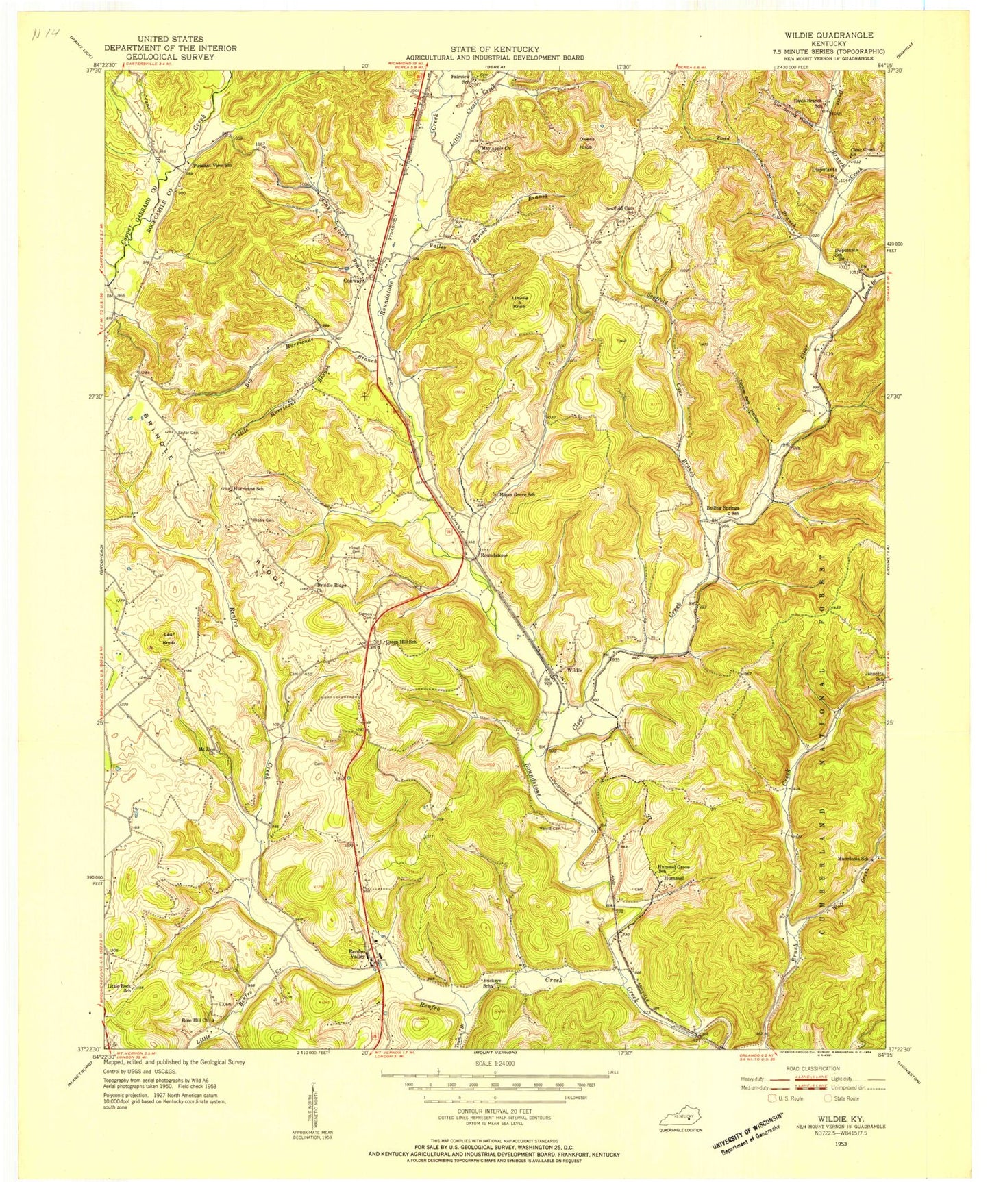
Classic USGS Wildie Kentucky 7.5'x7.5' Topo Map
Couldn't load pickup availability
Historical USGS topographic quad map of Wildie in the state of Kentucky. Map scale may vary for some years, but is generally around 1:24,000. Print size is approximately 24" x 27"
This quadrangle is in the following counties: Garrard, Rockcastle.
The map contains contour lines, roads, rivers, towns, and lakes. Printed on high-quality waterproof paper with UV fade-resistant inks, and shipped rolled.
Contains the following named places: Big Hurricane Branch, Brindle Ridge, Brindle Ridge Baptist Church, Brindle Ridge Volunteer Fire Department, Brush Creek, Buckeye Church, Clay Lick Branch, Clear Creek, Clear Creek Church, Conway, Conway Division, Conway Railroad Station, Cove School, Crane Branch, Crawford Airport, Davis Branch, Disputanta, Fairview Church, Hummel, Johnetta School, Kentucky Music Hall of Fame and Museum, Lake Linville, Langford Railroad Station, Lear Knob, Linville Knob, Little Clear Creek, Little Hurricane Branch, Little Renfro Creek, Loman Branch, May Apple Church, Merritt Cemetery, Mount Zion Church, New Testament Church, North Fork Copper Creek, Owens Knob, Renfro Creek, Renfro Valley, Renfro Valley Barn Dance and Pioneer Museum, Riddle Cemetery, Rimmel Cemetery, Rose Hill Church, Roundstone, Roundstone Railroad Station, Salt Spring Hollow, Saylor Cemetery, Scaffold Cane Branch, Scaffold Cane Church, Sigmon Cemetery, Snider Switch Station, Todd Branch, Town Branch, Travis Todds Tannery, Turkey Pen Hollow, Union Chapel, Valley Spring Branch, Wards Railroad Station, Wildie, Wildie Post Office, Wolf Creek, WRVK-AM (Mount Vernon)