MyTopo
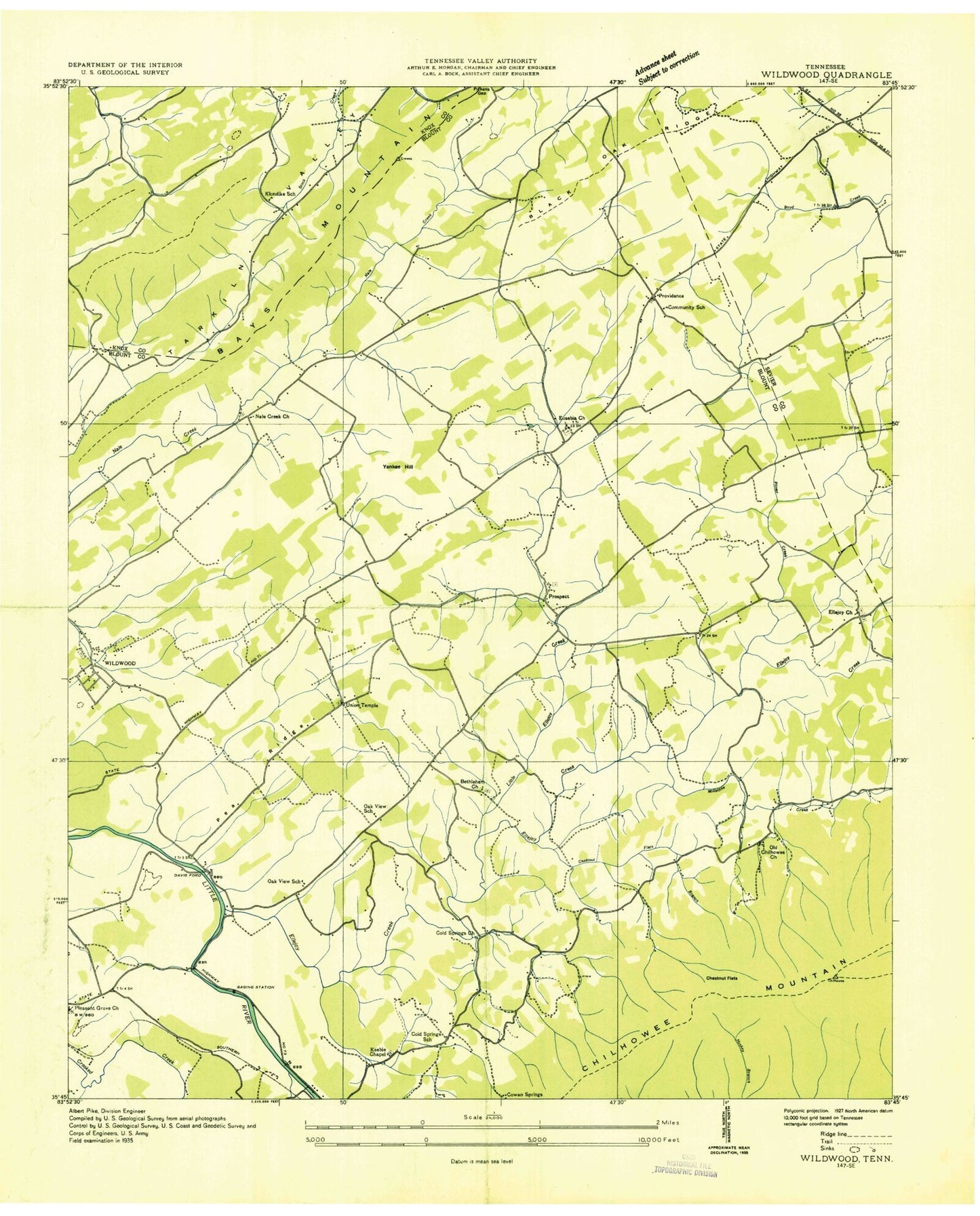
Classic USGS Wildwood Tennessee 7.5'x7.5' Topo Map
Couldn't load pickup availability
Historical USGS topographic quad map of Wildwood in the state of Tennessee. Map scale may vary for some years, but is generally around 1:24,000. Print size is approximately 24" x 27"
This quadrangle is in the following counties: Blount, Knox, Sevier.
The map contains contour lines, roads, rivers, towns, and lakes. Printed on high-quality waterproof paper with UV fade-resistant inks, and shipped rolled.
Contains the following named places: Bays Mountain Country Club, Bays Mountain Estates, Bayview, Bethel Methodist Church, Bethlehem Cemetery, Bethlehem Methodist Church, Blackoak Ridge, Blount County Fire Protection District Station 7, Camp Chilhowee, Cedar Grove Baptist Church, Cedar Grove Cemetery, Chestnut Flats, Chestnut Flats Branch, Chilhowee Mountain, Cold Springs, Cold Springs Cemetery, Cold Springs Church, Cold Springs School, Community School, Cowan Springs, Crooked Creek, Davis Ford, Elajay, Ellejoy, Ellejoy Baptist Church, Ellejoy Baptist Church Cemetery, Ellejoy Creek, Ellejoy Valley, Eusebia Cemetery, Eusebia Presbyterian Church, Fairfield, Gambles Fort, Headrick Cemetery, Heritage High School, Heritage Vocational School, Huskey Valley, Into the Wind Airport, Keebles Chapel Baptist Church, Keebles Chapel Cemetery, Klondike School, Little Ellejoy Creek, Logans Chapel Cemetery, Logans Chapel Methodist Church, McCammon Cemetery, McTeers Fort, Millstone Creek, Millstone Gap Lookout Tower, Mountcastle Methodist Church, Murray Gap, Nails Creek Cemetery, Newcastle Presbyterian Church, Newell Station, Oak View, Oak View Cemetery, Oak View Church, Oak View Community Center, Oak View School, Old Chilhowee, Old Chilhowee Church, Old Chilhowee School, Pitner Creek, Pleasant Grove Baptist Church, Porter Elementary School, Porter High School, Prospect, Prospect Baptist Church, Prospect Cemetery, Prospect Junior High School, Providence, Red Mountain, Rhea Cemetery, Rhea Gap, Rocky Branch, Seymour Air Park, Seymour Volunteer Fire Department Station 4, Tarklin Valley Church, Tipton Hollow, Union Temple, Union Temple Cemetery, Wildwood, Wildwood Census Designated Place, Wildwood Division, Wildwood School, Yankee Hill


