MyTopo
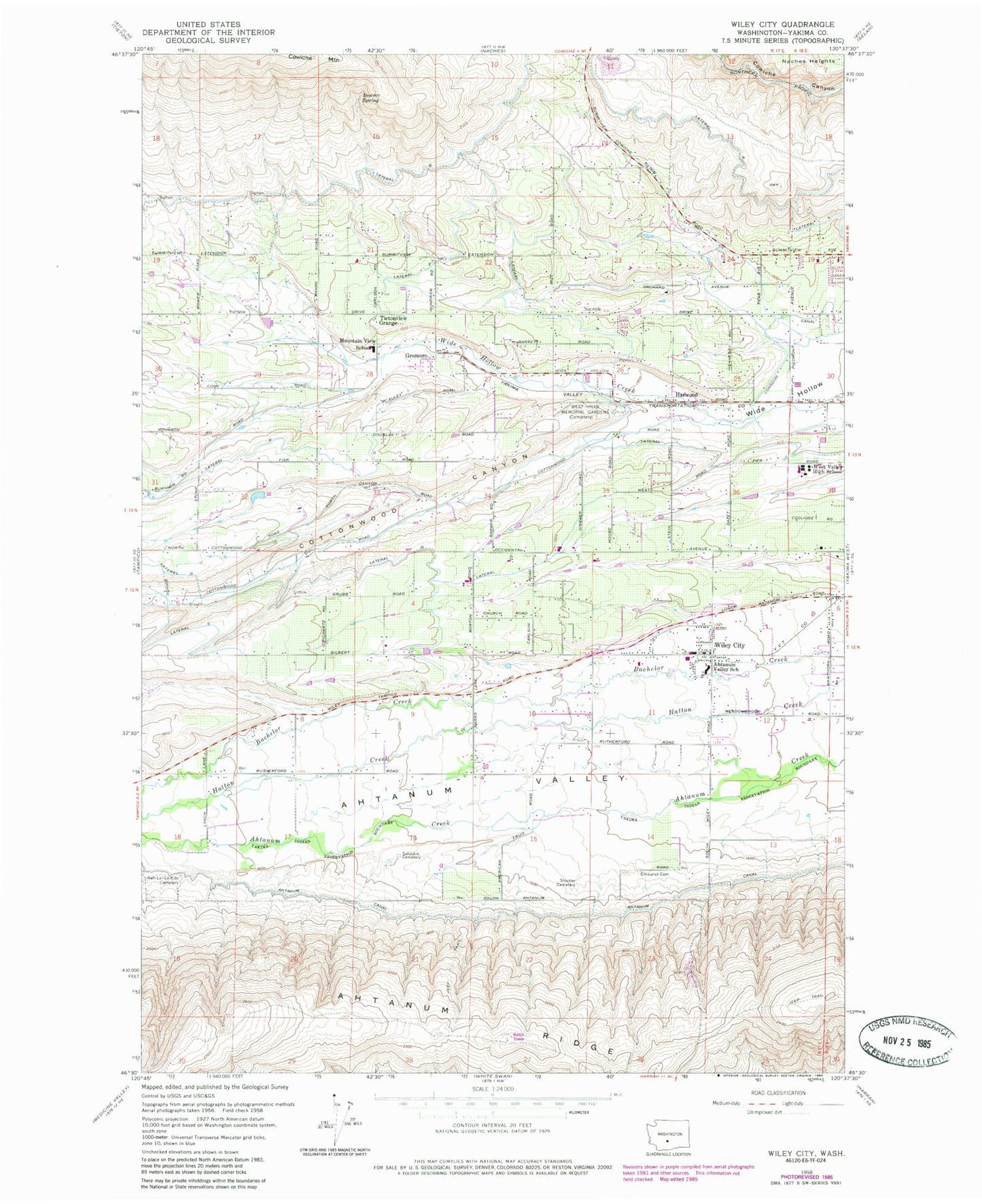
Classic USGS Wiley City Washington 7.5'x7.5' Topo Map
Couldn't load pickup availability
Historical USGS topographic quad map of Wiley City in the state of Washington. Map scale may vary for some years, but is generally around 1:24,000. Print size is approximately 24" x 27"
This quadrangle is in the following counties: Yakima.
The map contains contour lines, roads, rivers, towns, and lakes. Printed on high-quality waterproof paper with UV fade-resistant inks, and shipped rolled.
Contains the following named places: Ahtanum Canal, Ahtanum Valley Elementary School, Bowser Spring, Cottonwood Canyon, Cottonwood Elementary School, Elliott Ave, Emeunot Cemetery, Gromore, Harwood, Henrybro, Lateral K, Lateral N, Lateral P, Lateral R, Lateral S, Lateral T, Mountainview Elementary School, Parker Reservoir, Parker Reservoir Dam, Popejoy Orchard, Saluskin Cemetery, Sloutier Cemetery, Summitview, Summitview Census Designated Place, Swanson Orchards, Tietonview Grange, Wah - Lal - La - Kite Cemetery, West Hills Memorial Gardens, West Valley Fire - Rescue Station 51, West Valley Fire - Rescue Station 52, West Valley Fire - Rescue Station 53, West Valley High School, Wiley City, Wilkinson Ranch Airport, ZIP Code: 98908