MyTopo
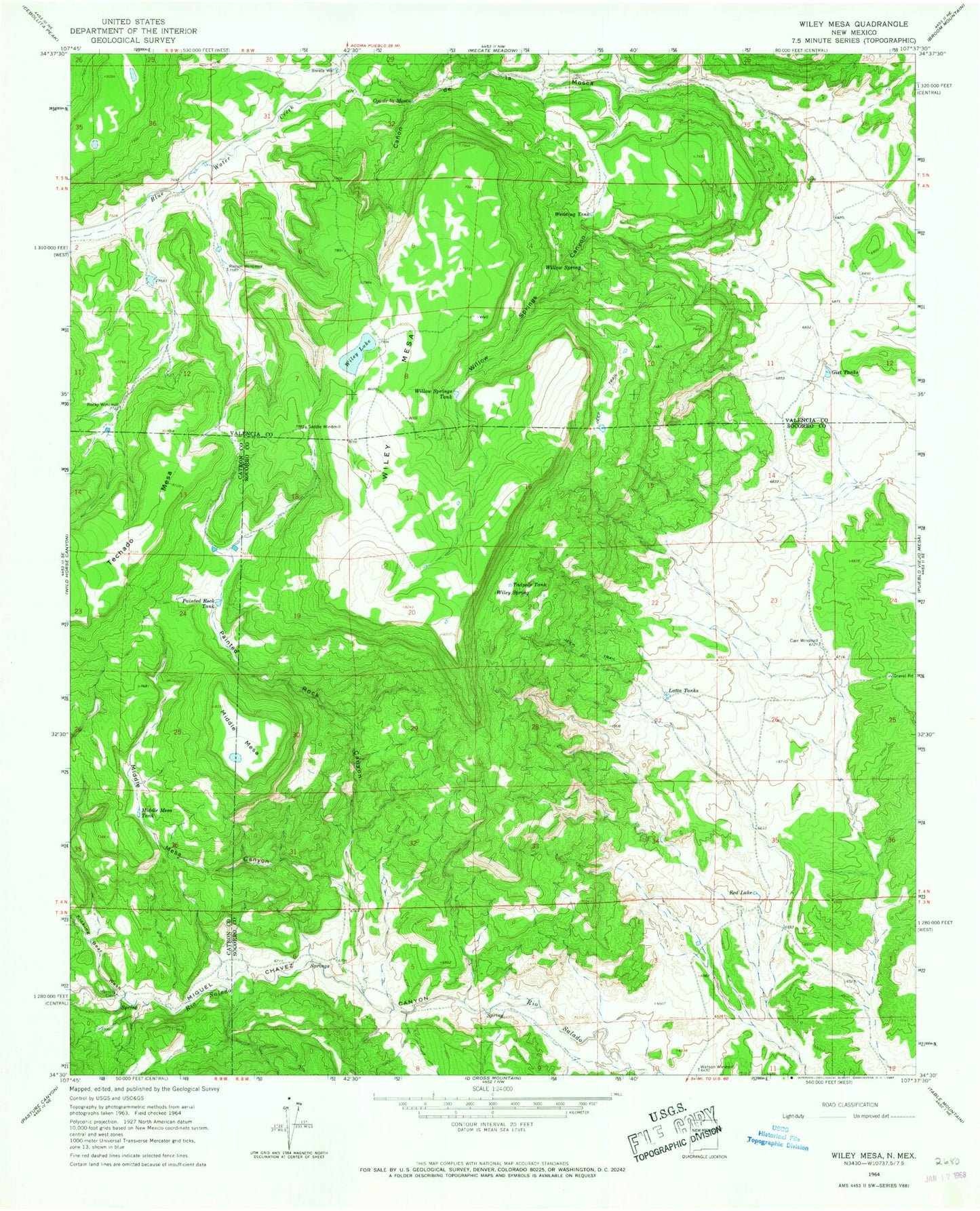
Classic USGS Wiley Mesa New Mexico 7.5'x7.5' Topo Map
Couldn't load pickup availability
Historical USGS topographic quad map of Wiley Mesa in the state of New Mexico. Map scale may vary for some years, but is generally around 1:24,000. Print size is approximately 24" x 27"
This quadrangle is in the following counties: Catron, Cibola, Socorro.
The map contains contour lines, roads, rivers, towns, and lakes. Printed on high-quality waterproof paper with UV fade-resistant inks, and shipped rolled.
Contains the following named places: Barela Water Well, Barela Well, Carr Windmill, Gist Tanks, Karr Windmill Water Well, Kicking Bear Wash, La Mosca Water Well, Latta Tanks, Manning Cabin, Middle Mesa, Middle Mesa Canyon, Middle Mesa Tank, Ojo de la Mosca, Painted Rock Canyon, Painted Rock Tank, Red Lake, Rincon Water Well, Rincon Windmill, S O B Water Well, Saddle Windmill, Saddle WM Water Well, Tadpole Tank, Watson Windmill, Watson Windmill Water Well, Wedding Tank, Wiley Lake, Wiley Mesa, Wiley Spring, Willow Spring, Willow Springs Canyon, Willow Springs Tank, Wylie Spring