MyTopo
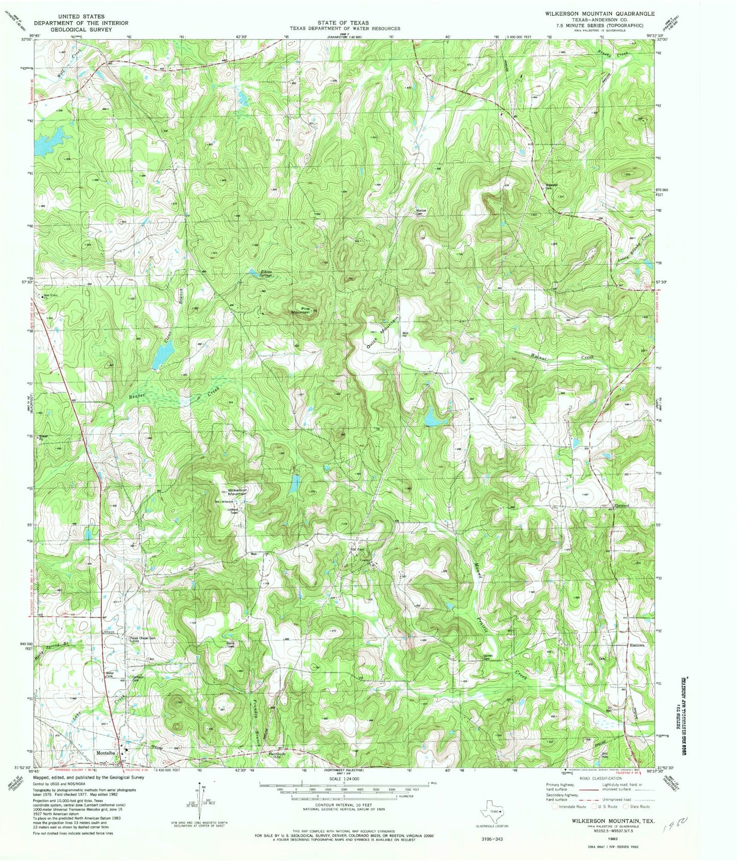
Classic USGS Wilkerson Mountain Texas 7.5'x7.5' Topo Map
Couldn't load pickup availability
Historical USGS topographic quad map of Wilkerson Mountain in the state of Texas. Map scale may vary for some years, but is generally around 1:24,000. Print size is approximately 24" x 27"
This quadrangle is in the following counties: Anderson.
The map contains contour lines, roads, rivers, towns, and lakes. Printed on high-quality waterproof paper with UV fade-resistant inks, and shipped rolled.
Contains the following named places: Beaver Marsh, Bois D' Arc Church, Briar Lakes Ranch Airport, Concord Church, Elmtown, Elmwood, Elmwood Volunteer Fire Department, Evergreen Marsh, Hopewell Cemetery, John B Jones Lake, John B Jones Lake Dam, Montalba, Montalba Post Office, Montalba Volunteer Fire Department, Pine Mountain, ZIP Code: 75803