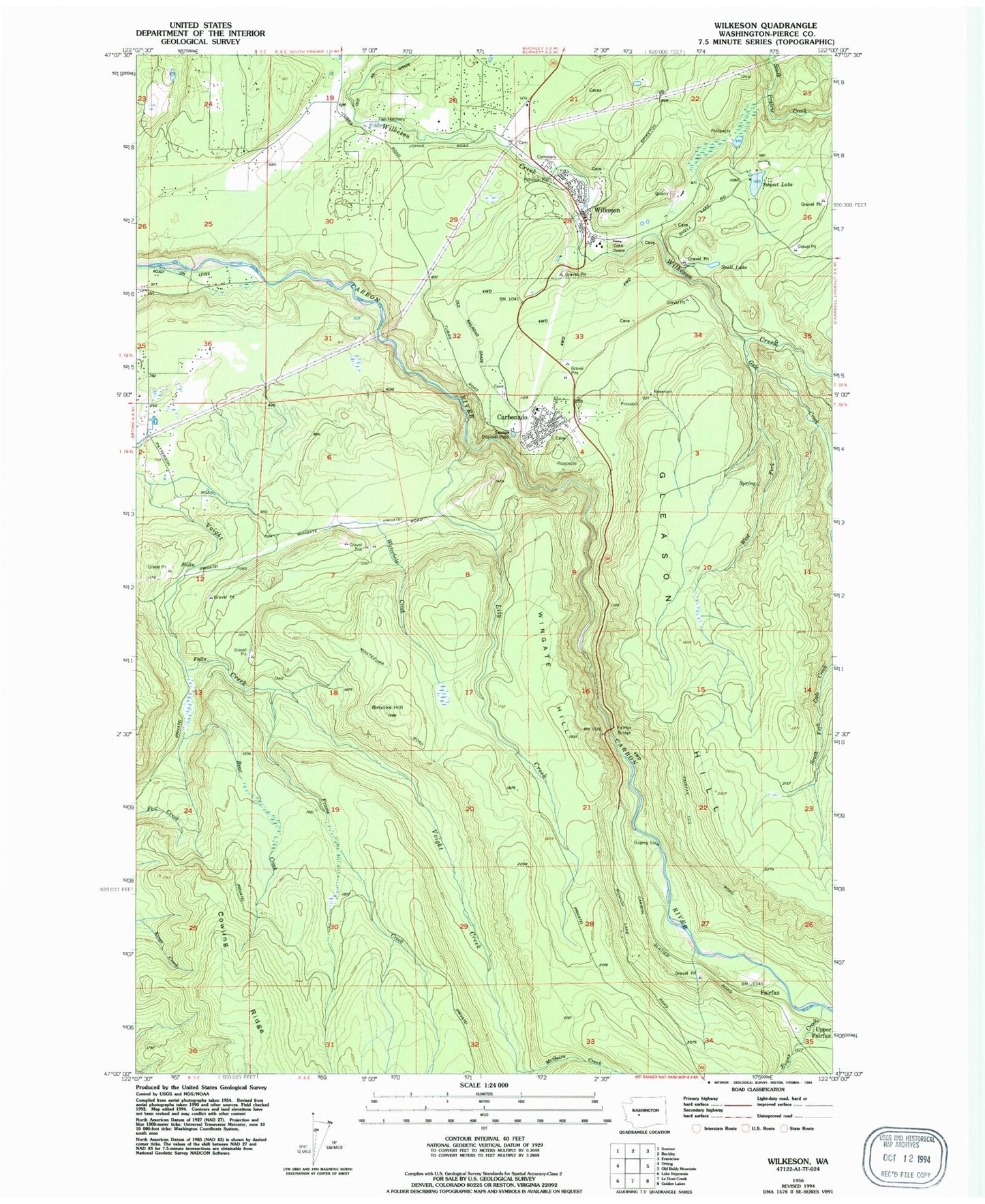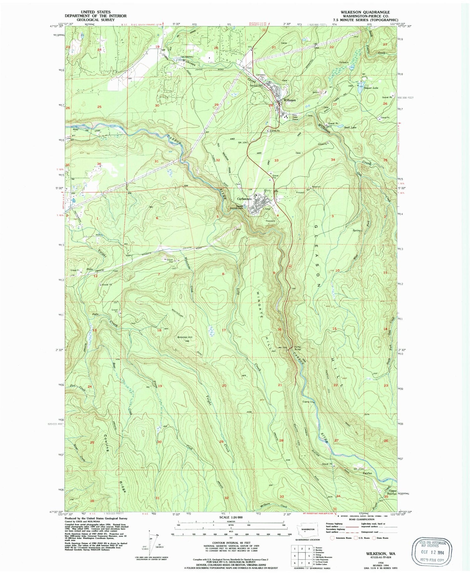
MyTopo
Classic USGS Wilkeson Washington 7.5'x7.5' Topo Map
Couldn't load pickup availability
Historical USGS topographic quad map of Wilkeson in the state of Washington. Map scale may vary for some years, but is generally around 1:24,000. Print size is approximately 24" x 27"
This quadrangle is in the following counties: Pierce.
The map contains contour lines, roads, rivers, towns, and lakes. Printed on high-quality waterproof paper with UV fade-resistant inks, and shipped rolled.
Contains the following named places: Bear Creek, Brooks Hill, Carbonado, Carbonado Fire Department, Carbonado Historical School 19, Carbonado Post Office, Carbonado Sewage Treatment Plant, Cowling Ridge, Crocker Census Designated Place, East Pierce Fire Protection District 22 East Pierce Fire and Rescue Station 110 Wilkeson, Electron Lookout, Evans Creek, Fairfax, Fairfax Bridge, Frame Creek, Gale Creek, Gleason Hill, Kepka Fishing Pond, Kepka Lake Dam, Lily Creek, McGuire Creek, Page Creek, Snell Lake, Sunset Lake, Sunset Lake Dam, Town of Carbonado, Town of Wilkeson, Upper Fairfax, Waterhole Creek, West Fork Gale Creek, Wilkeson, Wilkeson Elementary School, Wilkeson Post Office, Wilkeson Sewage Treatment Plant, Wilkeson Town Police Department, Wingate Hill, ZIP Code: 98396