MyTopo
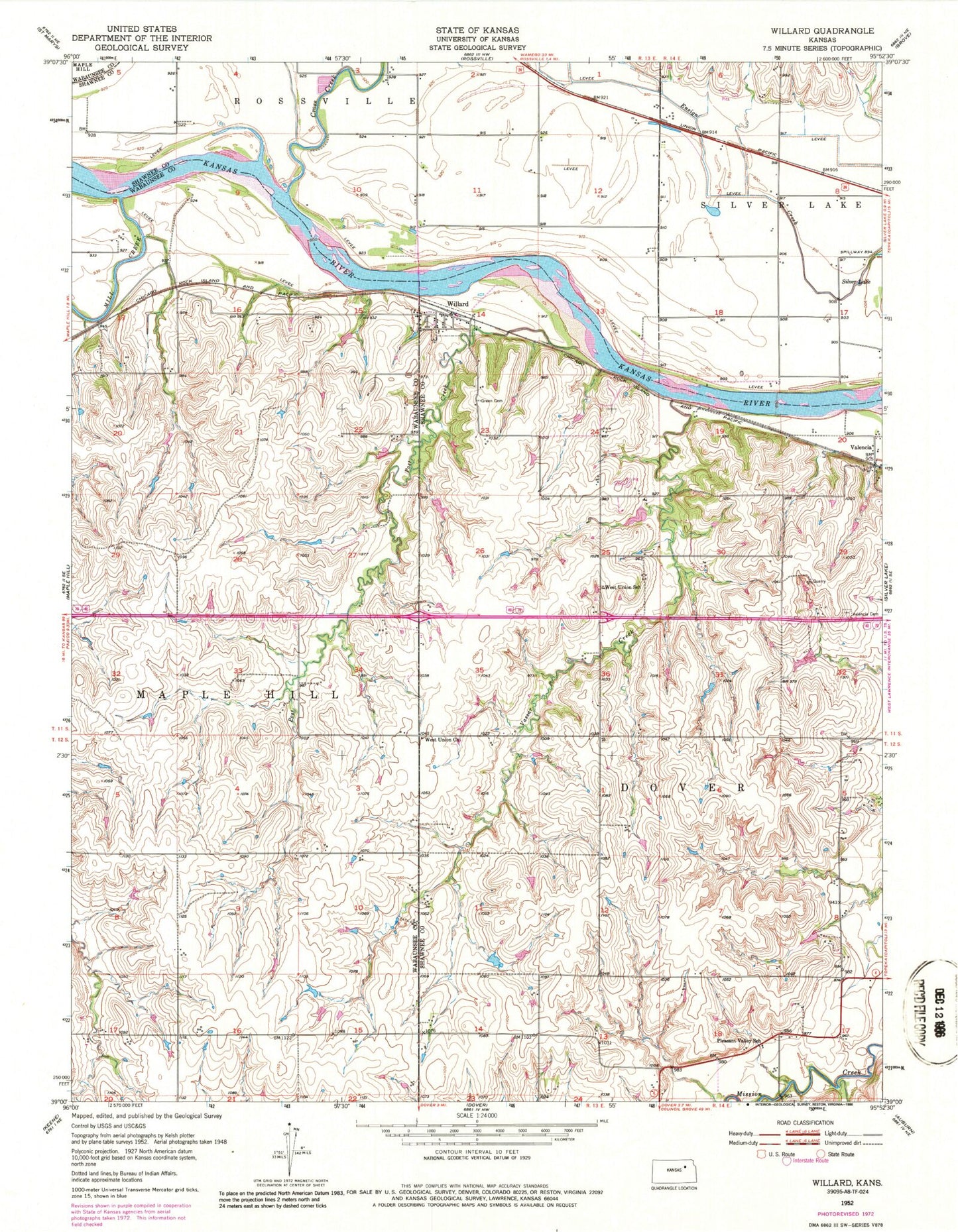
Classic USGS Willard Kansas 7.5'x7.5' Topo Map
Couldn't load pickup availability
Historical USGS topographic quad map of Willard in the state of Kansas. Map scale may vary for some years, but is generally around 1:24,000. Print size is approximately 24" x 27"
This quadrangle is in the following counties: Shawnee, Wabaunsee.
The map contains contour lines, roads, rivers, towns, and lakes. Printed on high-quality waterproof paper with UV fade-resistant inks, and shipped rolled.
Contains the following named places: City of Willard, Cross Creek, Kingville, KTKA - TV (Topeka), KTMJ - TV (Topeka), Lambert Greenhouse and Nursery, Mill Creek, Pleasant Valley School, Post Creek, Township of Dover, Union Ferry, Uniontown Cemetery, Valencia, Valencia Cemetery, Vassar Creek, West Union Church, West Union School, Willard, ZIP Code: 66615