MyTopo
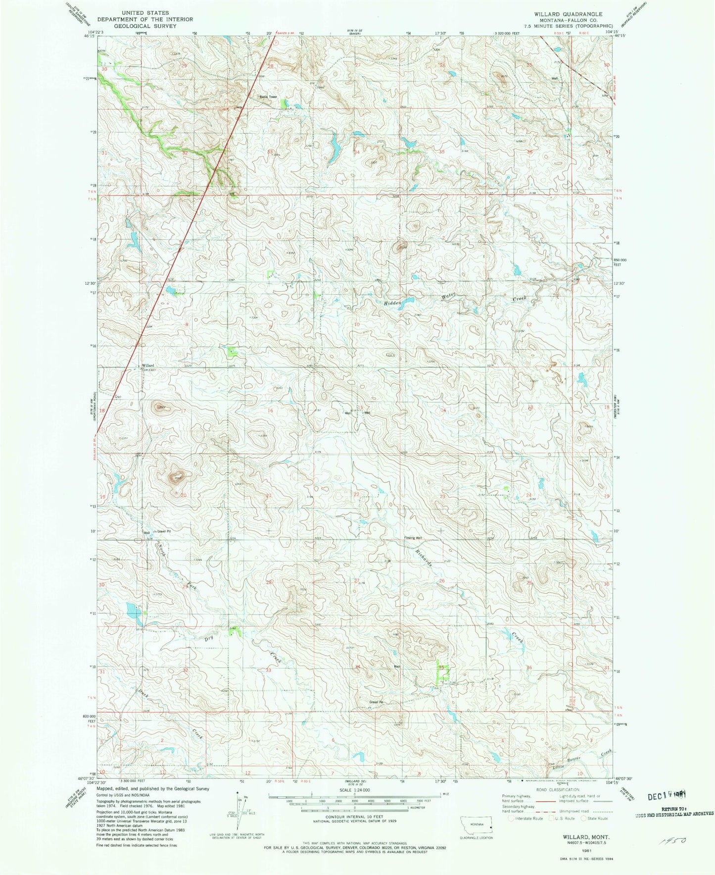
Classic USGS Willard Montana 7.5'x7.5' Topo Map
Couldn't load pickup availability
Historical USGS topographic quad map of Willard in the state of Montana. Map scale may vary for some years, but is generally around 1:24,000. Print size is approximately 24" x 27"
This quadrangle is in the following counties: Fallon.
The map contains contour lines, roads, rivers, towns, and lakes. Printed on high-quality waterproof paper with UV fade-resistant inks, and shipped rolled.
Contains the following named places: 05N59E06AA__01 Well, 05N59E08BA__01 Well, 05N59E08BC__01 Well, 05N59E09AB__01 Well, 05N59E09AB__02 Well, 05N59E18AAAB01 Well, 05N59E24CD__01 Well, 05N59E30AAA_01 Well, 06N59E30AB__01 Well, 06N59E30AC__01 Well, 06N59E30AC__02 Well, 06N60E30BC__01 Well, 59354, First Lutheran Church, Lindstrom Dam, North Fork of Dry Creek, R Myhre Number 1 Dam, Wesleyan Methodist Church, Willard, Willard Post Office, Willard School