
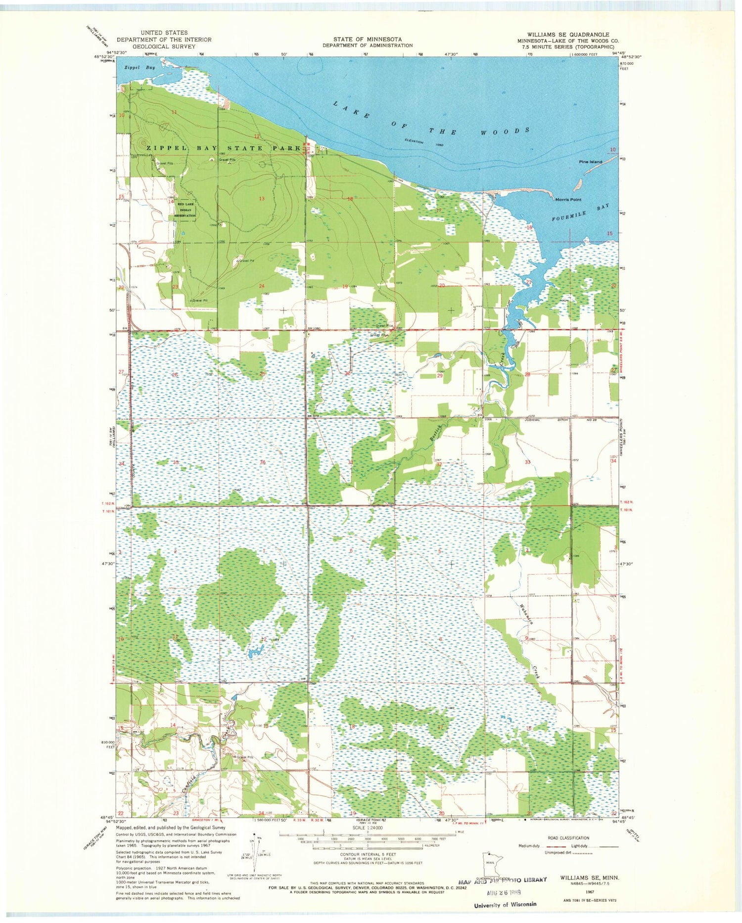
MyTopo
Classic USGS Williams SE Minnesota 7.5'x7.5' Topo Map
Regular price
$16.95
Regular price
Sale price
$16.95
Unit price
per
Couldn't load pickup availability
Historical USGS topographic quad map of Williams SE in the state of Minnesota. Map scale may vary for some years, but is generally around 1:24,000. Print size is approximately 24" x 27"
This quadrangle is in the following counties: Lake of the Woods.
The map contains contour lines, roads, rivers, towns, and lakes. Printed on high-quality waterproof paper with UV fade-resistant inks, and shipped rolled.
Contains the following named places: Angler's Campground, Birch Campground, Bostick Creek, Canfield Creek, Lady's-slipper Campground, Morris Point, Ridge Campground, Township of Wabanica, Township of Wheeler, Unorganized Territory of District 4, Zippel Bay, Zippel Bay State Park, Zippel Post Office


