MyTopo
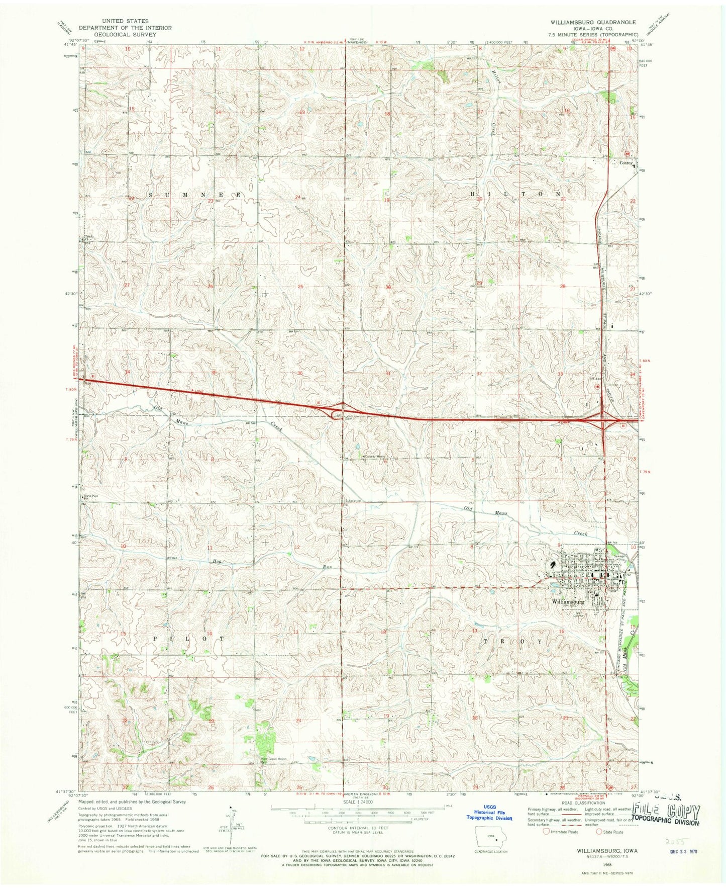
Classic USGS Williamsburg Iowa 7.5'x7.5' Topo Map
Couldn't load pickup availability
Historical USGS topographic quad map of Williamsburg in the state of Iowa. Map scale may vary for some years, but is generally around 1:24,000. Print size is approximately 24" x 27"
This quadrangle is in the following counties: Iowa.
The map contains contour lines, roads, rivers, towns, and lakes. Printed on high-quality waterproof paper with UV fade-resistant inks, and shipped rolled.
Contains the following named places: Bellevue Farms Airport, City of Williamsburg, First Presbyterian Church, Hog Run, Iowa County, Iowa County Ambulance Williamsburg, Iowa County Home, Iowa County Home Cemetery, Kinze Manufacturing Incorporated, Lutheran Interparish School, Mary Welsh Elementary School, Methodist Church, North Pilot School, Open Bible Church, Pilot Grove State Preserve, Pilot Grove Union Cemetery, Saint Marys Catholic Church, Saint Pauls Lutheran Church, Sport Hill Country Club, Township of Hilton, Township of Pilot, Township of Sumner, Township of Troy, Trinity Church, West Pilot Post Office, West Troy, West Troy Post Office, Williamsburg, Williamsburg Care Center, Williamsburg Elementary School, Williamsburg Fire Department, Williamsburg First Responders, Williamsburg Junior / Senior High School, Williamsburg Police Department, Williamsburg Post Office, Williamsburg Public Library, Williamsburg Sport Complex, ZIP Code: 52361