MyTopo
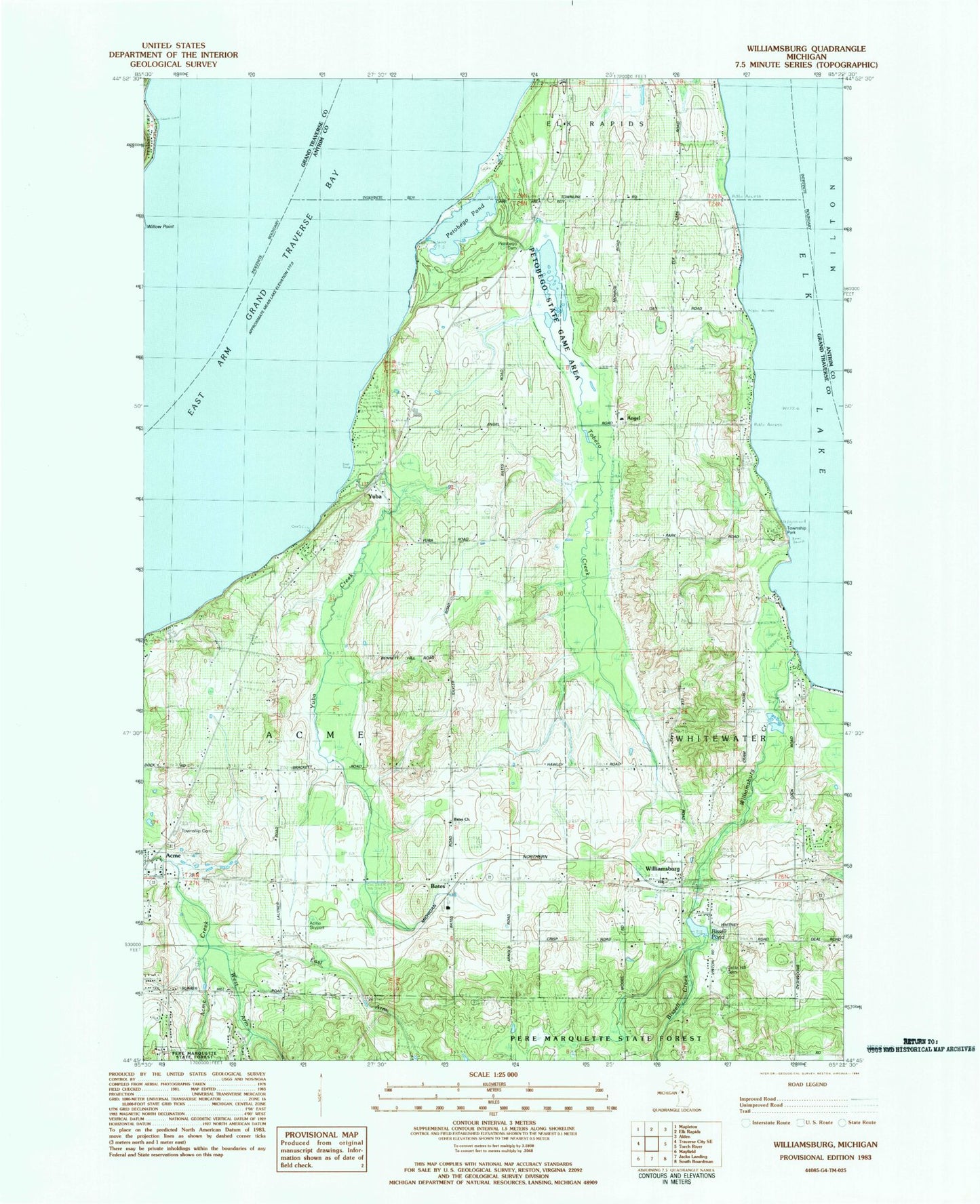
Classic USGS Williamsburg Michigan 7.5'x7.5' Topo Map
Couldn't load pickup availability
Historical USGS topographic quad map of Williamsburg in the state of Michigan. Map scale may vary for some years, but is generally around 1:24,000. Print size is approximately 24" x 27"
This quadrangle is in the following counties: Antrim, Grand Traverse.
The map contains contour lines, roads, rivers, towns, and lakes. Printed on high-quality waterproof paper with UV fade-resistant inks, and shipped rolled.
Contains the following named places: Acme Skyport, Acme Township Cemetery, Acme Township Community Policing, Acme Township Park, Angel, Angell Post Office, Angell Station, Bates, Bates Church, Bates Post Office, Bates Station, Bay Area Baptist Church, Bear Golf Course, Bissell Creek, Bissell Pond, Circle Hill Cemetery, East Arm Acme Creek, Elk Lake, Elk Lake Church, Everflowing Waters Campground, Feast of Victory Lutheran Church, Grand Traverse Metro Fire Department Station 8, Grand Traverse Resort, High Pointe Golf Club, Lochen Heath Golf Club, Mill Creek Elementary School, Music House Museum, New Hope Community Church, Northern Pines Campground, Petabego Dam, Petobego Pond, Petobego State Game Area, Safe Harbor Baptist Church, Sayler Park, Spruce Run Golf Course, Sunrise Academy, Tobeco Creek, Township of Acme, Township of Whitewater, Traverse Bay RV Park, West Arm Acme Creek, Whitewater Township Fire Department - EMS, Whitewater Township Hall, Whitewater Township Park, Williamsburg, Williamsburg Cemetery, Williamsburg Creek, Williamsburg Post Office, Williamsburg Station, Williamsburg United Methodist Church, Willow Point, Wolverine Golf Course, Yuba, Yuba Acme Township Cemetery, Yuba Airport, Yuba Creek, Yuba Post Office, ZIP Code: 49690


