MyTopo
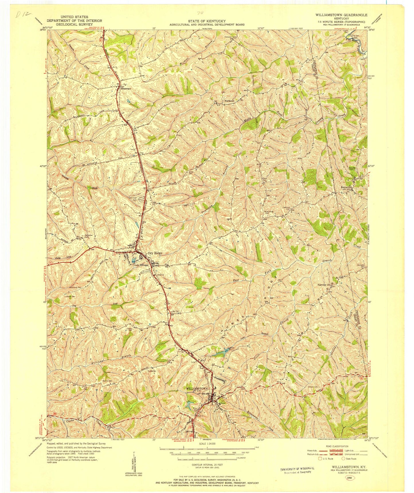
Classic USGS Williamstown Kentucky 7.5'x7.5' Topo Map
Couldn't load pickup availability
Historical USGS topographic quad map of Williamstown in the state of Kentucky. Map scale may vary for some years, but is generally around 1:24,000. Print size is approximately 24" x 27"
This quadrangle is in the following counties: Grant, Pendleton.
The map contains contour lines, roads, rivers, towns, and lakes. Printed on high-quality waterproof paper with UV fade-resistant inks, and shipped rolled.
Contains the following named places: Barnes Cemetery, Bennette Cemetery, Boltz Lake, Broad Ridge Cemetery, Campbells Block House, City of Dry Ridge, City of Williamstown, Clark Cemetery, Clay Cemetery, Conrad Cemetery, Conrads Airport, Dey Cemetery, Dickerson Cemetery, Dry Ridge, Dry Ridge Fire Department, Dry Ridge Police Department, Dry Ridge Post Office, Duncan Cemetery, Fairview Church, Fairview Ridge, Goose Creek, Grant County, Grant County Hospital Heliport, Grant County Sheriff's Office, Hill Crest Cemetery, Humes Ridge, Kentucky State Police Post 6, Knox Cemetery, Knoxville, Knoxville Post Office, Lake Branch, Lake Polliwog, Landrum Cemetery, Martin Cemetery, McGuinnis Cemetery, Northcutt, Panther Run, Poison Spring, Railroad Lake, Reid, Renneckar Cemetery, Saint Elizabeth Grant Hospital, Saint Williams Church, Sherman, Sherman Church, Steammill Branch, Tomlin Cemetery, Townsend Branch, Unity Cemetery, Williamstown, Williamstown Fire Department, Williamstown Lake, Williamstown Post Office