
MyTopo
Classic USGS Willington South Carolina 7.5'x7.5' Topo Map
Couldn't load pickup availability
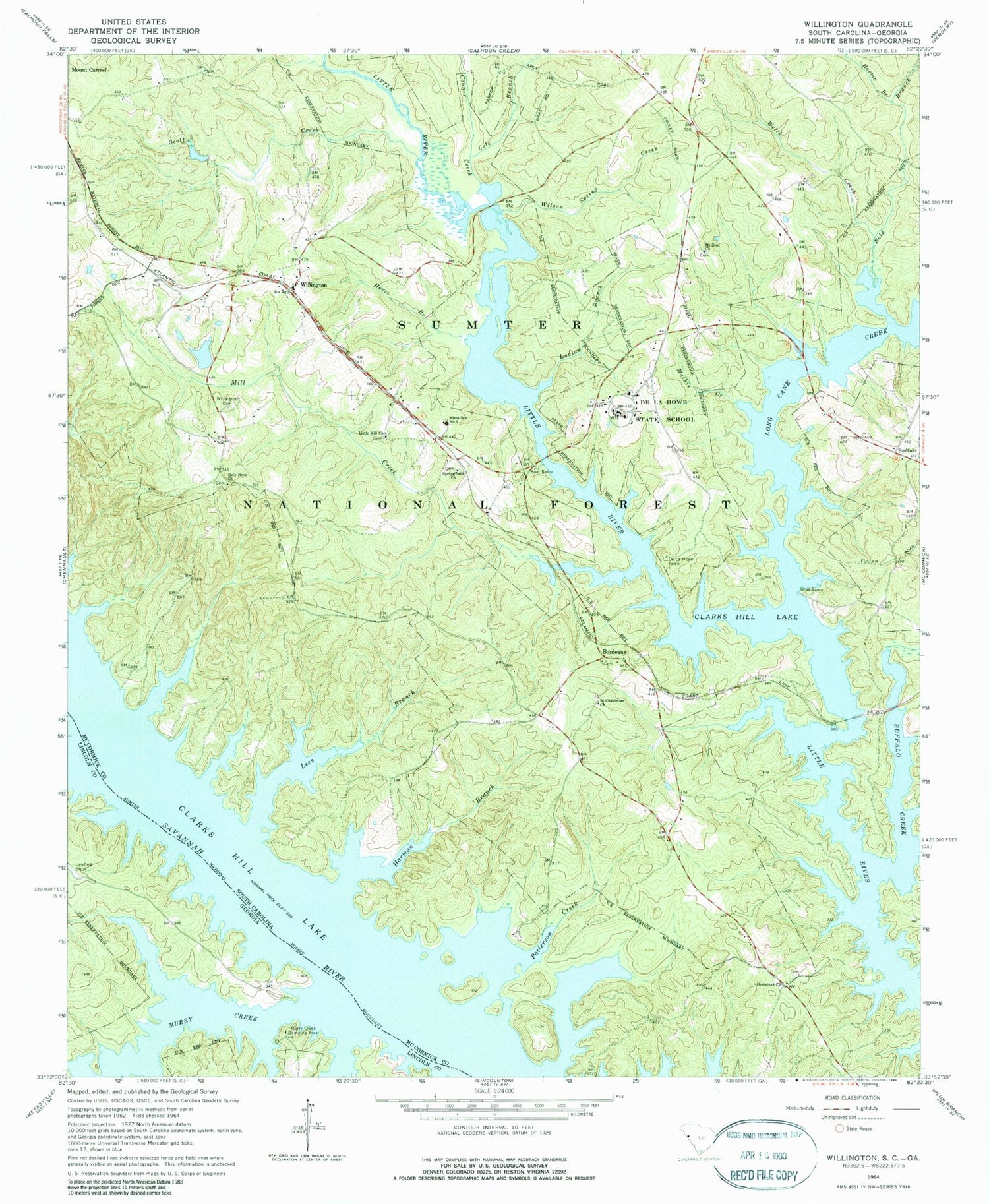
Historical USGS topographic quad map of Willington in the states of South Carolina, Georgia. Typical map scale is 1:24,000, but may vary for certain years, if available. Print size: 24" x 27"
This quadrangle is in the following counties: Lincoln, McCormick.
The map contains contour lines, roads, rivers, towns, and lakes. Printed on high-quality waterproof paper with UV fade-resistant inks, and shipped rolled.
Contains the following named places: Badwell Cemetery, Bordeaux Cemetery, Bordeaux Church, Bordeaux School (historical), Buffalo Creek Recreation Area, Gibert Rosenwald School (historical), Green Olive School (historical), Hickory Knob State Park, Leroys Ferry (historical), Leroys Ferry Recreation Area, Little Mill School (historical), Little River Quarry, Long Cane Bridge, Long Cane Creek Picnic Area, McKissick Memorial Chapel, Morrow Bridge, Mount Zion School (historical), New Bordeaux Church, Old Willington Church (historical), Rocky Creek Church (historical), Saint Charlotte School (historical), Willing Church (historical), Willington Presbyterian Church, Willington School (historical), Bold Branch, Cole Branch, Holy Rock Church, Horse Branch, Lees Branch, Ludlow Branch, Mill Creek, Rocky Branch, Scott Creek, Welch Creek, Willington, Willington Cemetery, Wilson Spring Creek, Long Crane Creek Campground, Monroe Ridge Hunt Campground, South Carolina Noname 35003 D-0641 Dam, Harman Branch, Hosannah Church, Little Mill Church, Mathis Creek, Mims School Number 3, Bordeaux, Buffalo Creek, Conner Creek, De La Howe State School, De La Howe Tomb, Mount Zion Church, Patterson Creek, Saint Charlottes Church, Springfield Church, Hickory Knob State Park, Long Cane Creek Boat Ramp, Little River Quarry Boat Ramp, Clay Branch, Lethia, Mill Branch, Mill Bridge, Remsens Ferry (historical), Mount Carmel Division, Willington Census Designated Place, Murry Creek Camping Area, Mill Creek, Murry Creek, Murry Island (historical), Leroys Ferry (historical), Remsens Ferry (historical)


