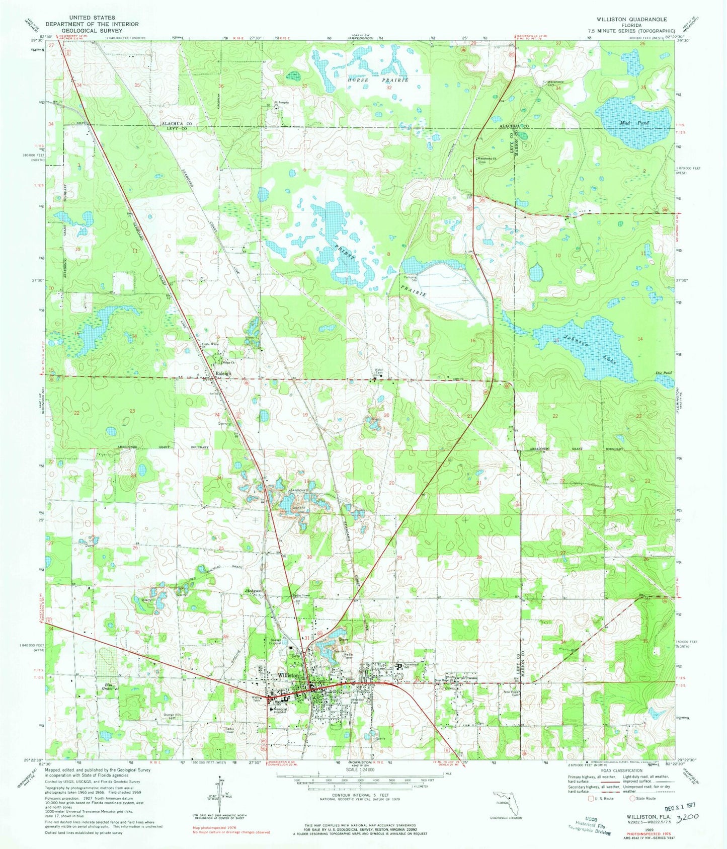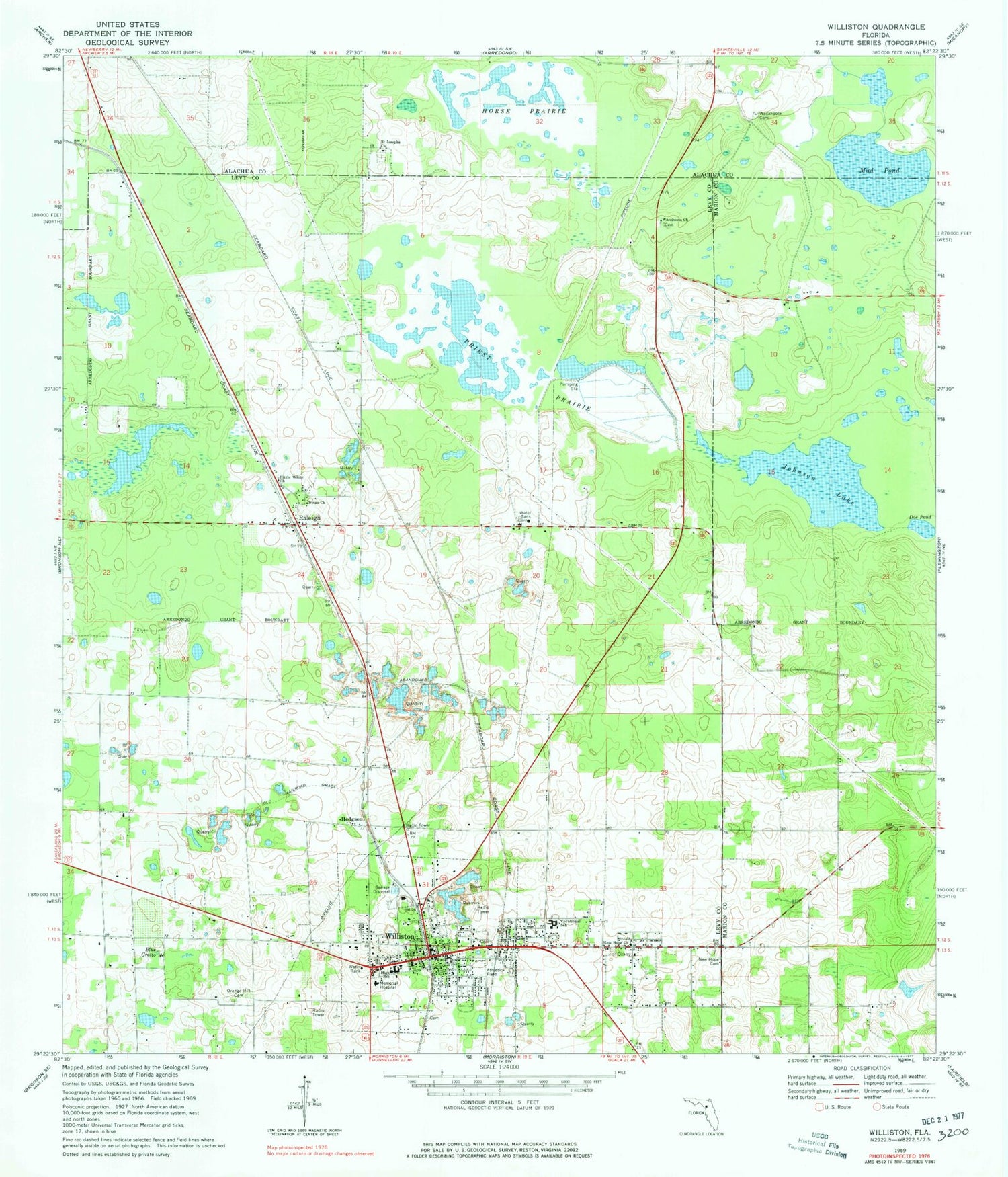
MyTopo
Classic USGS Williston Florida 7.5'x7.5' Topo Map
Couldn't load pickup availability
Historical USGS topographic quad map of Williston in the state of Florida. Map scale may vary for some years, but is generally around 1:24,000. Print size is approximately 24" x 27"
This quadrangle is in the following counties: Alachua, Levy, Marion.
The map contains contour lines, roads, rivers, towns, and lakes. Printed on high-quality waterproof paper with UV fade-resistant inks, and shipped rolled.
Contains the following named places: Allen Chapel AME Church, Baptist Tabernacle, Church of God, City of Williston, Cross Word Community Church, Destiny Church of God by Faith, Doe Pond, East Williston Census Designated Place, Ebenezer United Methodist Church, First Baptist Church, First Presbyterian Church, First United Methodist Church, Greater Rock Hill Missionary Baptist Church, Gunnals, Hodgson, Holy Family Catholic Church, Horse Prairie, Johnson Lake, Jones Temple Church of God in Christ, Joyce M Bullock Elementary School, Levy County Emergency Medical Services Station 4, Levy County EMS Station Number 4, Little White Bethel Faith Church, Mud Pond, New Hope Baptist Church, New Hope Cemetery, New Zion AME Church, Nolan Church, Orange Hill Cemetery, Priest Prairie, Raleigh, Raleigh Census Designated Place, Regional General Hospital - Williston, Saint Barnabas Episcopal Church, Saint Josephs Church, The Church of Jesus Christ of Latter Day Saints, Voice of Deliverance Church, Wacahoota Cemetery, Wacahoota United Methodist Church, Willis Family Cemetery, Williston, Williston City Hall, Williston Elementary School, Williston Fire Department, Williston High School, Williston Memorial Hospital Heliport, Williston Middle School, Williston Plaza, Williston Police Department, Williston Post Office, Williston Public Library, ZIP Code: 32696