
MyTopo
Classic USGS Willow Creek Butte Utah 7.5'x7.5' Topo Map
Couldn't load pickup availability
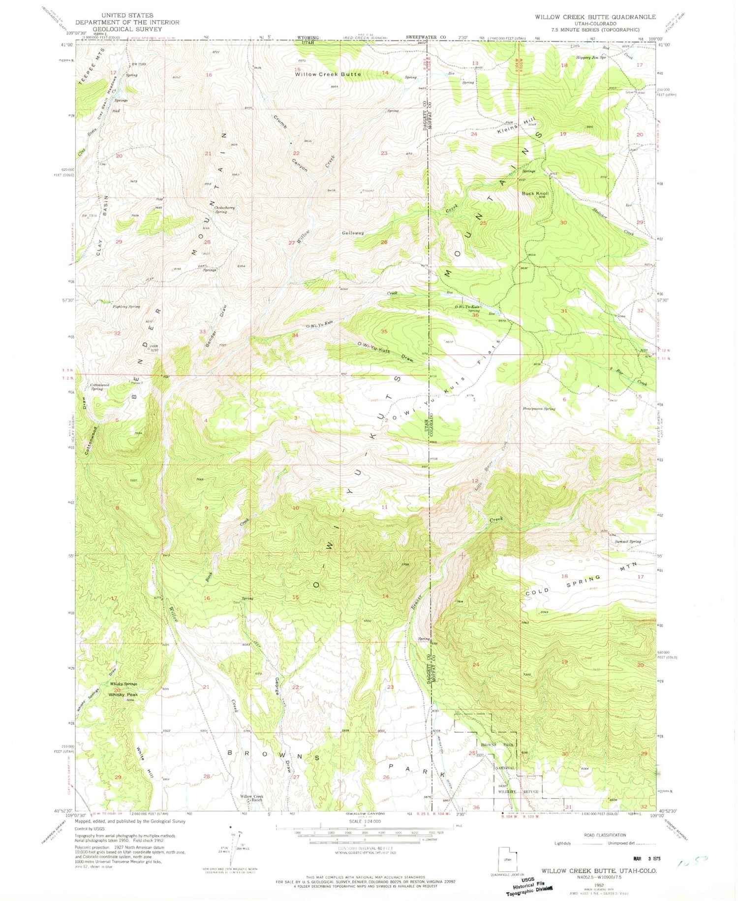
Historical USGS topographic quad map of Willow Creek Butte in the states of Utah, Colorado. Map scale may vary for some years, but is generally around 1:24,000. Print size is approximately 24" x 27"
This quadrangle is in the following counties: Daggett, Moffat.
The map contains contour lines, roads, rivers, towns, and lakes. Printed on high-quality waterproof paper with UV fade-resistant inks, and shipped rolled.
Contains the following named places: Bender Draw, Bender Mountain, Birch Creek, Buck Knoll, Chokecherry Spring, Clay Basin Meadows, Cottonwood Draw, Cottonwood Spring, Crumb Canyon, Fighting Spring, Galloway Creek, Honeymoon Spring, Kleins Hill, Little Beaver Creek, O-Wi-Yu-Kuts Creek, O-Wi-Yu-Kuts Draw, O-Wi-Yu-Kuts Flats, O-Wi-Yu-Kuts Mountains, O-Wi-Yu-Kuts Spring, Slippery Jim Spring, Summit Spring, Whisky Peak, Whisky Springs, White Hill, Willow Creek Butte, Willow Creek Ranch


