MyTopo
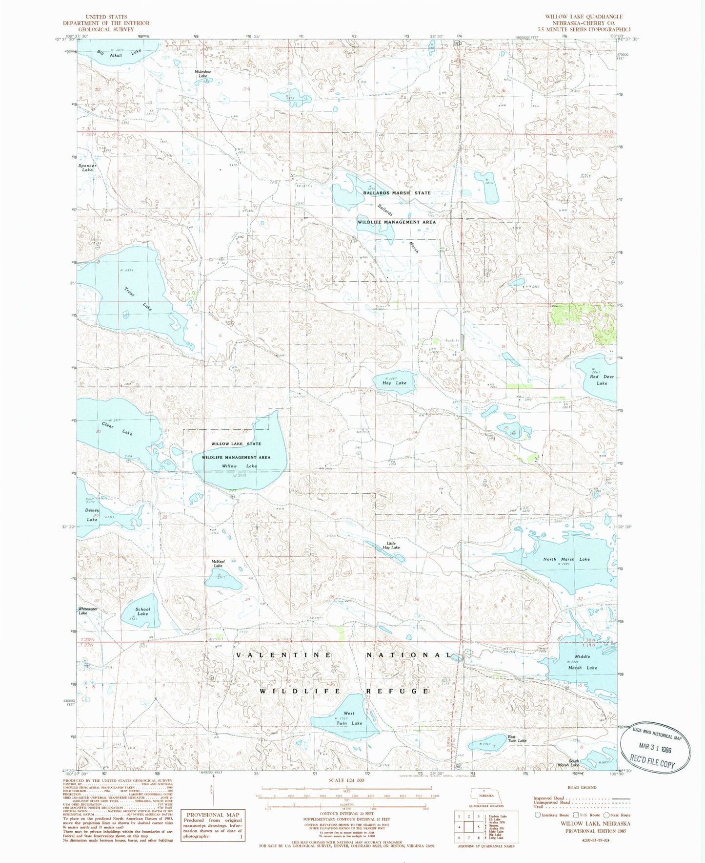
Classic USGS Willow Lake Nebraska 7.5'x7.5' Topo Map
Couldn't load pickup availability
Historical USGS topographic quad map of Willow Lake in the state of Nebraska. Map scale may vary for some years, but is generally around 1:24,000. Print size is approximately 24" x 27"
This quadrangle is in the following counties: Cherry.
The map contains contour lines, roads, rivers, towns, and lakes. Printed on high-quality waterproof paper with UV fade-resistant inks, and shipped rolled.
Contains the following named places: Ballard Marsh Public School, Ballards Marsh, Ballards Marsh State Wildlife Management Area, Clear Lake, Cleveland Election Precinct, East Twin Lake, Harns School, Hay Lake, Little Hay Lake, McKeel Lake, Middle Marsh Lake, Muleshoe Lake, North Marsh Lake, School Lake, South Marsh Lake, Trout Lake, West Twin Lake, Willow Lake, Willow Lake State Wildlife Management Area