
MyTopo
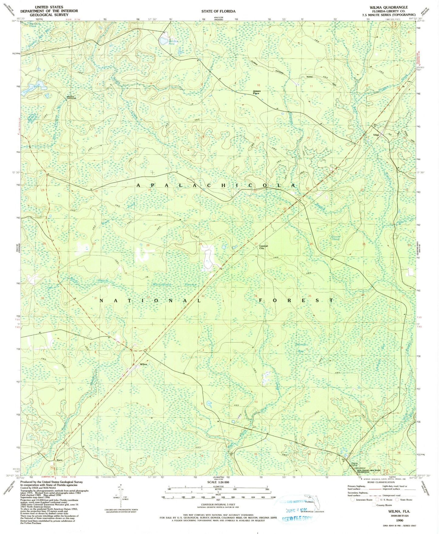
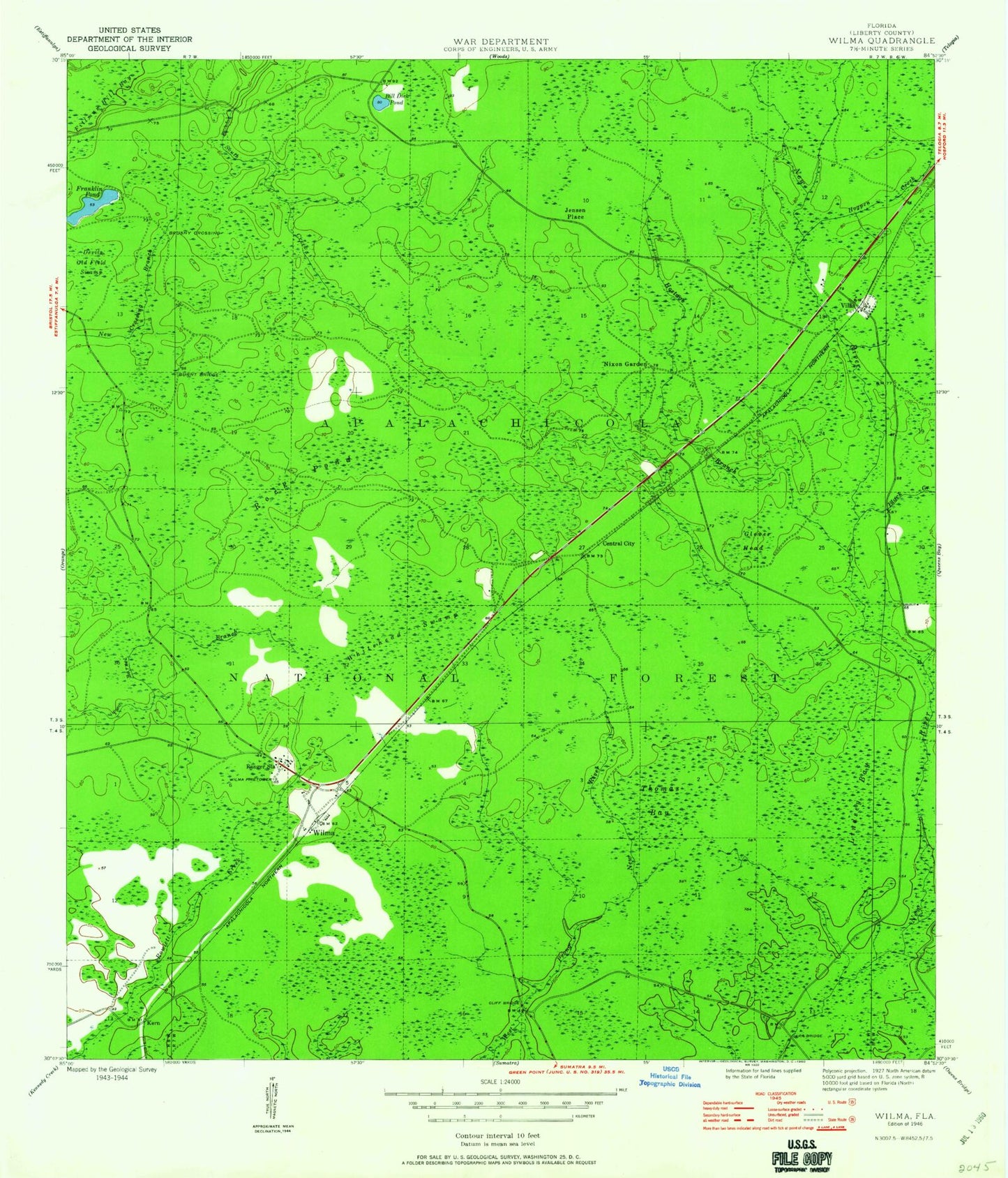
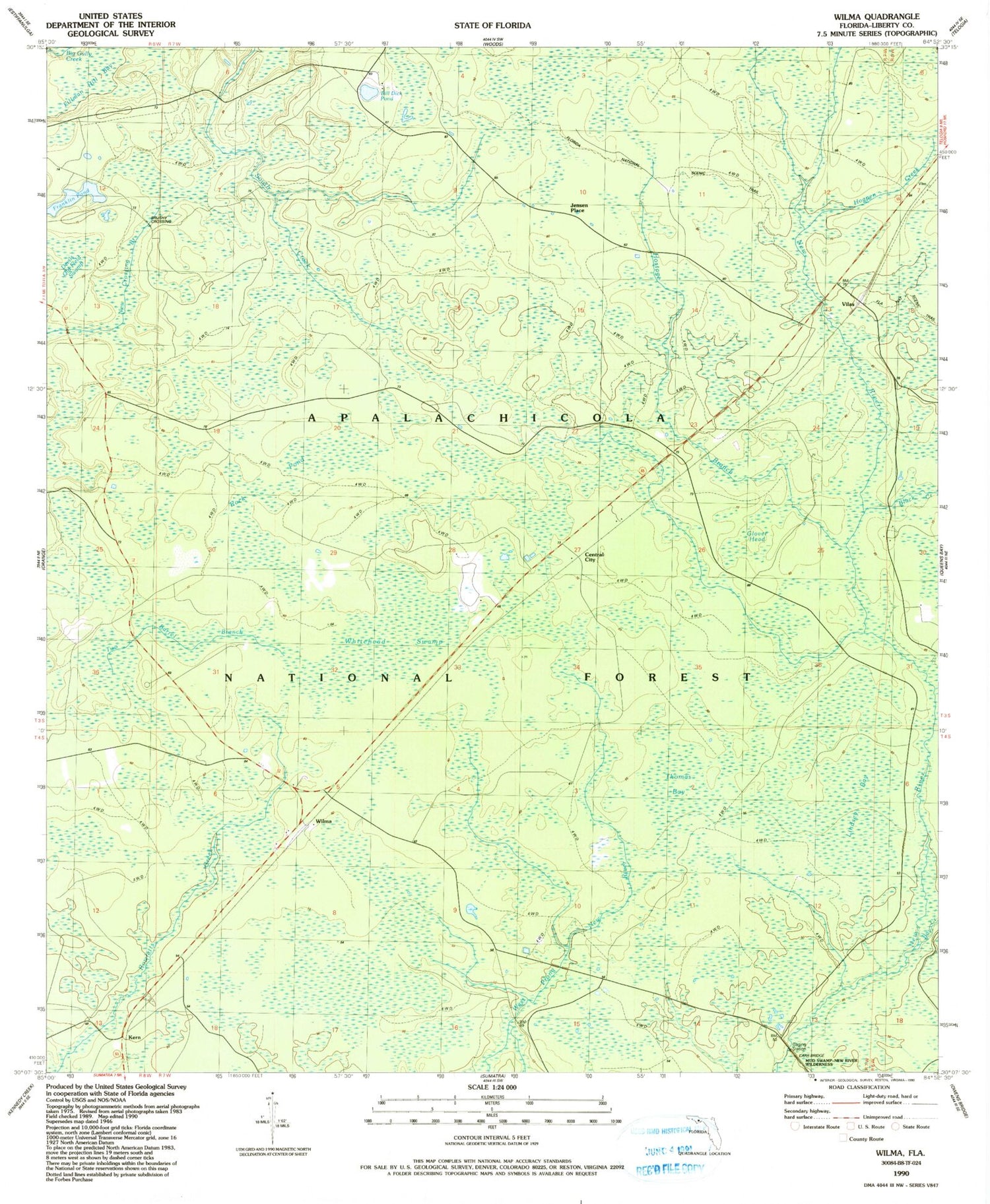
Classic USGS Wilma Florida 7.5'x7.5' Topo Map
Couldn't load pickup availability
Historical USGS topographic quad map of Wilma in the state of Florida. Map scale may vary for some years, but is generally around 1:24,000. Print size is approximately 24" x 27"
This quadrangle is in the following counties: Liberty.
The map contains contour lines, roads, rivers, towns, and lakes. Printed on high-quality waterproof paper with UV fade-resistant inks, and shipped rolled.
Contains the following named places: Bay Creek, Bill Dick Pond, Black Creek, Bracel Branch, Brushy Crossing, Burnt Bridge, Carr Bridge, Central City, Cliff Bridge, Devils Old Field Swamp, Fillman Hill Bay, Franklin Pond, Glover Head, Hogpen Creek, Hostage Branch, Jensen Place, Kern, Liberty County, Lindsey Bay, Nixon Garden Cemetery, Ranger Station, Rock Pond, Thomas Bay, Two Barrel Branch, Vilas, Whitehead Swamp, Wilma, Wilma Fire Tower, Wilma Work Center