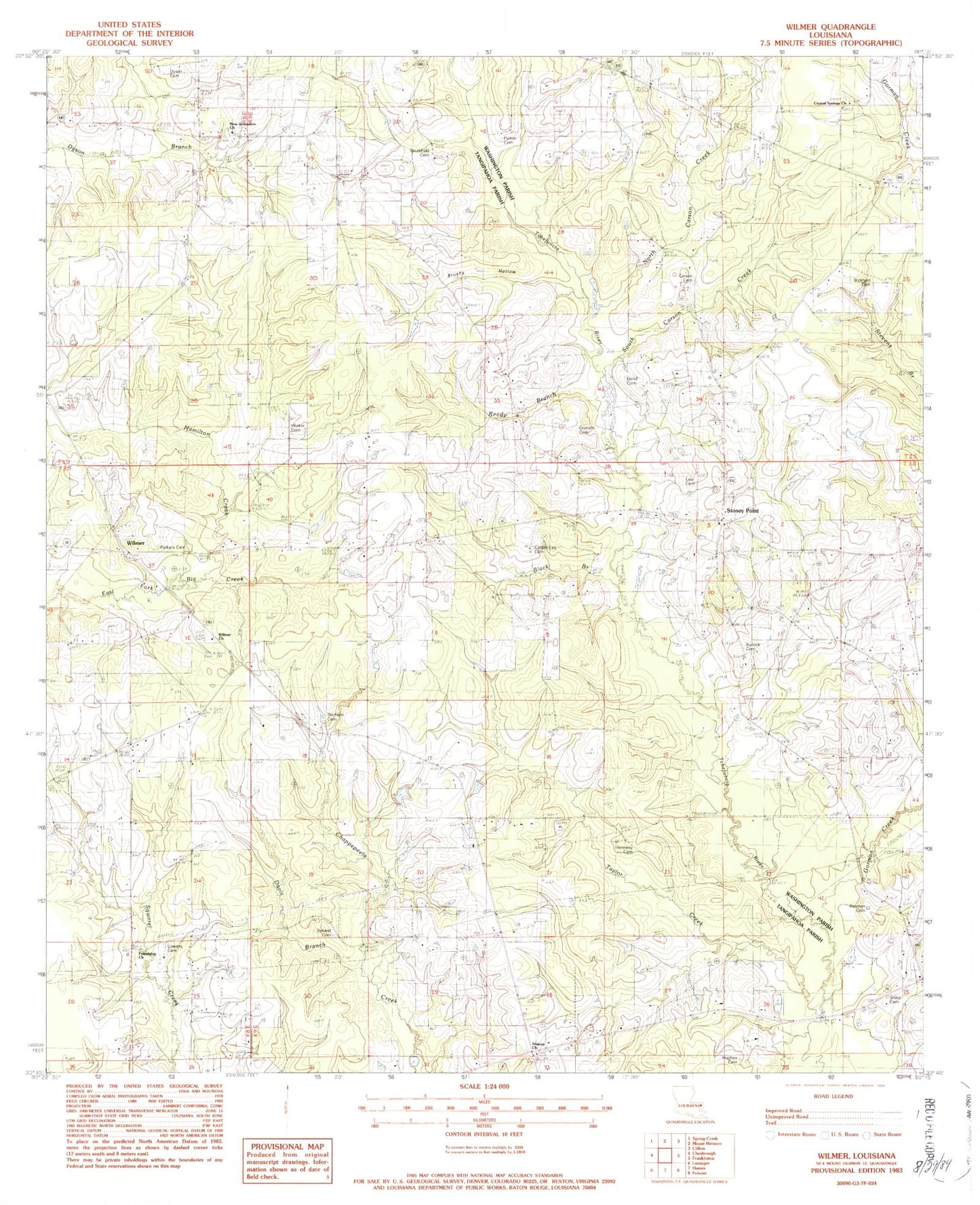
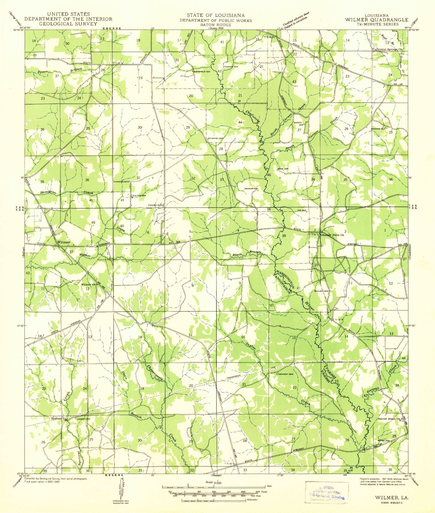
MyTopo
Classic USGS Wilmer Louisiana 7.5'x7.5' Topo Map
Couldn't load pickup availability
Historical USGS topographic quad map of Wilmer in the state of Louisiana. Map scale may vary for some years, but is generally around 1:24,000. Print size is approximately 24" x 27"
This quadrangle is in the following counties: Tangipahoa, Washington.
The map contains contour lines, roads, rivers, towns, and lakes. Printed on high-quality waterproof paper with UV fade-resistant inks, and shipped rolled.
Contains the following named places: Bickham Cemetery, Black Branch, Bond Cemetery, Brumfield Cemetery, Brushy Hollow, Bullock Cemetery, Buras Pond Dam, Carson Cemetery, Casper - Lea Cemetery, Crystal Springs Church, Davis Branch, Dyson Cemetery, Friendship Baptist Church, Gorman Creek, Graham Cemetery, Hennesy Cemetery, Hughes Cemetery, Lea Cemetery, Lowery Cemetery, McDaniel Cemetery, New Jerusalem Church, North Carson Creek, Parker Cemetery, Parkers Cemetery, Pasman Cemetery, Reedy Branch, Reedy Pond, Reedy Pond Dam, Sharon Church, Sharp Cemetery, Sharp Church, South Carson Creek, Statham Cemetery, Stoney Point, Stoney Point Baptist Church, Stony Point School, Sylvest Cemetery, Taylor Creek, Walker Cemetery, Wilmer, Wilmer Church, Wilmer Volunteer Fire Department Station 1