MyTopo
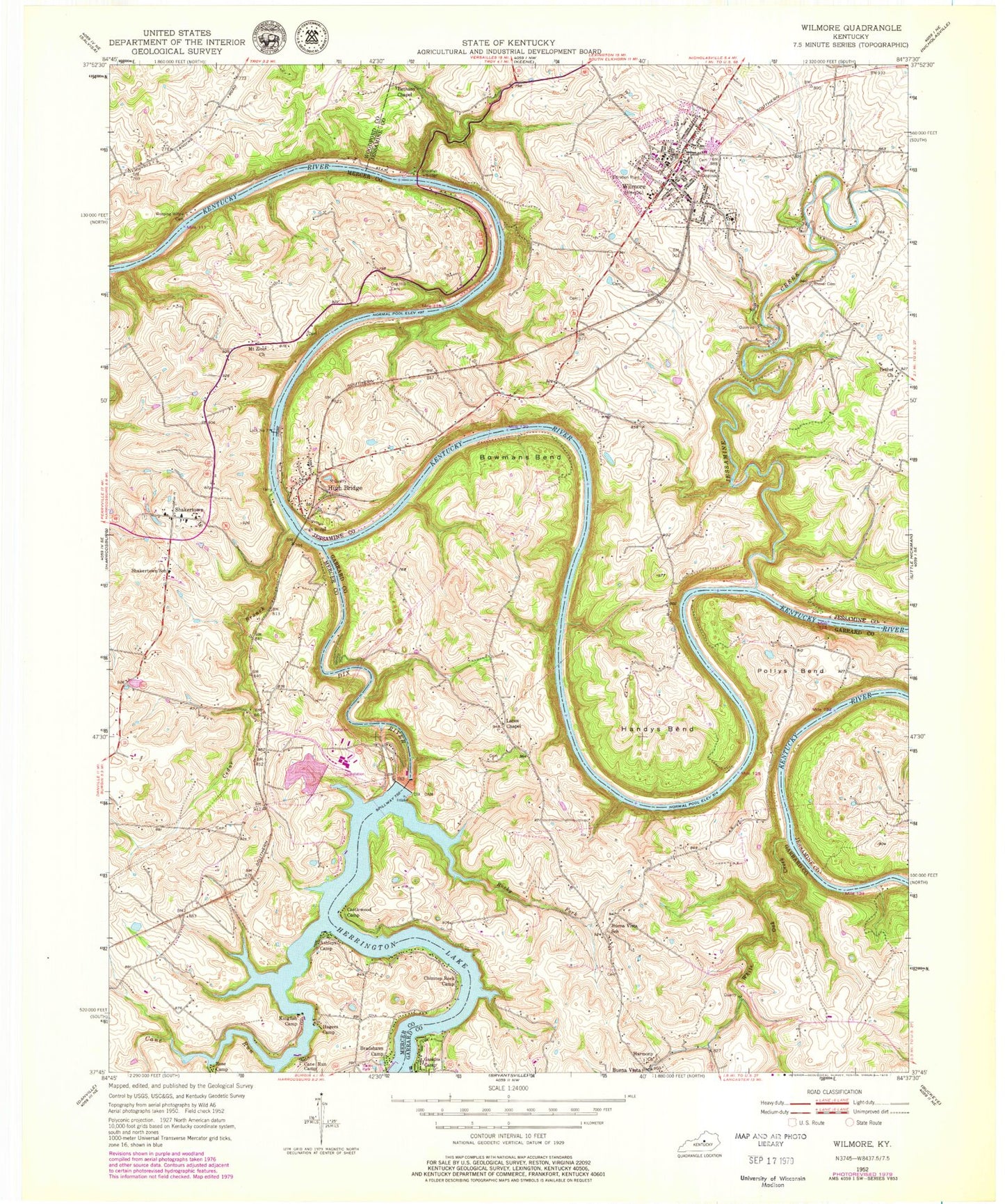
Classic USGS Wilmore Kentucky 7.5'x7.5' Topo Map
Couldn't load pickup availability
Historical USGS topographic quad map of Wilmore in the state of Kentucky. Typical map scale is 1:24,000, but may vary for certain years, if available. Print size: 24" x 27"
This quadrangle is in the following counties: Garrard, Jessamine, Mercer, Woodford.
The map contains contour lines, roads, rivers, towns, and lakes. Printed on high-quality waterproof paper with UV fade-resistant inks, and shipped rolled.
Contains the following named places: Ashleys Camp, Bethany Chapel, Bethel Church, Bowmans Bend, Bradshaws Camp, Buena Vista School, Cane Run, Cane Run Camp, Castlewood Camp, Cedar Branch, Chimney Rock Camp, Cog Hill Cemetery, Dix Dam, Gaskins Camp, Hagers Camp, Handys Bend, Harmony Church, High Bridge, High Bridge, Jessamine Creek, Kingfish Camp, Lanes Chapel, Mount Zion Church, Pollys Bend, Rhorer Cemetery, Rocky Fork, Rose Camp, Shakertown, Shakertown School, Weeping Willow Cemetery, White Oak Creek, Wilmore, Buena Vista, Dix River, WUKY-FM (Lexington), WDKY-TV (Danville), Burgin Division, Wilmore Division, City of Wilmore, Cedar Grove Farm (historical), Rose Hill Farm (historical), Walnut Grove Farm (historical), Alliance School (historical), Jessamine Gorge, Curds Ferry (historical), High Bridge Railroad Station (historical), High Bridge Post Office (historical), Sparks Estate (historical), Mount Freedom Post Office (historical), Glass Mill (historical), Glass Mill Bridge, Rudicil Post Office (historical), Freedom Church (historical), Wilmore Railroad Station (historical), Indian Creek, Cogars Landing (historical), Boone Tunnel (historical), Cogars Landing Post Office (historical), School Number Twenty-Eight (historical), Oakdale (historical), Jessamine Church (historical), Corrylyn Farm (historical), Pekin Post Office (historical), Pekin (historical), Buena Vista Post Office (historical), Castlewood Camp, Lambert Church (historical), Redwing Post Office (historical), Sugar Tree Grove Farm (historical), Brooklyn Bridge, Cogers Ferry (historical), Mount Zion Church (historical), Pleasant Hill Post Office (historical), Shaker Ferry (historical), Spring Branch, High Bridge Census Designated Place, Wilmore City Fire Department, Camp Dick Fire Department Station 2, High Bridge Fire Department, Lock Number 7, Harmony (historical), Wilmore Police Department, Megee - Phillips Cemetery, Prentice Family Cemetery, Lowry Cemetery, Weeping Willow Cemetery, Wilmore Post Office