MyTopo
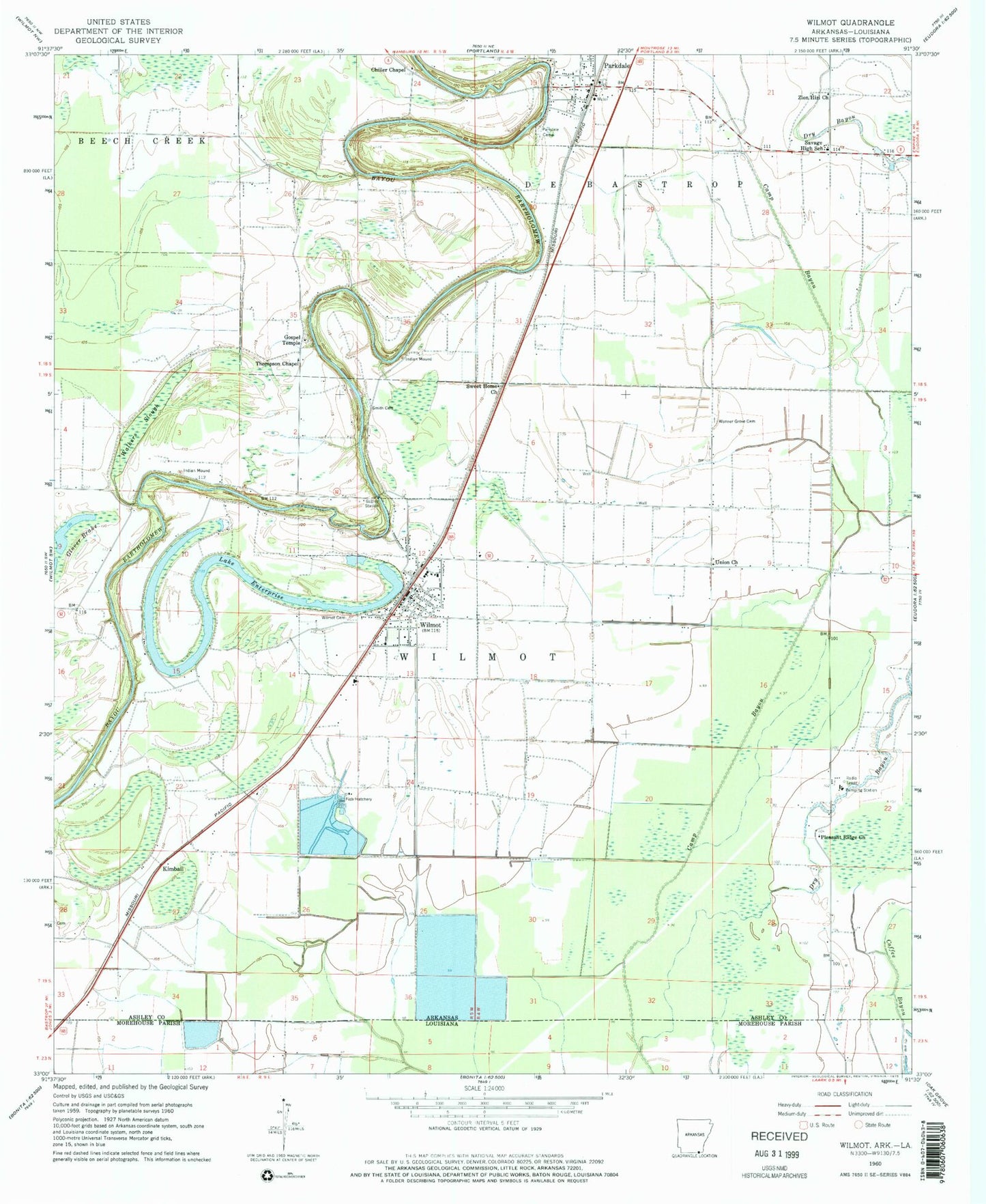
Classic USGS Wilmot Arkansas 7.5'x7.5' Topo Map
Couldn't load pickup availability
Historical USGS topographic quad map of Wilmot in the states of Arkansas, Louisiana. Map scale may vary for some years, but is generally around 1:24,000. Print size is approximately 24" x 27"
This quadrangle is in the following counties: Ashley, Morehouse.
The map contains contour lines, roads, rivers, towns, and lakes. Printed on high-quality waterproof paper with UV fade-resistant inks, and shipped rolled.
Contains the following named places: Bell Ferry, Camp Bayou Canal, Chiller Chapel, City of Parkdale, City of Wilmot, Coffee Bayou, Dry Bayou, Eatman Ferry, Farmer School, Gospel Temple, Johnson Memorial Airport, Keller Ferry, Kimball, Lake Enterprise, Parkdale, Parkdale Baptist Church, Parkdale Cemeteries, Parkdale Elementary School, Parkdale Fire Department, Parkdale Post Office, Pleasant Ridge Church, Savage High School, Slack-LeGrande High School, Small Fry Fish Farm, Smith Cemetery, Smith Ferry, Sweet Home Church, Thompson Chapel, Township of De Bastrop, Township of Wilmot, Union Church, Walkers Slough, Wilmot, Wilmot Cemetery, Wilmot Elementary School, Wilmot Police Department, Wilmot Post Office, Wilmot Volunteer Fire Department, Wonner Grove Cemetery, Zion Hill Church, ZIP Code: 71676