MyTopo
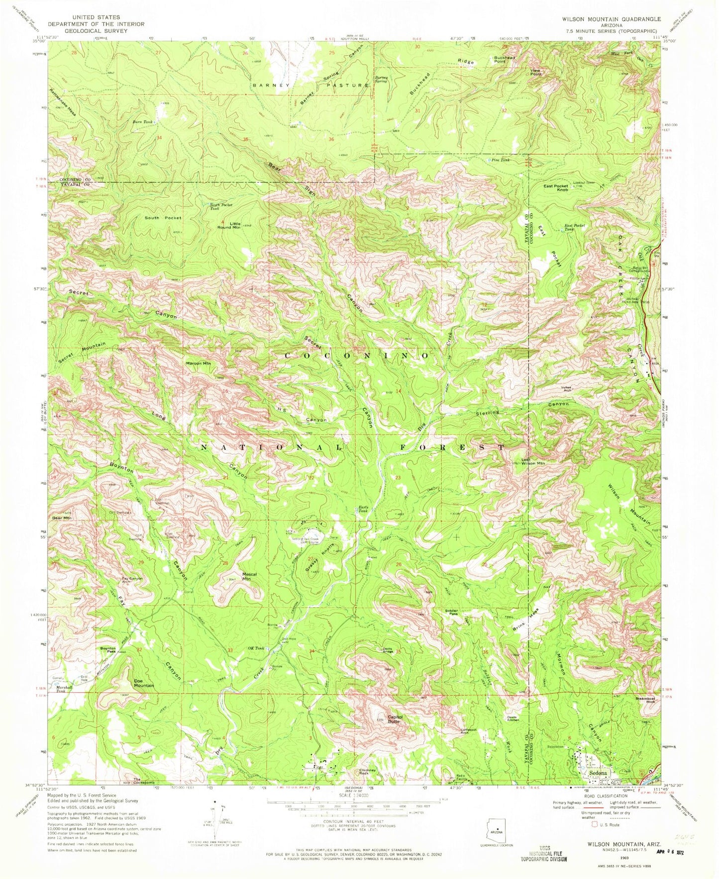
USGS Classic Wilson Mountain Arizona 7.5'x7.5' Topo Map
Couldn't load pickup availability
Historical USGS topographic quad map of Wilson Mountain in the state of Arizona. Scale: 1:24000. Print size: 24" x 27"
This quadrangle is in the following counties: Coconino, Yavapai.
The map contains contour lines, roads, rivers, towns, lakes, and grids including latitude / longitude and UTM / MGRS. Printed on high-quality waterproof paper with UV fade-resistant inks.
Contains the following named places: Banjo Bill Campground, Barney Pasture, Barney Spring, Bear Sign Canyon, Boynton Canyon, Boynton Pass, Bridle Trail, Brins Mesa, Buckhead Point, Buckhead Ridge, Burn Tank, Capitol Butte, Chimney Rock, Coffeepot Rock, Devils Bridge, Devils Kitchen, Doe Mountain, Earls Tank, East Pocket, East Pocket Knob, East Pocket Tank, Fay Canyon, Fay Canyon Arch, Grassy Knolls, H S Canyon, Halfway Picnic Area, Little Round Mountain, Long Canyon, Lost Wilson Mountain, Maroon Mountain, Marshall Tank, Mescal Mountain, OK Tank, Pine Tank, Rattlesnake Mesa, Secret Canyon, Side Rock Campground, Soldier Pass, South Pocket, South Pocket Tank, Steamboat Rock, Sterling Canyon, The Cockscomb, View Point, Vultee Arch, Wilson Mountain, Barney Pasture Burn, East Pocket Lookout Tower, Slide Rock Swim Area, Vultee Arch Twenty Two, Wilson Tank, Round Top Mountain, Test Hole Tank, Sedona-Oak Creek Golf Course, Red Rock-Secret Mountain Wilderness, Indian Head Arch, Buckshead Tank, First Tank, Hancock Cabin Tank, Crater Tank, Lil Round Tank, Mos Tank, AM Tank, Rattlesnake Tank, Bootlegger Campground, Oak Creek Canyon Census Designated Place, Oak Creek Canyon