
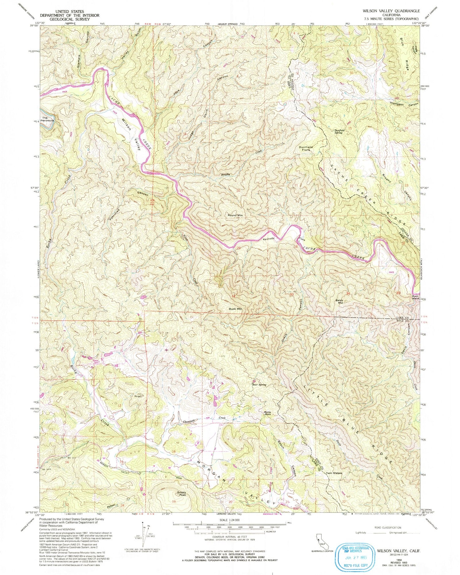
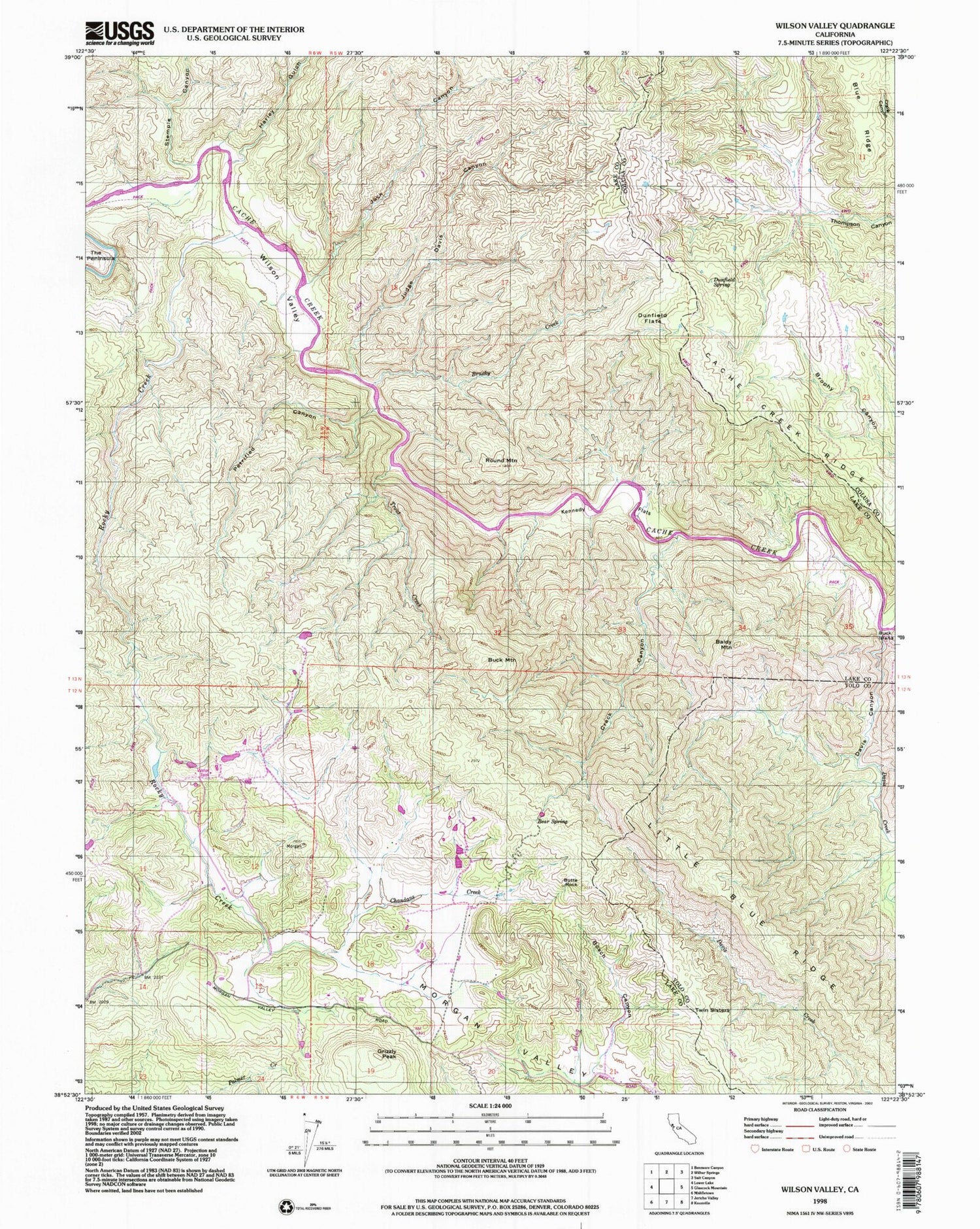
MyTopo
USGS Classic Wilson Valley California 7.5'x7.5' Topo Map
Couldn't load pickup availability
Historical USGS topographic quad map of Wilson Valley in the state of California. Scale: 1:24000. Print size: 24" x 27"
This quadrangle is in the following counties: Colusa, Lake, Yolo.
The map contains contour lines, roads, rivers, towns, lakes, and grids including latitude / longitude and UTM / MGRS. Printed on high-quality waterproof paper with UV fade-resistant inks.
Contains the following named places: Baldy Mountain, Bear Spring, Bosch Canyon, Brushy Creek, Butte Rock, Cache Creek Ridge, Chandans Creek, Crack Canyon, Davis Canyon, Davis Creek, Dunfield Flats, Dunfield Spring, Harley Gulch, Jack Canyon, Judge Davis Canyon, Kennedy Flats, Little Blue Ridge, Petrified Canyon, Rocky Creek, Round Mountain, Stemple Canyon, Trout Creek, Wilson Valley, Buck Mountain, Grizzly Peak, Twin Sisters, Morgan Valley School (historical), Reiff Post Office (historical), Cache Creek Wilderness


