MyTopo
Classic USGS Wilson Kentucky 7.5'x7.5' Topo Map
Couldn't load pickup availability
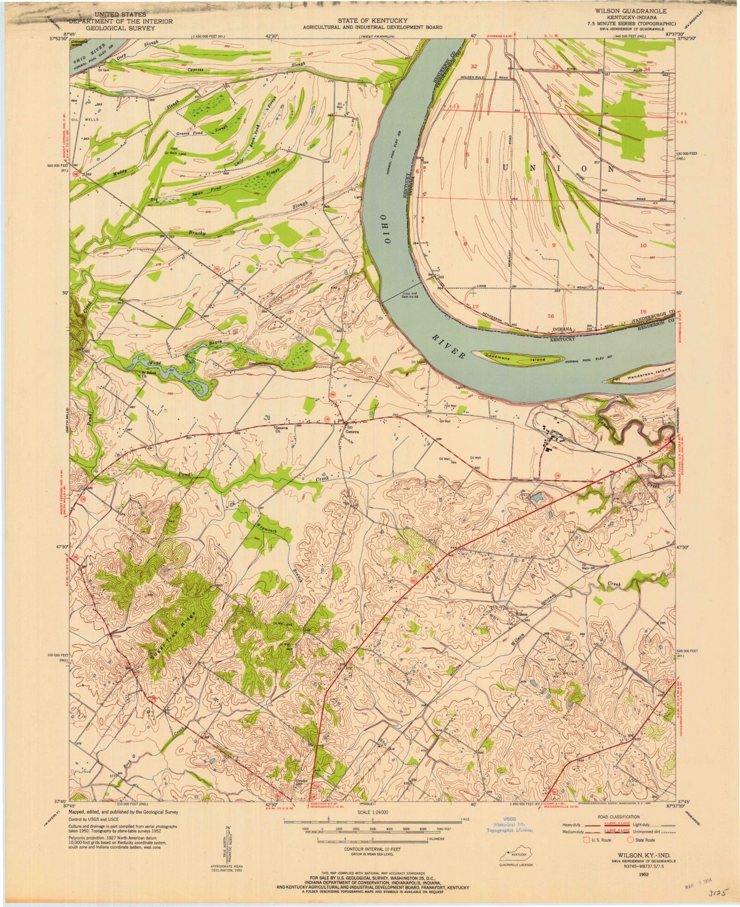
Historical USGS topographic quad map of Wilson in the states of Kentucky, Indiana. Typical map scale is 1:24,000, but may vary for certain years, if available. Print size: 24" x 27"
This quadrangle is in the following counties: Henderson, Vanderburgh.
The map contains contour lines, roads, rivers, towns, and lakes. Printed on high-quality waterproof paper with UV fade-resistant inks, and shipped rolled.
Contains the following named places: Big Swan Pond Slough, Canoe Creek, Clay Cemetery, Deadmans Island, Deep Slough, Geneva, Geneva Church, Grassy Pond Slough, Henderson Island, Little Cypress Slough, Little Swan Pond Slough, Pond Bayou, Saint Johns Church, Sandy Slough, Sugar Tree Ridge, Weymouth Branch, Wilson, Lock and Dam Number 48, Henderson City-County Airport, Corydon Division, First Kentucky Consumer Rural Cooperative Electric Service Historical Marker, Albert B Happy Chandler Historical Marker, Frenchmans Slough, Hickory Ridge, Lock and Dam Number 48, Stroud Cemetery, Fair Play Post Office (historical), Big Swan Pond Slough, Canoe Creek, Clay Cemetery, Deadmans Island, Deep Slough, Geneva, Geneva Church, Grassy Pond Slough, Henderson Island, Little Cypress Slough, Little Swan Pond Slough, Pond Bayou, Saint Johns Church, Sandy Slough, Sugar Tree Ridge, Weymouth Branch, Wilson, Lock and Dam Number 48, Henderson City-County Airport, Corydon Division, First Kentucky Consumer Rural Cooperative Electric Service Historical Marker, Albert B Happy Chandler Historical Marker, Frenchmans Slough, Hickory Ridge, Lock and Dam Number 48, Stroud Cemetery, Fair Play Post Office (historical)