
MyTopo
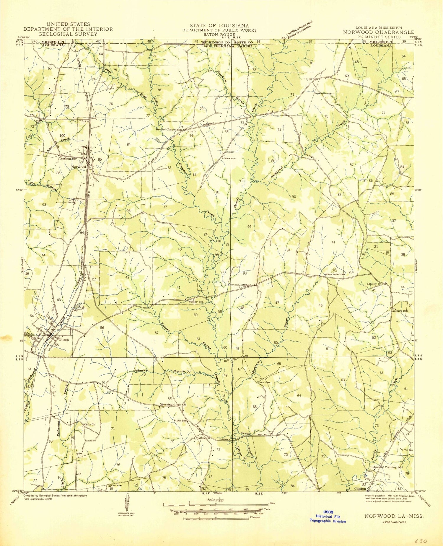
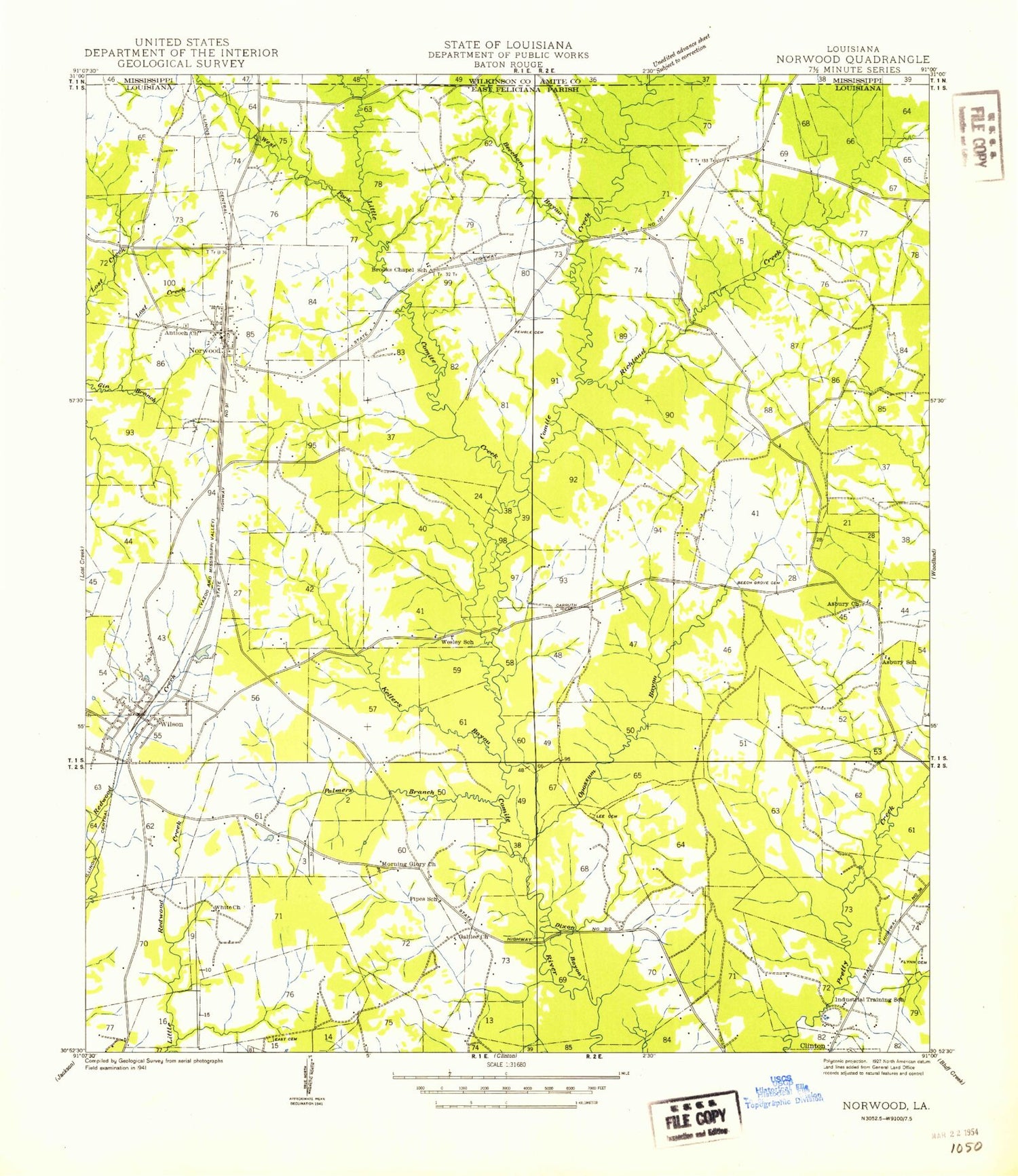
Classic USGS Wilson Louisiana 7.5'x7.5' Topo Map
Couldn't load pickup availability
Historical USGS topographic quad map of Wilson in the states of Louisiana, Mississippi. Map scale may vary for some years, but is generally around 1:24,000. Print size is approximately 24" x 27"
This quadrangle is in the following counties: Amite, East Feliciana, Wilkinson.
The map contains contour lines, roads, rivers, towns, and lakes. Printed on high-quality waterproof paper with UV fade-resistant inks, and shipped rolled.
Contains the following named places: Asbury Church, Asury School, Beech Grove Cemetery, Beecham Bayou, Beechgrove Lake Dam, Bonnie Burn Plantation, Carruth Cemetery, Comite Creek, Dixon Branch, Dubose Cemetery, East Cemetery, Easter Star Cemetery, Flynn Cemetery, Galilee Church, Haynes Lake Dam, Hollywood Lake Dam, Kellers Bayou, Lee Cemetery, Little Comite Creek, McCutcheon Field, Morning Glory Church, New Zion Church, Norwood, Norwood Cemetery, Norwood Police Department, Norwood School, Norwood Volunteer Fire Department, Opossum Bayou, Palmers Branch, Parish Governing Authority District 7, Pemble Cemetery, Pipes Cemetery, Redwood Lake Dam, Richland Church, Richland Creek, Richland Lake Dam, Richland Plantation, Richland School, Saint Paul Church Number 2, Sharps Creek, Springhill Cemetery, Village of Norwood, Village of Wilson, Walnut Branch, Ward Four, Ward Seven, Wesley Church, West Fork Little Comite Creek, White Cemetery, Wilson, Wilson Lookout Tower, Wilson Post Office, Wilson Volunteer Fire Department, WQCK-FM (Clinton), ZIP Codes: 70761, 70789


