MyTopo
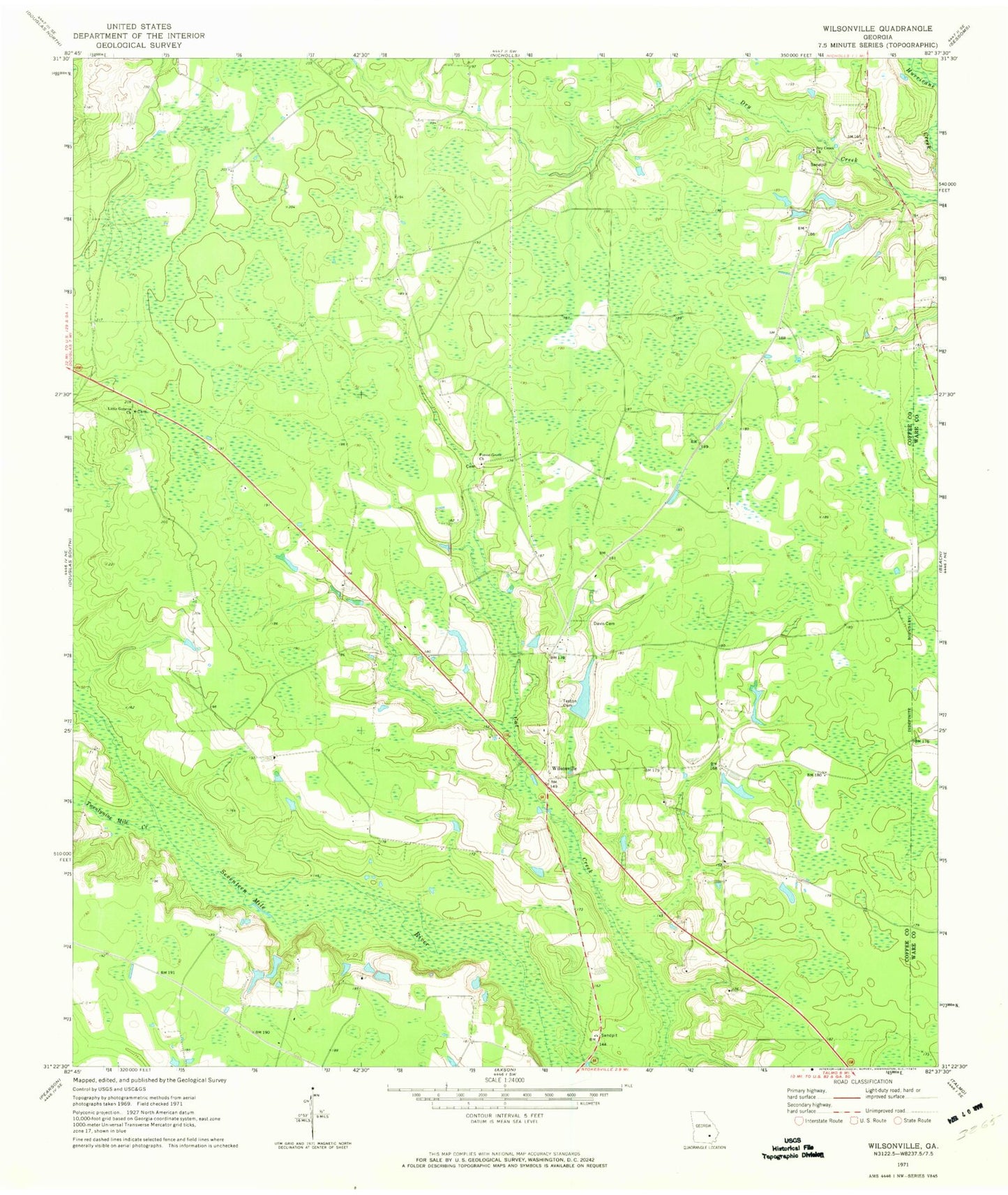
Classic USGS Wilsonville Georgia 7.5'x7.5' Topo Map
Couldn't load pickup availability
Historical USGS topographic quad map of Wilsonville in the state of Georgia. Map scale may vary for some years, but is generally around 1:24,000. Print size is approximately 24" x 27"
This quadrangle is in the following counties: Coffee, Ware.
The map contains contour lines, roads, rivers, towns, and lakes. Printed on high-quality waterproof paper with UV fade-resistant inks, and shipped rolled.
Contains the following named places: Coffee County Fire and Rescue Department Station 16, Davis Cemetery, Dry Creek Church, Dry Creek Church Cemetery, Forest Grove Church, Forest Grove Church Cemetery, Little Geneva Church, Nicholls Division, Roxie Mae Cemetery, Roxy Mae Church, Solomons Bridge Church, Teston Cemetery, Twentynine Mile Creek, Wilsonville, Wilsonville Church