MyTopo
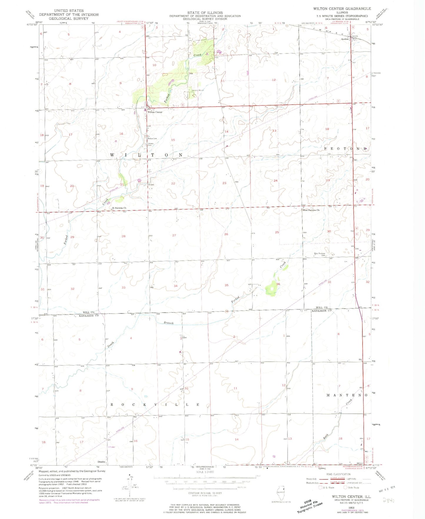
Classic USGS Wilton Center Illinois 7.5'x7.5' Topo Map
Couldn't load pickup availability
Historical USGS topographic quad map of Wilton Center in the state of Illinois. Map scale may vary for some years, but is generally around 1:24,000. Print size is approximately 24" x 27"
This quadrangle is in the following counties: Kankakee, Will.
The map contains contour lines, roads, rivers, towns, and lakes. Printed on high-quality waterproof paper with UV fade-resistant inks, and shipped rolled.
Contains the following named places: Andres, Andres Census Designated Place, Andres School, Crawford School, Gilkerson School, Hykes Grove School, Keigher School, Kelly School, Lamphere School, Manhattan Fire Protection District Station 82, McGowan School, Moran Landing Strip, Mount Saint Patrick Cemetery, Neiner Airport, Rice-School, Saint Patrick Catholic Church, Township of Wilton, Viall Homestead Airport, Wallingford, Wallingford School, West Peotone Cemetery, West Peotone Church, Will County Forest Preserve, Wilton Center, Wilton Center Cemetery, Wilton Center Census Designated Place, Wilton Center Elementary School, ZIP Code: 60950