MyTopo
Classic USGS Wilton Iowa 7.5'x7.5' Topo Map
Couldn't load pickup availability
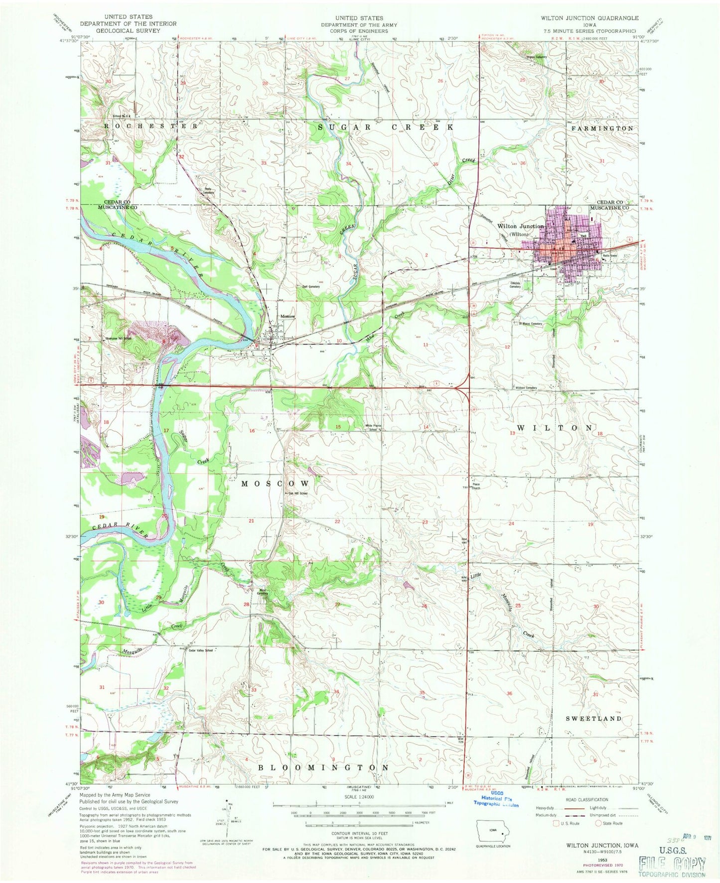
Historical USGS topographic quad map of Wilton in the state of Iowa. Map scale may vary for some years, but is generally around 1:24,000. Print size is approximately 24" x 27"
This quadrangle is in the following counties: Cedar, Muscatine.
The map contains contour lines, roads, rivers, towns, and lakes. Printed on high-quality waterproof paper with UV fade-resistant inks, and shipped rolled.
Contains the following named places: Cedar Valley School, Champion Hill School, Cherrydale Park, City of Wilton, Duff Cemetery, First Presbyterian Church, Grace United Church of Christ, Healy Cemetery, Heartland Fellowship Church, Hebron Cemetery, Jack Shuger Memorial Park, Klein Cemetery, Langes Ferry, Methodist Church, Moscow, Moscow Cemetery, Moscow Census Designated Place, Moscow Post Office, Moscow Quarry, Mud Creek, Oak Hill School, Oakdale Cemetery, Otter Creek, Peace Church, Saint Marys Catholic Church, Saint Mary's Cemetery, Sharon Cemetery, South Towne Park, Sugar Creek, Sugar Creek Mills, Sugar Creek Post Office, Summit, Summit Post Office, Summit Ridge Post Office, Township of Moscow, West View Park, White Prairie School, Wildasin Cemetery, Wildsan Cemetery, Wilton, Wilton Care Center, Wilton City Hall, Wilton Depot, Wilton Elementary School, Wilton Emergency Medical Service, Wilton Fire Department, Wilton Junior - Senior High School, Wilton Police Department, Wilton Post Office, Wilton Public Library, Wilton Water Treatment Plant, Zion Lutheran Church, Zion Lutheran School, ZIP Code: 52760