
MyTopo
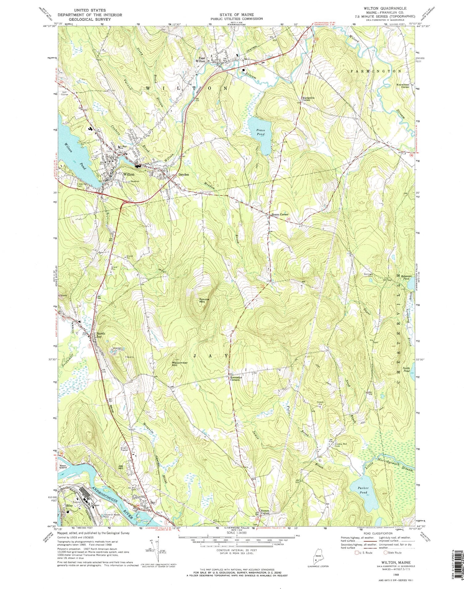
Classic USGS Wilton Maine 7.5'x7.5' Topo Map
Couldn't load pickup availability
Historical USGS topographic quad map of Wilton in the state of Maine. Typical map scale is 1:24,000, but may vary for certain years, if available. Print size: 24" x 27"
This quadrangle is in the following counties: Franklin, Oxford.
The map contains contour lines, roads, rivers, towns, and lakes. Printed on high-quality waterproof paper with UV fade-resistant inks, and shipped rolled.
Contains the following named places: Bean Island, Beans Corner, Borough Cemetery, Coubers Brook, Dryden, East Wilton, Fuller Brook, Huckleberry Stream, James Brook, Jay, Jay Hill, Jay Hill Cemetery, Kennedys Corners, Lakeview Cemetery, Macomber Hill, Meadow Brook, Nash Brook, North Jay, Parker Pond, Pease Pond, Riley, Stony Brook, Stubbs Mill Cemetery, Varnum Stream, Wilton, Knowltons Corner, MacQuillis Corner, Stones Corner, Spruce Mountain, Hilltop Airport, Town of Jay, Town of Wilton, Jay Dam, Androscoggin River Reservoir, Riley Dam, Androscoggin River Reservoir, Wilson Pond Dam, Wilson Pond, Academy Hill School, Beans Corner Baptist Church, Beans Corner Cemetery, Dryden Post Office, First Congregational Church, Gerald Cushing School, Jay Niles Memorial Library, Kineowatha Park, North Jay Cemetery, Saint Lukes Episcopal Church, Tree of Life Worship Center, Wilson Lake Country Club, Wilton Farm and Home Museum, Wilton Free Public Library, Wilton Post Office, Wilton Station (historical), Wilton United Methodist Church, Wilton Census Designated Place, Wilton Fire Department, Jay Fire Rescue Station 1, Jay Police Department, Wilton Police Department, East Wilton Cemetery, Weld Road Cemetery, Calvary Hill Christian School, Western Maine Christian Academy School, East Wilton Post Office


