MyTopo
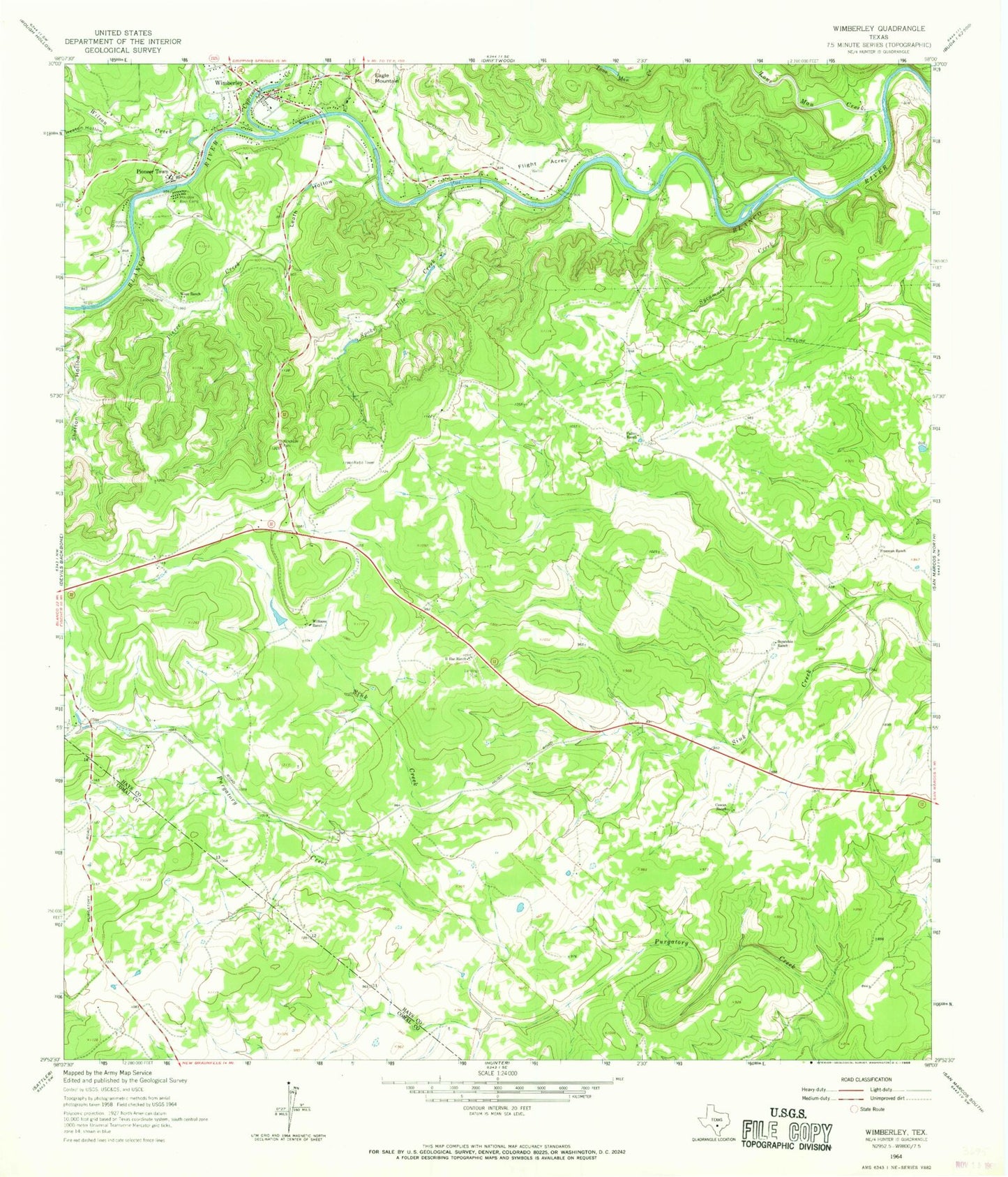
Classic USGS Wimberley Texas 7.5'x7.5' Topo Map
Couldn't load pickup availability
Historical USGS topographic quad map of Wimberley in the state of Texas. Typical map scale is 1:24,000, but may vary for certain years, if available. Print size: 24" x 27"
This quadrangle is in the following counties: Comal, Hays.
The map contains contour lines, roads, rivers, towns, and lakes. Printed on high-quality waterproof paper with UV fade-resistant inks, and shipped rolled.
Contains the following named places: B Bar Ranch, Cowan Ranch, Cypress Creek, Eagle Mountain, Flight Acres, Freeman Ranch, Fulton Ranch, Houston Boys Camp, Leath Hollow, Lone Man Creek, Pierce Creek, Pioneer Town, Scrutchin Ranch, Spoke Pile Creek, Sycamore Creek, Williams Ranch, Wimberley, Winn Ranch, Heaton Hollow, Wilson Creek, Cloptins Crossing, Winn Ranch Airport (historical), Trinity Chapel Church, Baptist Academy San Marocs Football Field, John R Dobie House, City of Wimberley, South Hays Fire Department Station 12, Wimberley Emergency Medical Service Systems, Restoration Ranch Airport, Hays County Constable's Office Precinct 3, Hays County Sheriff's Office Wimberley - Junction Substation, Wimberley City Hall