MyTopo
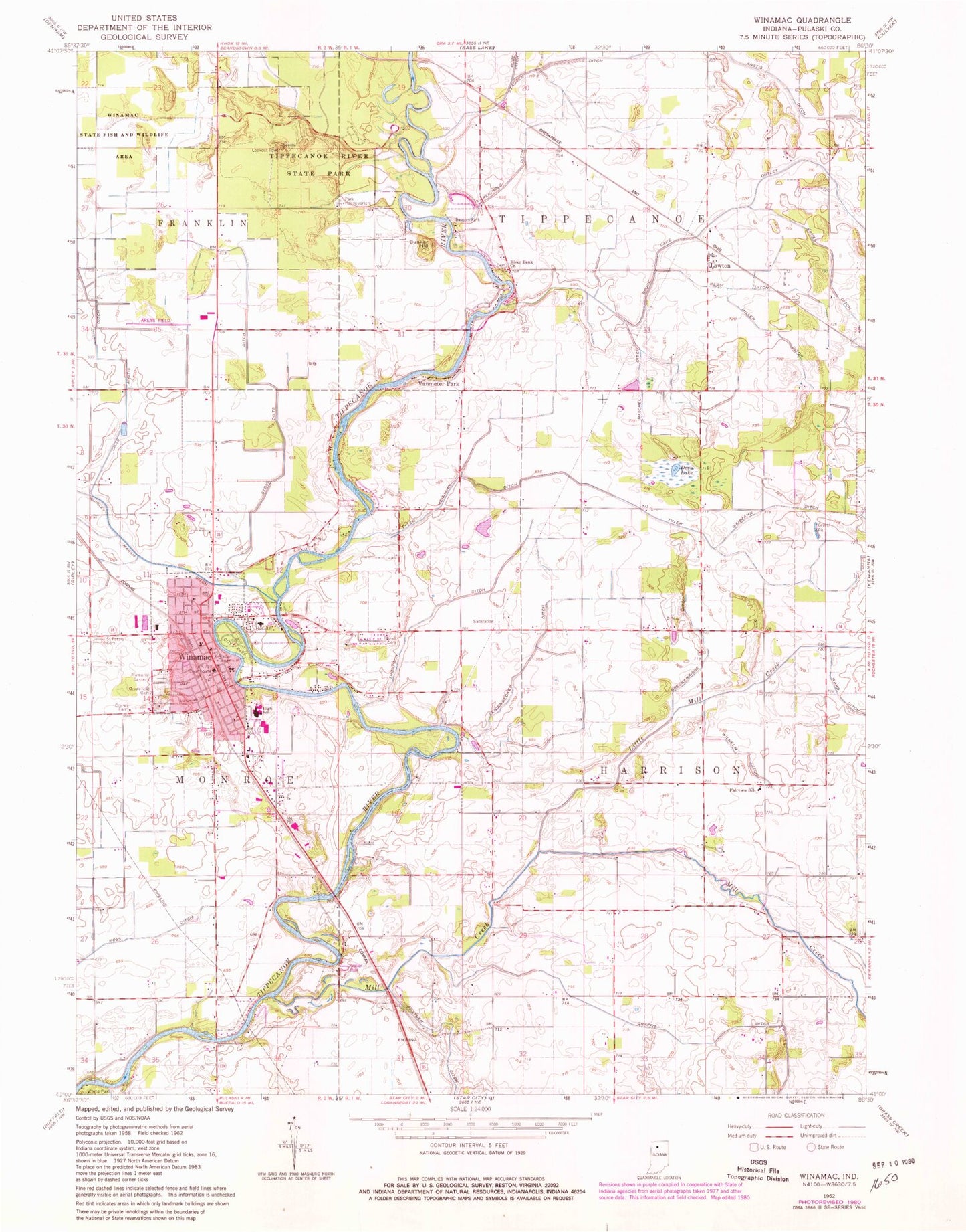
Classic USGS Winamac Indiana 7.5'x7.5' Topo Map
Couldn't load pickup availability
Historical USGS topographic quad map of Winamac in the state of Indiana. Map scale may vary for some years, but is generally around 1:24,000. Print size is approximately 24" x 27"
This quadrangle is in the following counties: Pulaski.
The map contains contour lines, roads, rivers, towns, and lakes. Printed on high-quality waterproof paper with UV fade-resistant inks, and shipped rolled.
Contains the following named places: Anstis Ditch, Arens Field, Beason Park, Breckenridge Ditch, Bruce Lake Outlet, Bunker Hill, Camp Paxton, Devil Lake, Eastern Pulaski Elementary School, Fairview School, Graffis Ditch, Haschel Ditch, James Ditch, Kessi Ditch, Lawton, Leidendecker Ditch, Little Mill Creek, McKinley Memorial Gardens, Mill Creek, Miller Ditch, Pulaski County Emergency Medical Services, Pulaski County Sheriff's Office, Pulaski Memorial Hospital, Reed Cemetery, Reinhold Ditch, River Bank Church, Saint Peters Cemetery, Stone Dilts Ditch, Thompson Ditch, Town of Winamac, Township of Harrison, Tyler Weisjahn Ditch, Vanmeter Park, Wilhelm Ditch, Winamac, Winamac Cemetery, Winamac Community High School, Winamac Community Junior High School, Winamac Police Department, Winamac Post Office, Winamac State Fish and Wildlife Area, Winamac Volunteer Fire Department