MyTopo
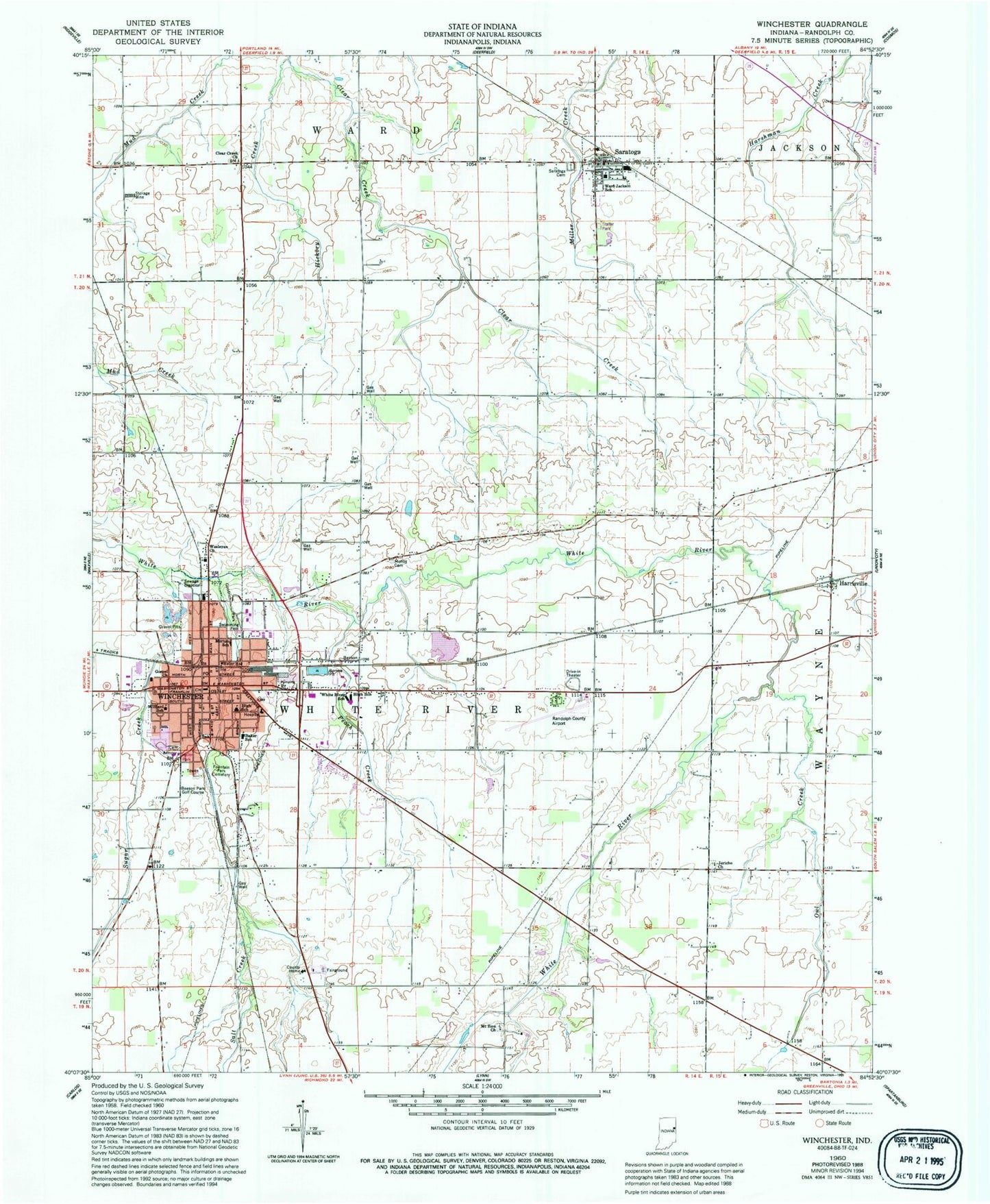
Classic USGS Winchester Indiana 7.5'x7.5' Topo Map
Couldn't load pickup availability
Historical USGS topographic quad map of Winchester in the state of Indiana. Map scale may vary for some years, but is generally around 1:24,000. Print size is approximately 24" x 27"
This quadrangle is in the following counties: Randolph.
The map contains contour lines, roads, rivers, towns, and lakes. Printed on high-quality waterproof paper with UV fade-resistant inks, and shipped rolled.
Contains the following named places: Airline Twin Drive-In, City of Winchester, Clear Creek Church, Fountain Park Cemetery, Goodrich Park, Gospel Church, Harrisville, Hickory Creek, Jericho Church, Lee L Driver Junior High School, Moffitt Cemetery, Mount Zion Church, O R Baker Elementary School, Oliver P Morton Elementary School, Owl Creek, Peach Creek, Randolph County Airport, Randolph County Emergency Medical Services, Randolph County Sheriff's Office, Saint Vincent Randolph Hospital, Salt Creek, Saratoga, Saratoga Airport, Saratoga Cemetery, Saratoga Post Office, Shelley Ditch, Sugar Creek, Town of Saratoga, Ward Township Volunteer Fire Department, Ward-Jackson School, Wesleyan Church, White River Township Fire Department, Willard Elementary School, Winchester, Winchester Community High School, Winchester Fire Department, Winchester Police Department, Winchester Post Office, WZZY-FM (Winchester), ZIP Codes: 47382, 47394