MyTopo
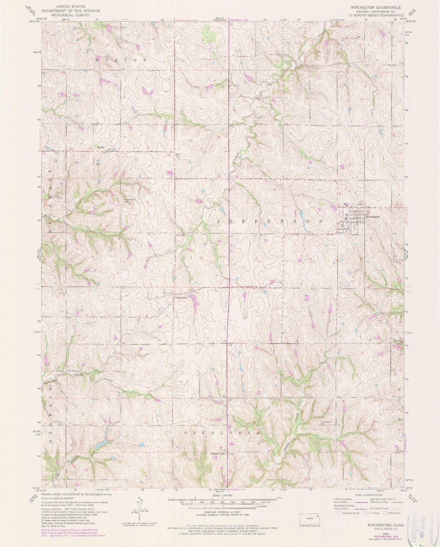
Classic USGS Winchester Kansas 7.5'x7.5' Topo Map
Couldn't load pickup availability
Historical USGS topographic quad map of Winchester in the state of Kansas. Map scale may vary for some years, but is generally around 1:24,000. Print size is approximately 24" x 27"
This quadrangle is in the following counties: Jefferson.
The map contains contour lines, roads, rivers, towns, and lakes. Printed on high-quality waterproof paper with UV fade-resistant inks, and shipped rolled.
Contains the following named places: Boyle, City of Winchester, Courtney Farms, Dunavant, F W Huston Medical Center, Fairview Cemetery, Flying T Airport, Grayson School, Jefferson County North High School, Jefferson County North School District Offices, Jefferson County Township Fire Department 10 and Winchester Fire Department, Plum Grove Cemetery, Spring Grove Cemetery, Township of Jefferson, Winchester, Winchester Police Department, Winchester Post Office, Winchester Public Library, Winchester Wastewater Treatment Facility