MyTopo
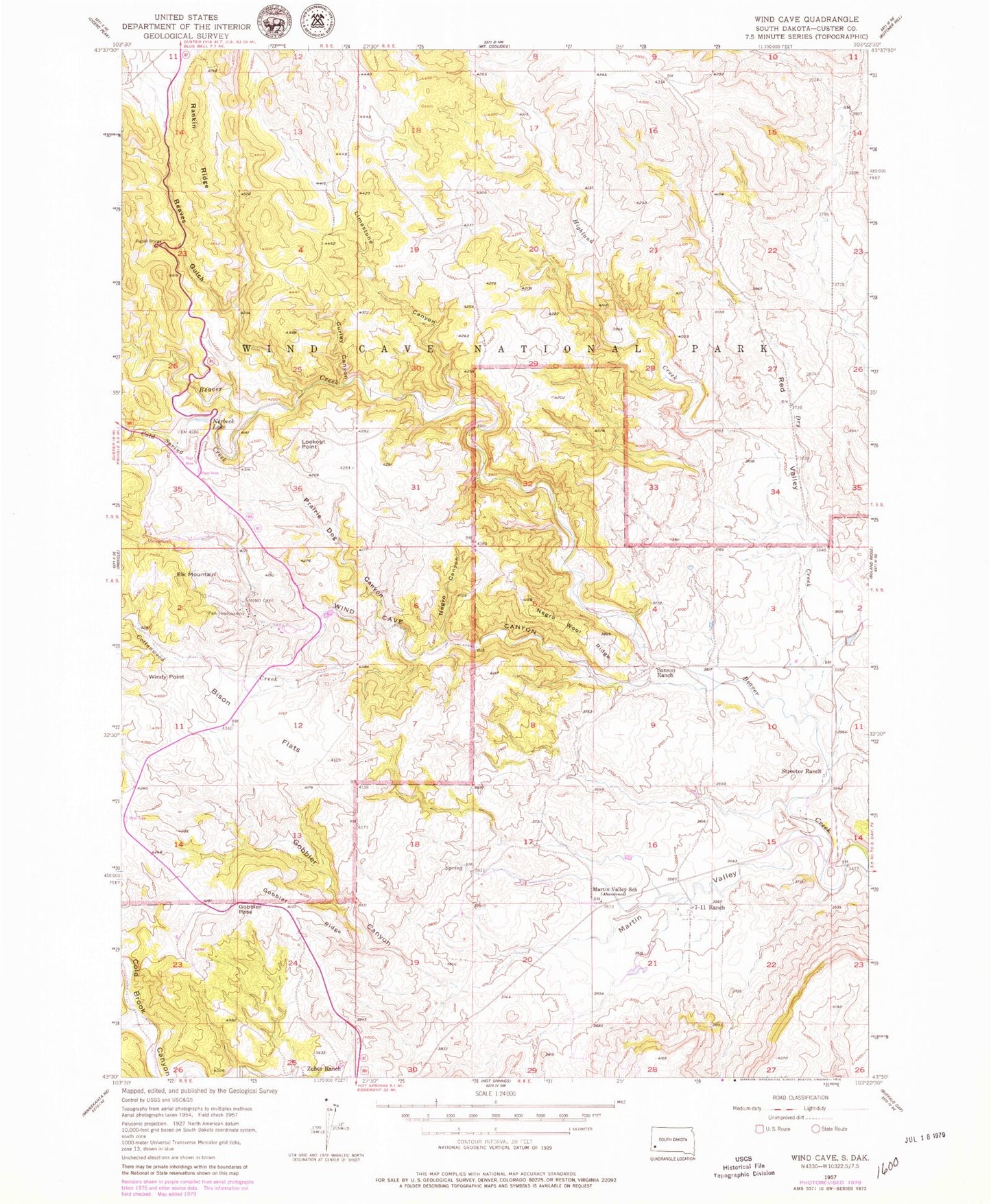
Classic USGS Wind Cave South Dakota 7.5'x7.5' Topo Map
Couldn't load pickup availability
Historical USGS topographic quad map of Wind Cave in the state of South Dakota. Typical map scale is 1:24,000, but may vary for certain years, if available. Print size: 24" x 27"
This quadrangle is in the following counties: Custer.
The map contains contour lines, roads, rivers, towns, and lakes. Printed on high-quality waterproof paper with UV fade-resistant inks, and shipped rolled.
Contains the following named places: Bison Flats, Cold Spring Creek, Cottonwood Creek, Curley Canyon, Dry Creek, Elk Mountain, Gobbler Canyon, Gobbler Pass, Gobbler Ridge, Highland Creek, Limestone Canyon, Lookout Point, Martin Valley, Martin Valley School, Negro Canyon, Negro Wool Ridge, Norbeck Lake, Pigtail Bridge, Prairie Dog Canyon, Reaves Gulch, Sanson Ranch, Seven-11 Ranch, Streeter Ranch, Wildcat Canyon, Wind Cave Canyon, Windy Point, Zuber Ranch, Nobeck Dam, Wind Cave National Park, Elk Mountain Campgrounds, Red Valley