
MyTopo
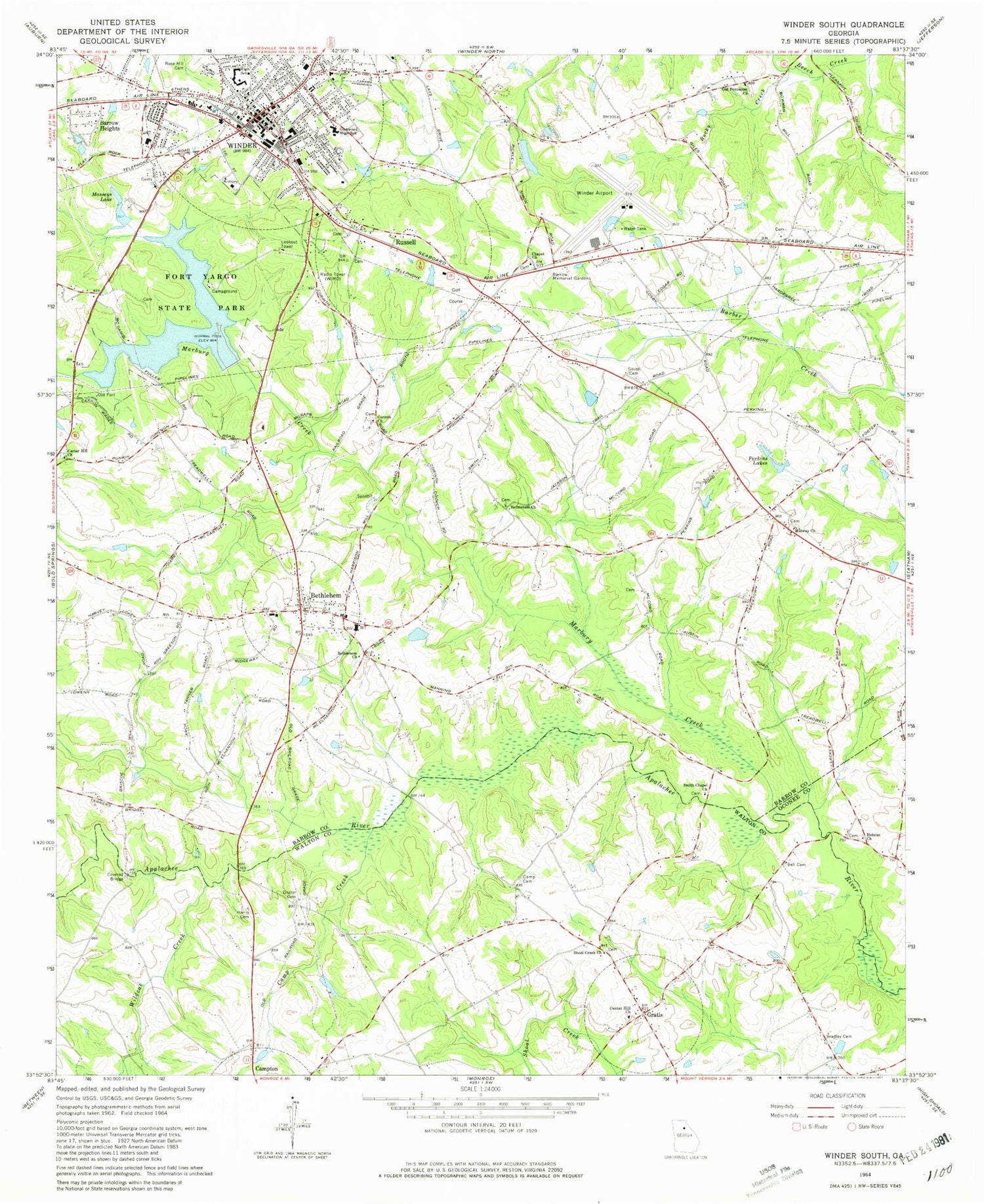
Classic USGS Winder North Georgia 7.5'x7.5' Topo Map
Couldn't load pickup availability
Historical USGS topographic quad map of Winder North in the state of Georgia. Map scale may vary for some years, but is generally around 1:24,000. Print size is approximately 24" x 27"
This quadrangle is in the following counties: Barrow, Jackson.
The map contains contour lines, roads, rivers, towns, and lakes. Printed on high-quality waterproof paper with UV fade-resistant inks, and shipped rolled.
Contains the following named places: Barrow County Fire and Emergency Services Station 6, Barrow Medical Center Heliport, Cedar Creek, Center Church, Center Methodist Cemetery, Collins School, County Line Elementary School, Dosters Creek, Dosters Family Cemetery, Ebenezer Cemetery, Ebenezer Church, Elmwood School, Flanagans Mill, Gum Spring School, Gum Springs Baptist Cemetery, Gum Springs Church, Gum Springs Elementary School, Guyouzts Dam, Guyouzts Lake, Hancock Bridge, Hawk Creek, Holsenbeck Elementary School, Hope Haven Mission, Hoschton Police Department, House Cemetery, Indian Creek, Jackson Trail Christian School, Jackson Trail Monument, Jackson Trail Volunteer Fire Department, Lesters Lake, Lesters Lake Dam, Lyle Cemetery, Marcus, Middle Oconee Walnut Creek 19 Dam, Middle Oconee-Walnut Creek 18 Dam, Mulberry, New Hope Church, New Hope Methodist Cemetery, New Pentecost Church, Northeast Georgia Medical Center Barrow, Oak Grove Baptist Cemetery, Oak Grove Church, Reservoir 18, Reservoir 19, Rockwell Church, Rockwell School, Rocky Creek, Rose Hill Cemetery, Sells, Sells Mill, Union Church, Walnut Fork Baptist Cemetery, Walnut Fork Church, West Jackson Middle School, White Plains Baptist Cemetery, White Plains Church, Winder - Barrow High School, Winder Division, Winder Reservoir, Winder Reservoir Dam, Wood Cemetery


