MyTopo
Classic USGS Winder South Georgia 7.5'x7.5' Topo Map
Couldn't load pickup availability
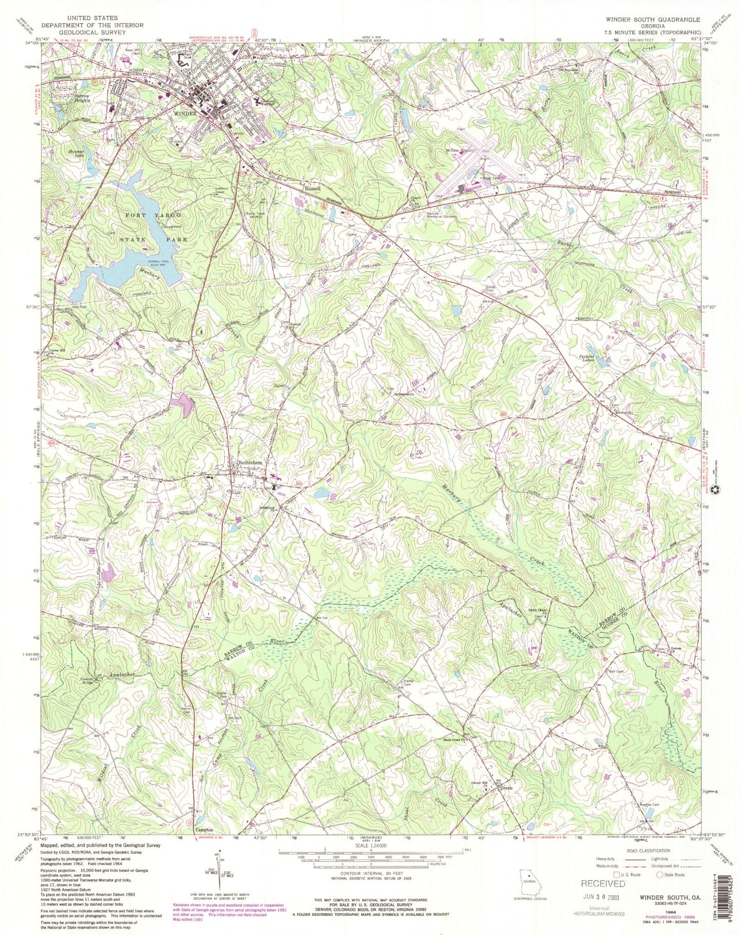
Historical USGS topographic quad map of Winder South in the state of Georgia. Typical map scale is 1:24,000, but may vary for certain years, if available. Print size: 24" x 27"
This quadrangle is in the following counties: Barrow, Oconee, Walton.
The map contains contour lines, roads, rivers, towns, and lakes. Printed on high-quality waterproof paper with UV fade-resistant inks, and shipped rolled.
Contains the following named places: Marbury Creek, Bell Cemetery, Bradley Cemetery, Camp Creek, Doster Cemetery, Fort Yargo State Park, Harris Cemetery, Hebron Church, Masseys Lake, Midway Church, Old Pentecost Church, Perkins Lakes, Rocky Creek, Rose Hill Cemetery, Shoal Creek Church, Smith Cemetery, Smith Chapel Church, Wildcat Creek, Winder, Barrow Heights, Bethlehem, Russell, Harrison Dam, Harrison Lake, Marburg Creek, Masseys Lake Dam, Lower Twin Lake Dam, Lower Twin Lake, Bradley, Barrow County Airport, WIMO-AM (Winder), Barrow Memorial Gardens, Bethlehem Church, Bethlehem Church, Camp Cemetery, Carter Hill Church, Center Hill Church, Chapel Church, Corinth Church, Winder - Barrow Middle School, Gratis, Sims Bridge, Sims Cemetery, Athens-Candler-Church Street Historic District, Barrow County, Barrow County Courthouse, Barrow County Jail, Bethlehem African Methodist Episcopal Zion Church, Bethlehem City Hall, Bethlehem Elementary School, Bethlehem Junior High School (historical), Broad Street Commercial Historic District, Bush Chapel African Methodist Episcopal Church, Carter Hill Christian Cemetery, Carter Hill School (historical), Church of Jesus Christ, Corinth School (historical), East Side Baptist Church, Eastside Church, First Baptist Church, First Christian Church, First Presbyterian Church, First United Methodist Church, Fort Yargo (historical), Hintons Academy (historical), Jackson Street Commerical Historic District, Kilgore Mill Covered Bridge, North Broad Street Residential Historic District, Pentecostal Temple, Pine Hills Golf Course, Russell Middle School, Russell Cemetery, Russell Homeplace Historic District, Smiths Chapel School (historical), Winder City Hall, Winder Depot, Winder Grade School (historical), Winder High School (historical), Winder Post Office, Winder Wesleyan Methodist Church, Winder-Barrow Hospital (historical), Bethlehem Division, Campton Division, Russell Census Designated Place, Town of Bethlehem, City of Winder, Hope Christian Academy, Winder Fire Department Station 1, Bethlehem Fire Department Station 3, Georgia Forestry Commission Clarke - Oconee Office, Winder Fire Department Station 2, Walton County Fire Rescue Department Station 9, Winder Police Department, Barrow County Sheriff's Office, Bethlehem Post Office