MyTopo
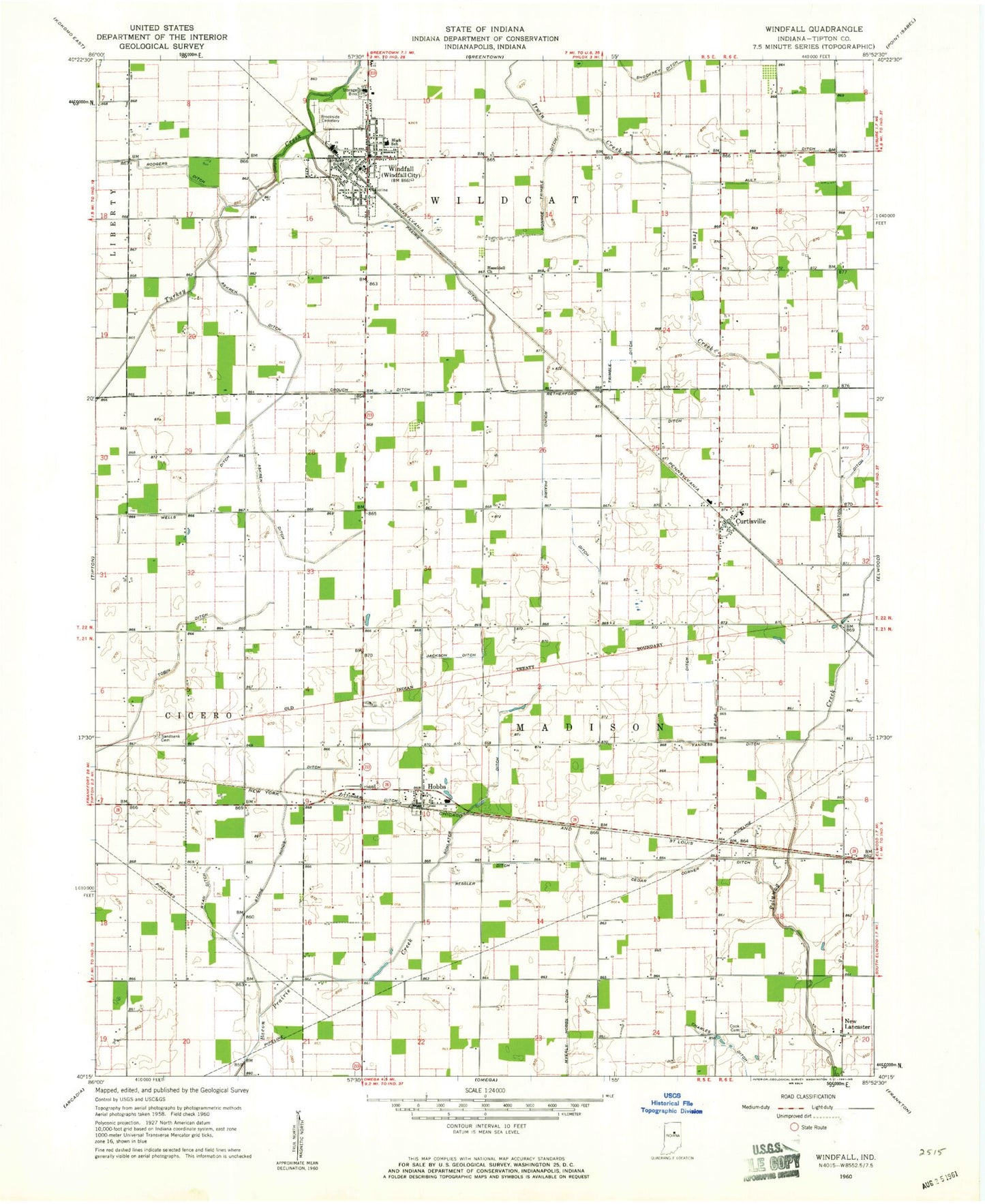
Classic USGS Windfall Indiana 7.5'x7.5' Topo Map
Couldn't load pickup availability
Historical USGS topographic quad map of Windfall in the state of Indiana. Map scale may vary for some years, but is generally around 1:24,000. Print size is approximately 24" x 27"
This quadrangle is in the following counties: Tipton.
The map contains contour lines, roads, rivers, towns, and lakes. Printed on high-quality waterproof paper with UV fade-resistant inks, and shipped rolled.
Contains the following named places: Askren Ditch, Ault Ditch, Brookside Cemetery, Cedar Corner Ditch, Charles Ditch, Cook Cemetery, Crouch Ditch, Curtisville, Ellison Airport, Hazeldell Church, Hobbs, Hobbs Post Office, Jackson Ditch, Madison Township Volunteer Fire Department, Monroe Trimble Ditch, Myerly Ditch, New Lancaster, Parr Ditch, Reddington Ditch, Ressler Ditch, Retherford Ditch, Rodgers Ditch, Round Prairie Ditch, Ryan Ditch, Sandbank Cemetery, Schlater Ditch, Stone Hinds Ditch, Tobin Ditch, Town of Windfall City, Township of Madison, Township of Wildcat, Trimble Ditch, Vanness Ditch, Wells Ditch, Wildcat Township Volunteer Fire Department, Windfall, Windfall Elementary School, Windfall Police Department, Windfall Post Office, Zea Mays Airport, Zittinger Ditch, ZIP Codes: 46047, 46076