MyTopo
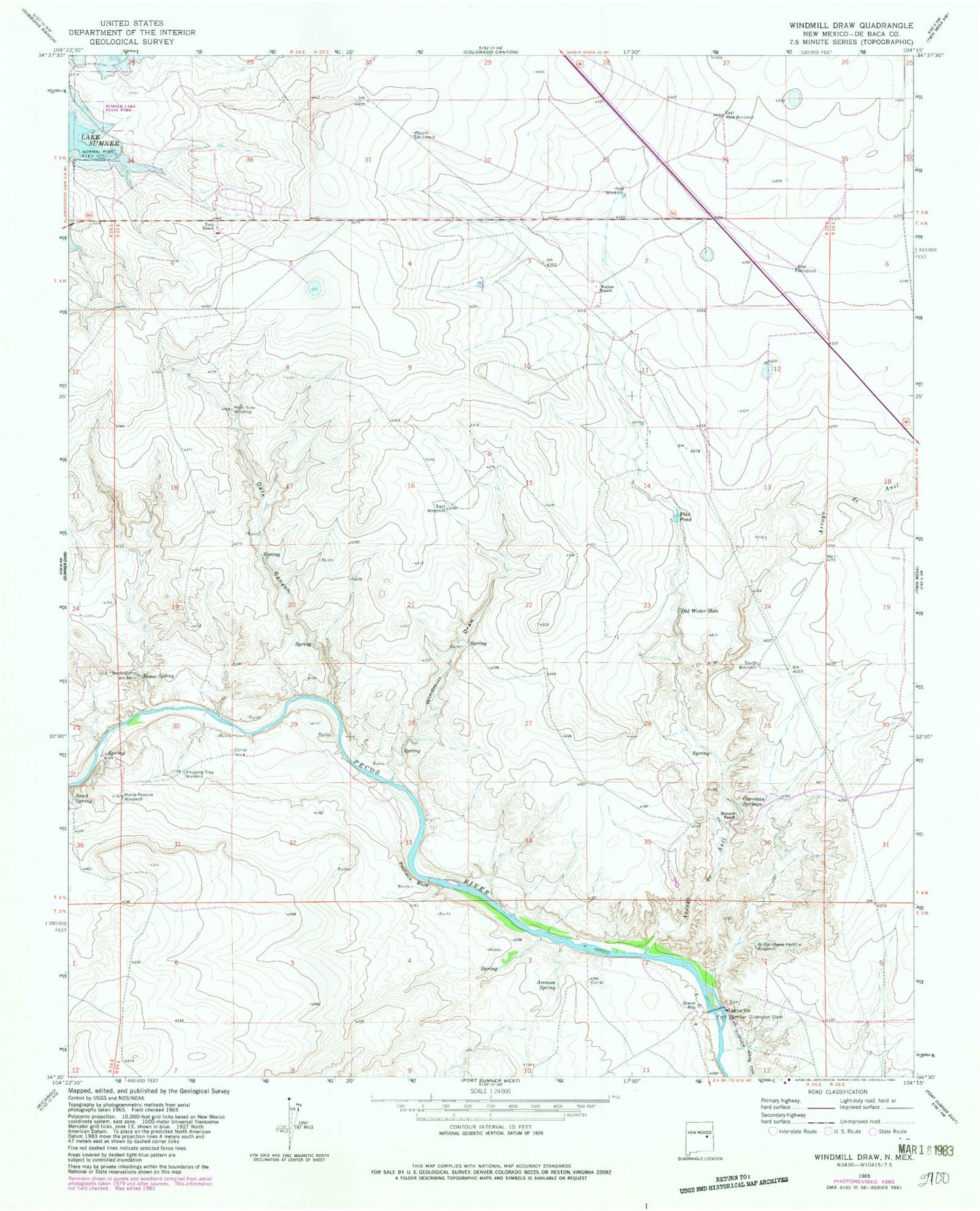
Classic USGS Windmill Draw New Mexico 7.5'x7.5' Topo Map
Couldn't load pickup availability
Historical USGS topographic quad map of Windmill Draw in the state of New Mexico. Map scale may vary for some years, but is generally around 1:24,000. Print size is approximately 24" x 27"
This quadrangle is in the following counties: De Baca.
The map contains contour lines, roads, rivers, towns, and lakes. Printed on high-quality waterproof paper with UV fade-resistant inks, and shipped rolled.
Contains the following named places: 10377 Water Well, Arenosa Spring, Arroyo de Anil, Brassell Ranch, Carretas Springs, Dark Canyon, East Hale Windmill, East Windmill, Fish Pond, Fort Sumner Diversion Dam, Hale Windmill, Horse Pasture Windmill, James Spring, North Camp Windmill, North Windmill, Old Water Hole, Pacheco Bluff, Sand Spring, Shipping Trap Windmill, South Windmill, Star Windmill, Walton Ranch, West River Windmill, Windmill Draw, Winter Horse Pasture Windmill, York Ranch