
MyTopo
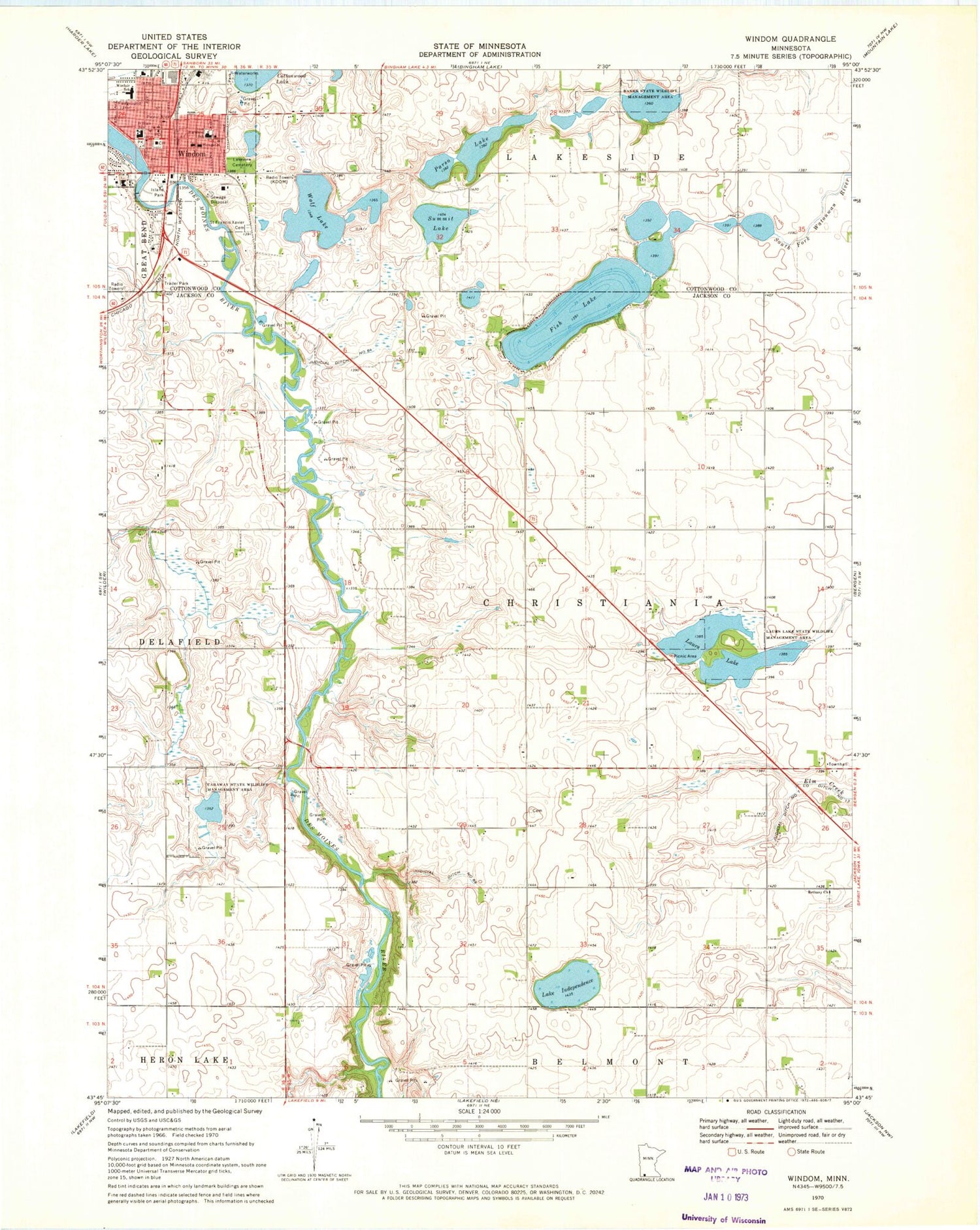
Classic USGS Windom Minnesota 7.5'x7.5' Topo Map
Couldn't load pickup availability
Historical USGS topographic quad map of Windom in the state of Minnesota. Map scale may vary for some years, but is generally around 1:24,000. Print size is approximately 24" x 27"
This quadrangle is in the following counties: Cottonwood, Jackson.
The map contains contour lines, roads, rivers, towns, and lakes. Printed on high-quality waterproof paper with UV fade-resistant inks, and shipped rolled.
Contains the following named places: American Lutheran Church, Banks State Wildlife Management Area, Bethany Cemetery, Bethany Church, Caraway State Wildlife Management Area, Christiana Norwegian Cemetery, City of Windom, Cottonwood County Courthouse, Cottonwood County Fairgrounds, Cottonwood County Historical Society, Cottonwood County Jail, Cottonwood County Sheriff's Office, Cottonwood County Waterfowl Production Area, Episcopal Church of the Good Shepherd, Evangelical Free Church, First Baptist Church, First Presbyterian Church, Fish Lake, Fish Lake Census Designated Place, Fish Lake Dam, Good Samaritan Community Care Center, Highland School, Island Park, Judicial Ditch Number Seven, Judicial Ditch Number Sixtyfour, Kastle Kingdom Park, KDOM-AM (Windom), Lake Independence, Lakeview Cemetery, Laurs Lake, Laurs Lake State Wildlife Management Area, Legion Field, Living Word Lutheran Church, Lowers Lake Wayside, Lutheran Church of Our Savior, Mayflower Park, Parso Lake, Saint Francis Xavier Catholic Church, Saint Francis Xavier Cemetery, Summit Lake, Township of Christiania, Turner Field, Windom, Windom City Hall, Windom Police Department, Windom Post Office, Windom Public Library, Windom Volunteer Fire Department, Winfair School, Witt Memorial Park, Wolf Lake


