MyTopo
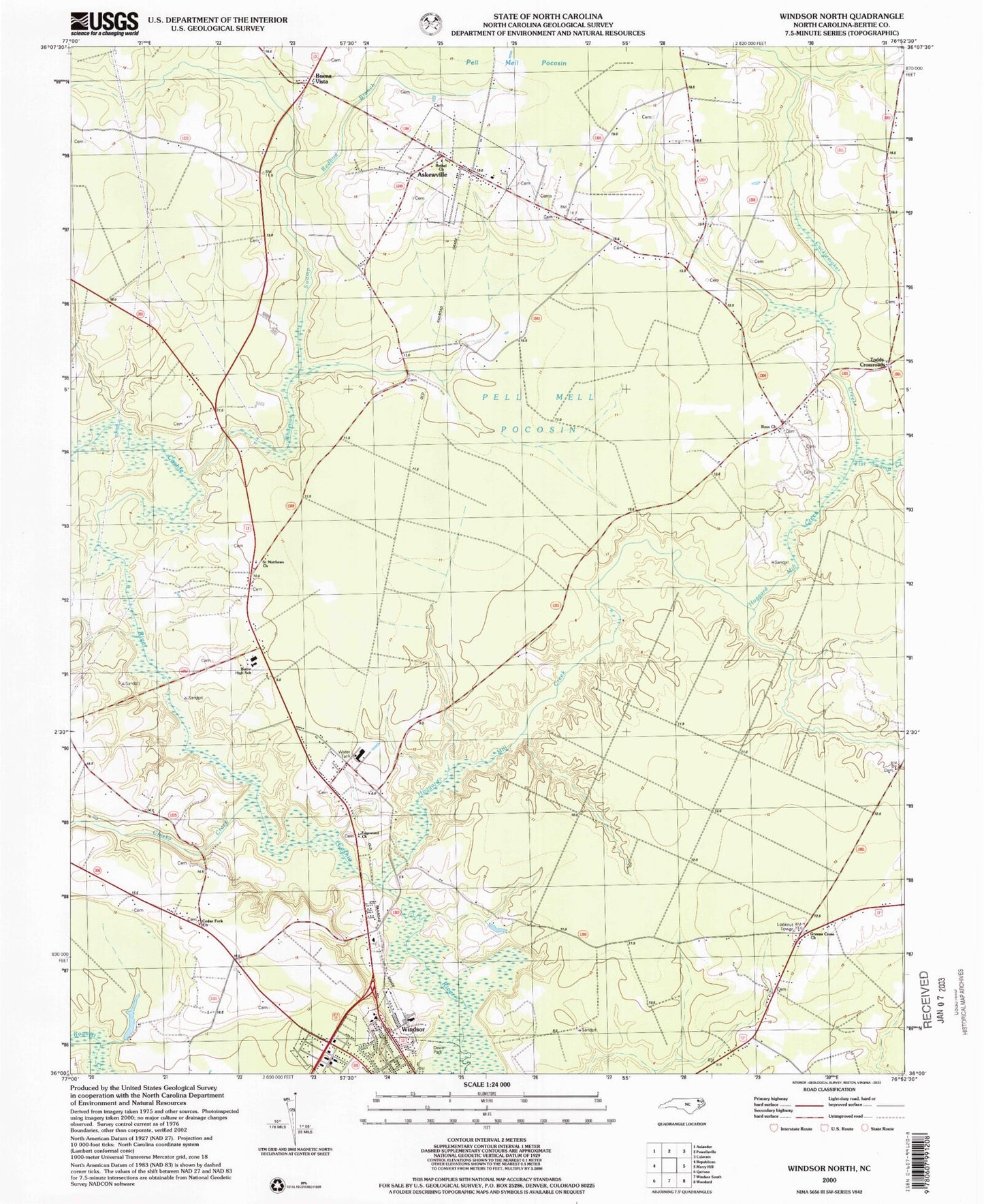
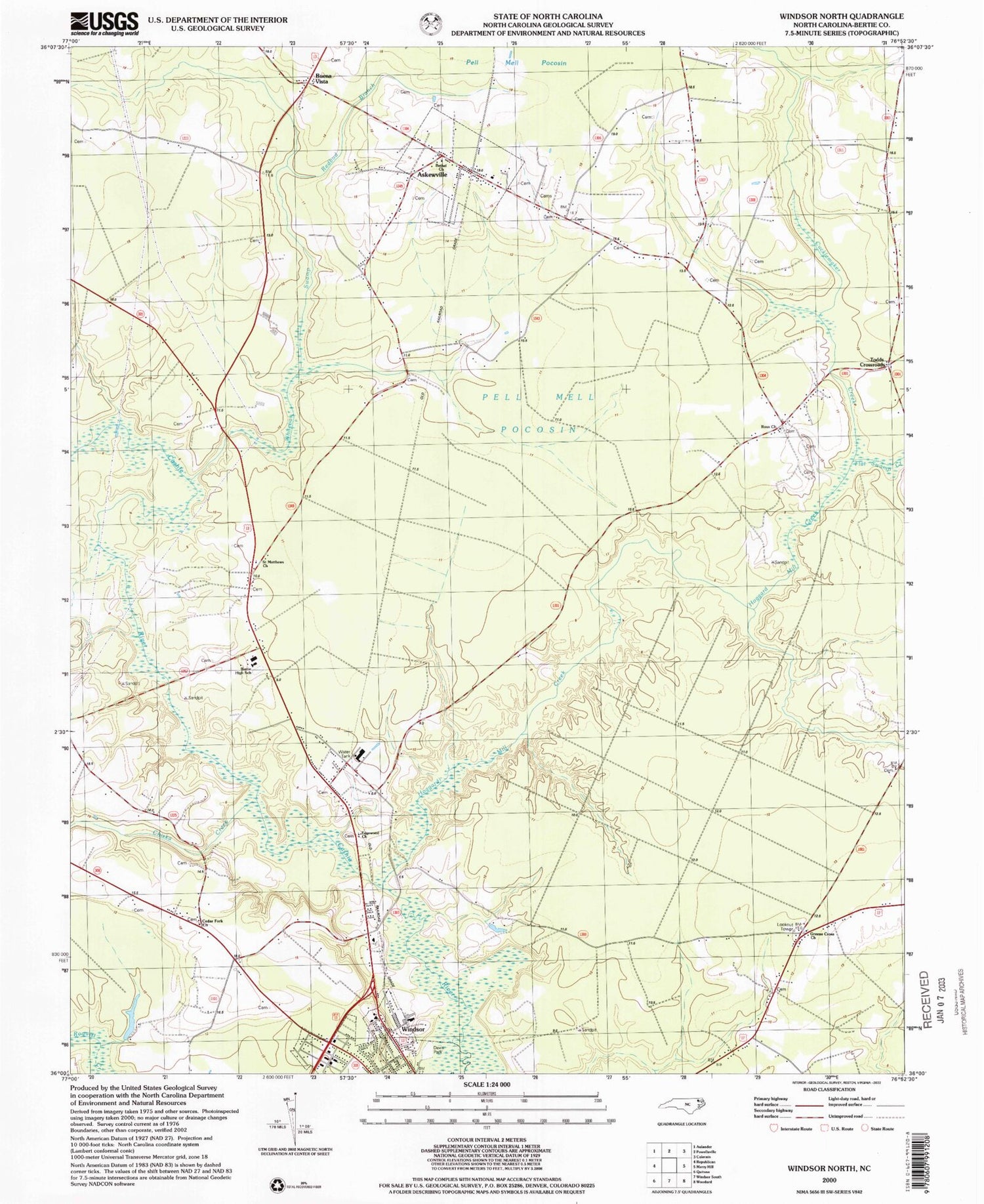
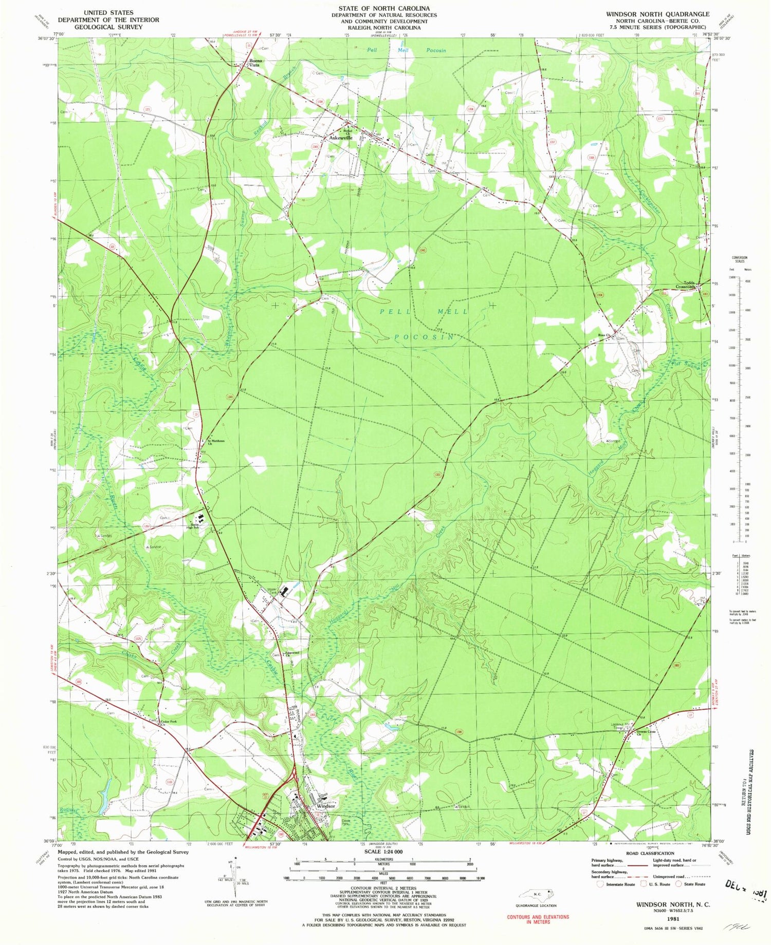
Classic USGS Windsor North North Carolina 7.5'x7.5' Topo Map
Couldn't load pickup availability
Historical USGS topographic quad map of Windsor North in the state of North Carolina. Map scale may vary for some years, but is generally around 1:24,000. Print size is approximately 24" x 27"
This quadrangle is in the following counties: Bertie.
The map contains contour lines, roads, rivers, towns, and lakes. Printed on high-quality waterproof paper with UV fade-resistant inks, and shipped rolled.
Contains the following named places: Askewville, Askewville School, Askewville Volunteer Fire Department, Bertie County, Bertie High School, Bethel Church, Buena Vista, Butlers, Cedar Fork Church, Chiska Creek, Cucklemaker Creek, Davis Park, Edgewood Cemetery, Edgewood Church, Flat Swamp Creek, Greens Cross Church, Hoggard Mill Creek, Lea Lumber Company Airport, Pell Mell Pocosin, Redbud Branch, Ross Church, Saint Matthews Church, Todds Crossroads, Town of Askewville, WDJB-FM (Windsor), Whiteoak Swamp, Windsor Fire Department, Wolfington