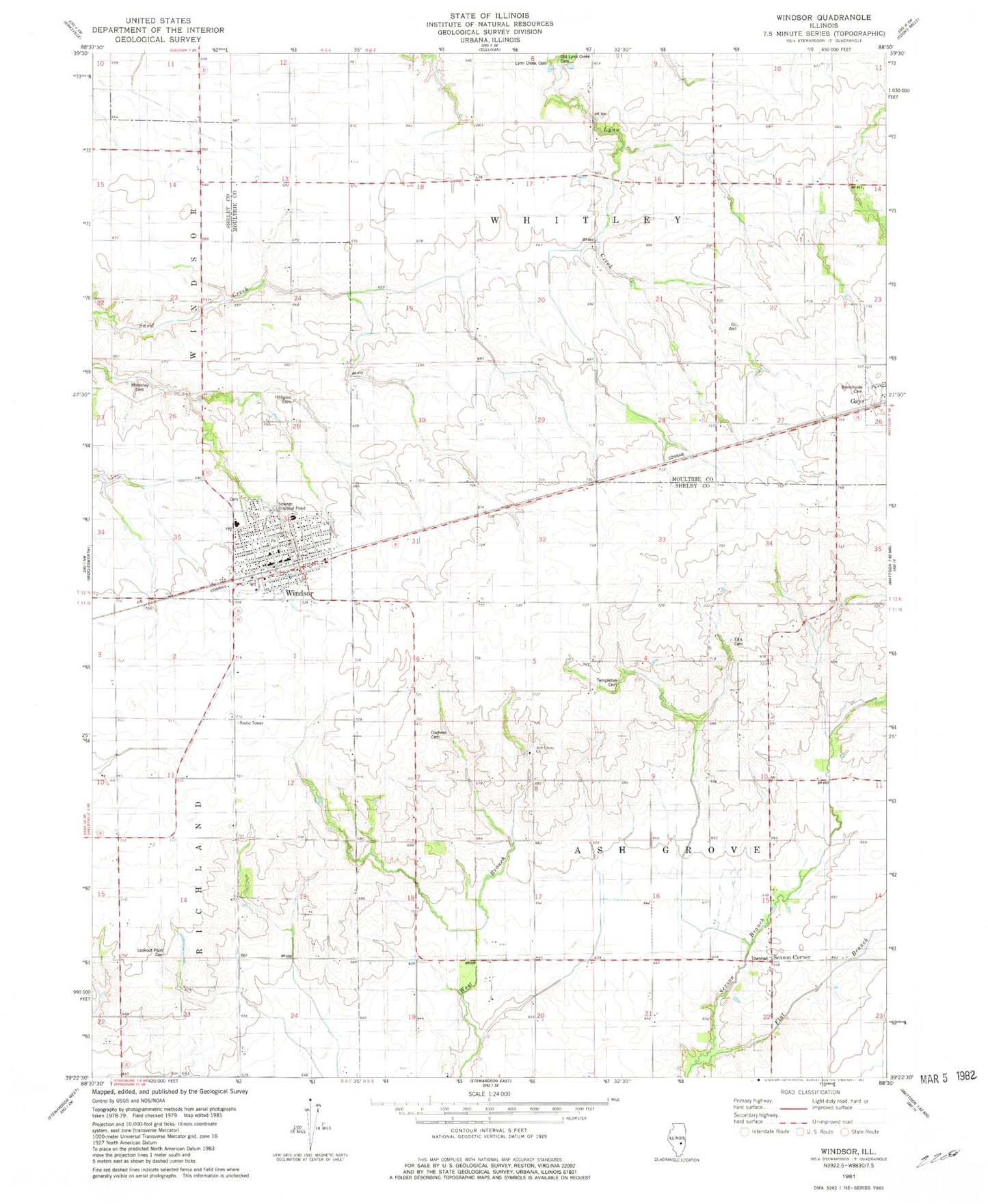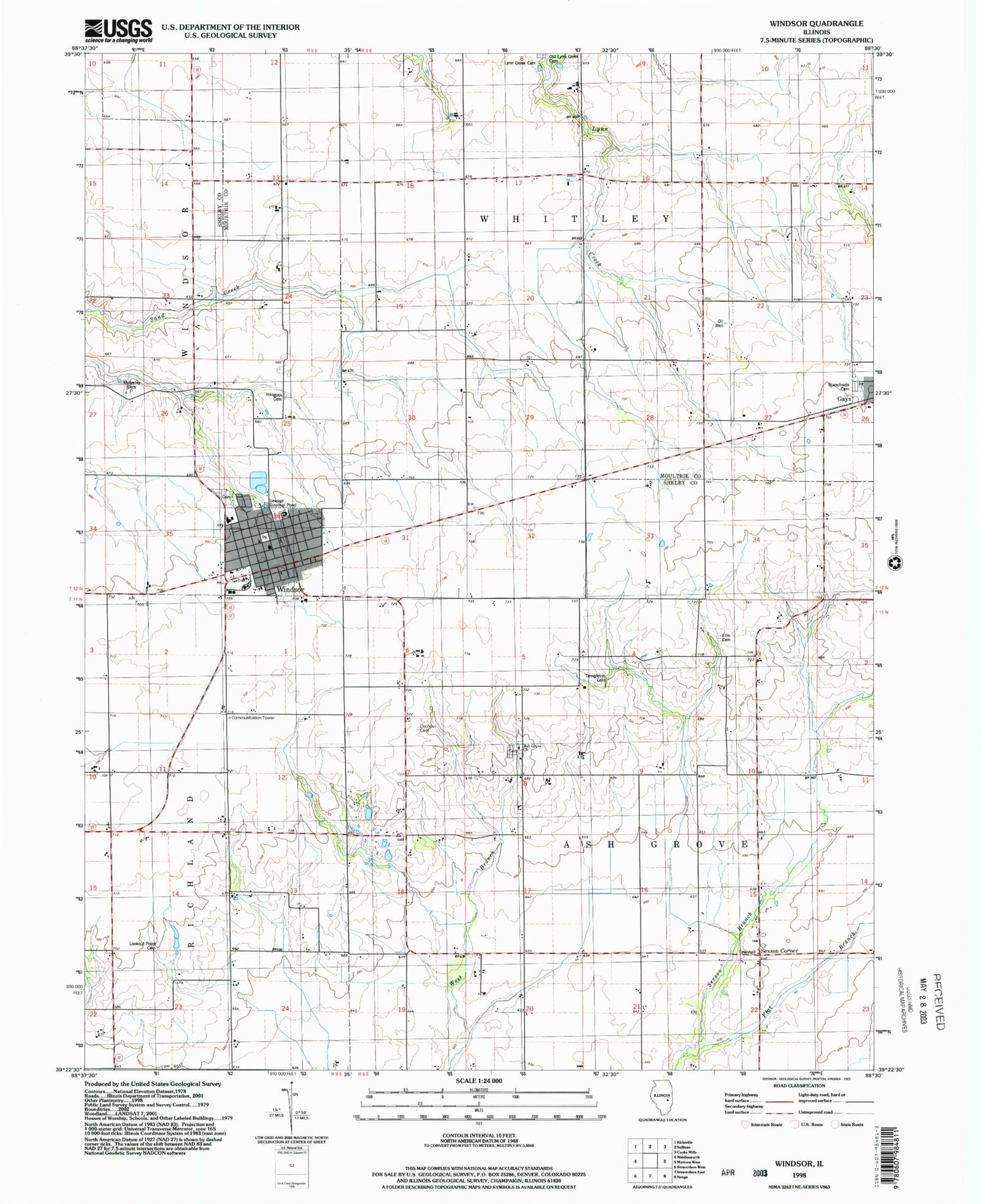
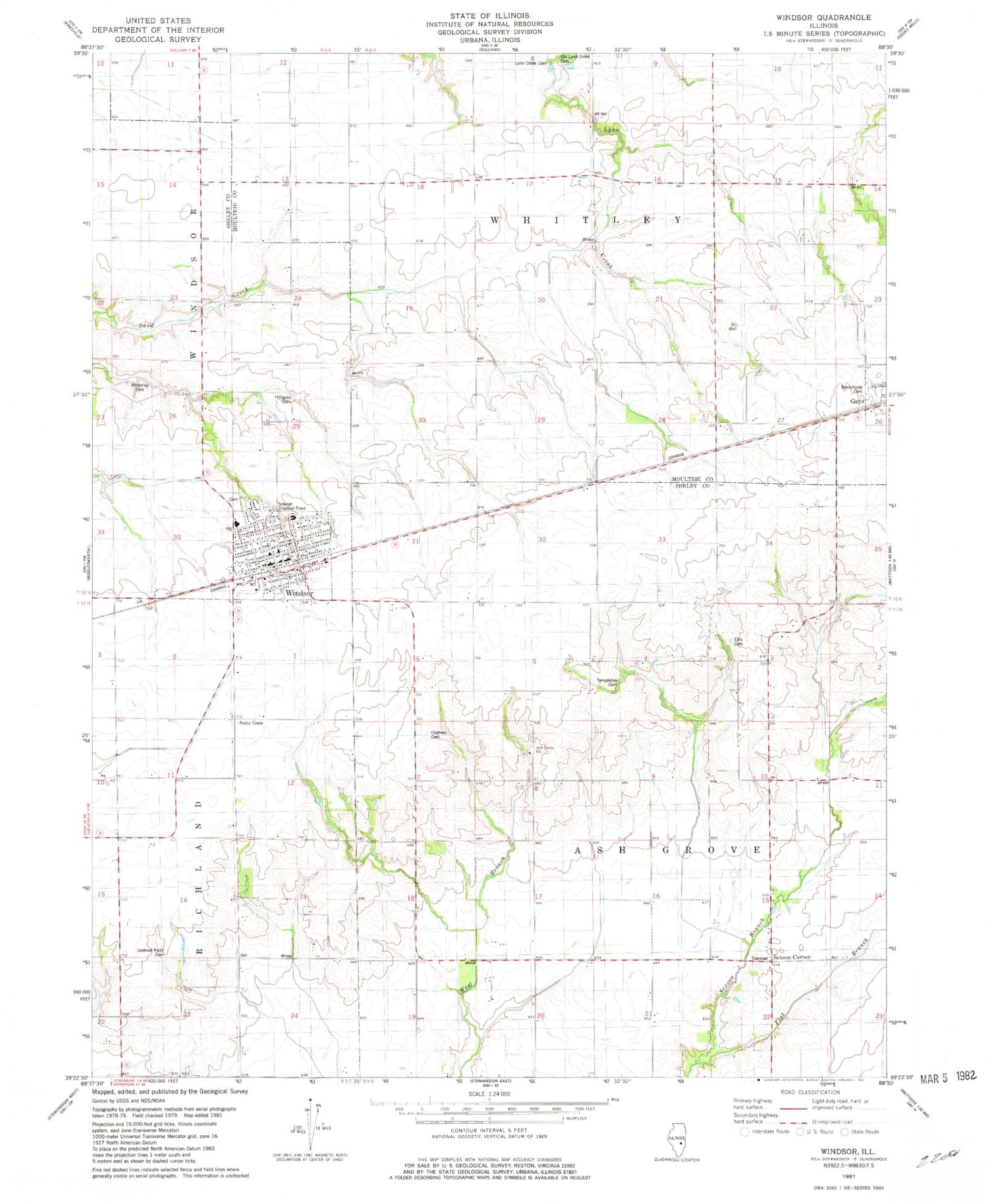
MyTopo
Classic USGS Windsor Illinois 7.5'x7.5' Topo Map
Couldn't load pickup availability
Historical USGS topographic quad map of Windsor in the state of Illinois. Map scale may vary for some years, but is generally around 1:24,000. Print size is approximately 24" x 27"
This quadrangle is in the following counties: Moultrie, Shelby.
The map contains contour lines, roads, rivers, towns, and lakes. Printed on high-quality waterproof paper with UV fade-resistant inks, and shipped rolled.
Contains the following named places: Ash Grove Cemetery, Ash Grove Church, Ash Grove School, Ash Grove Townhall, Branch Side Cemetery, City of Windsor, Cochran Cemetery, Ellis Cemetery, Flat Branch, Hilligoss Cemetery, Lynn Creek Cemetery, Moberley Cemetery, Old Lynn Creek Cemetery, Point Lookout Cemetery, Sexson Corner, Templeton Cemetery, Township of Ash Grove, Township of Whitley, Windsor, Windsor Area Ambulance Service, Windsor Cemetery, Windsor Christian Church, Windsor Elementary School, Windsor Fire District, Windsor High School, Windsor Police Department, Windsor Post Office, Windsor United Methodist Church, ZIP Codes: 61928, 61957