MyTopo
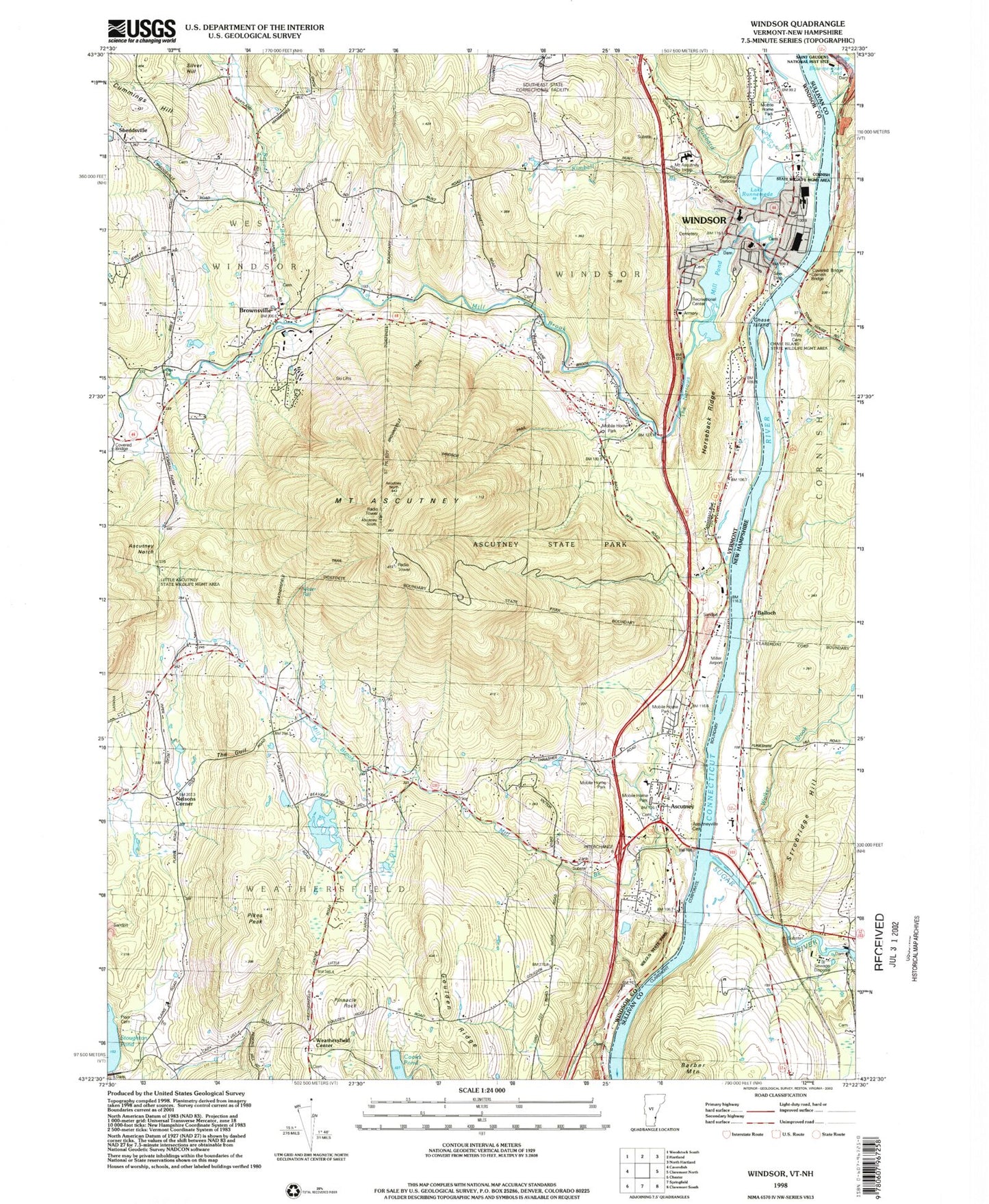
Classic USGS Windsor Vermont 7.5'x7.5' Topo Map
Couldn't load pickup availability
Historical USGS topographic quad map of Windsor in the states of Vermont, New Hampshire. Typical map scale is 1:24,000, but may vary for certain years, if available. Print size: 24" x 27"
This quadrangle is in the following counties: Sullivan, Windsor.
The map contains contour lines, roads, rivers, towns, and lakes. Printed on high-quality waterproof paper with UV fade-resistant inks, and shipped rolled.
Contains the following named places: Ascutney, Ascutney Notch, Ascutney State Park, Beaver Brook, Brownsville, Cooks Pond, Cummings Hill, Goulden Ridge, Horseback Ridge, Hubbard Brook, Kimball Brook, Marsh School, Mill Brook, Mill Brook, Mill Pond, Pikes Peak, Pinnacle Rock, Plain Cemetery, Lake Runnenede, Sheddsville, Stoughton Pond, The Gulf, The Narrows, Weathersfield Center, Wilgus State Park, Windsor, Nelsons Corner, Mount Ascutney, Windsor Armory Heliport, WVPR-FM (Windsor), WNNE-TV (Hartford), WVTA-TV (Windsor), Town of Weathersfield, Town of West Windsor, Town of Windsor, Windsor Upper Dam, Lake Runnemede Dam, Howland Dam, Agatha Young Library, Albert Bridge School, Ascutneyville Cemetery, Ascutney Cemetery, Ascutneyville Cemetery, Ascutney Post Office, Bowers Covered Bridge, Brownsville Community Church, Brownsville Number 1 Cemetery, Brownsville Post Office, Cornish Bridge, Crystal Cascade Falls, Futures Trail, Gerrys Falls, Grout Cemetery, Hang Glider Trail, Knee Lookout, Little Cascade Falls, Miller Airport (historical), Mount Ascutney Hospital and Health Center, Mount Ascuteney Ski Area, Mount Ascutney State Park Campground, Old South Church Cemetery, Old South Church, Running Bear Campground, Sheddsville Cemetery, Slot Trail, Tolles Cemetery, Trinity Cemetery, Tuttle Cemetery, Weathersfield Center Historic District, Weathersfield Middle School, Windsor High School, Windsor Municipal Forest, Windsor Post Office, Windsor Public Library, Windsor State Street School, Windsor Village Historic District, Brownsville Cemetery, Little Ascutney State Wildlife Manage Area, Silver Hill, Ascutney Volunteer Fire Department, West Windsor Volunteer Fire Department, Windsor Fire Department, Windsor Southeast Supervisory Union, Ascutney Census Designated Place, Windsor Census Designated Place, Windsor Police Department, Weathersfield Police, Barber Mountain, Blow-me-down Brook, Blow-me-down Pond, Chase Island, Cornish Bridge, Lottery Bridge, Mill Brook, Strobridge Hill, Trinity Church, Walker Brook, Balloch, Sugar River, Saint Gaudens National Historic Site, Coy Dam, Sugar River Reservoir, Cornish-Windsor Bridge, Trinity Cemetery, Cornish State Wildlife Management Area, Chase Island State Wildlife Management Area