MyTopo
Classic USGS Windy Hill Texas 7.5'x7.5' Topo Map
Couldn't load pickup availability
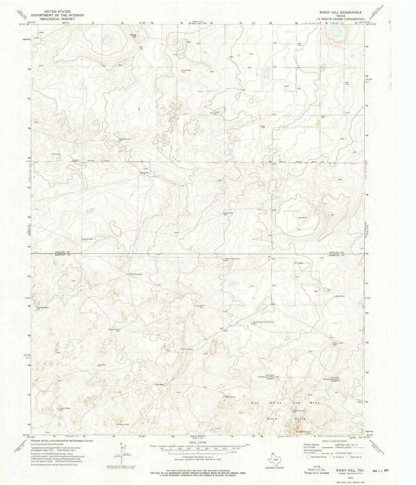
Historical USGS topographic quad map of Windy Hill in the state of Texas. Map scale may vary for some years, but is generally around 1:24,000. Print size is approximately 24" x 27"
This quadrangle is in the following counties: Dallam, Hartley.
The map contains contour lines, roads, rivers, towns, and lakes. Printed on high-quality waterproof paper with UV fade-resistant inks, and shipped rolled.
Contains the following named places: Bagot Ranch, Cakehouse Well, Dinkle Well, Dipping Vat Well, Dogtown Well, East Well, Field Well, Flower Well, Greenhouse Well, House Well, Lake Well, Lake Windmill, Martin Ranch, Middle Well, Northeast Red White and Blue Windmill, Northwest Red White and Blue Windmill, Red White and Blue Camp Well, Red White and Blue Sand Hills, Sandhill Well, Sandhill Windmill, Southwest Well, Steel Windmill, West Yellowhouse Well, Windy Hill