
MyTopo
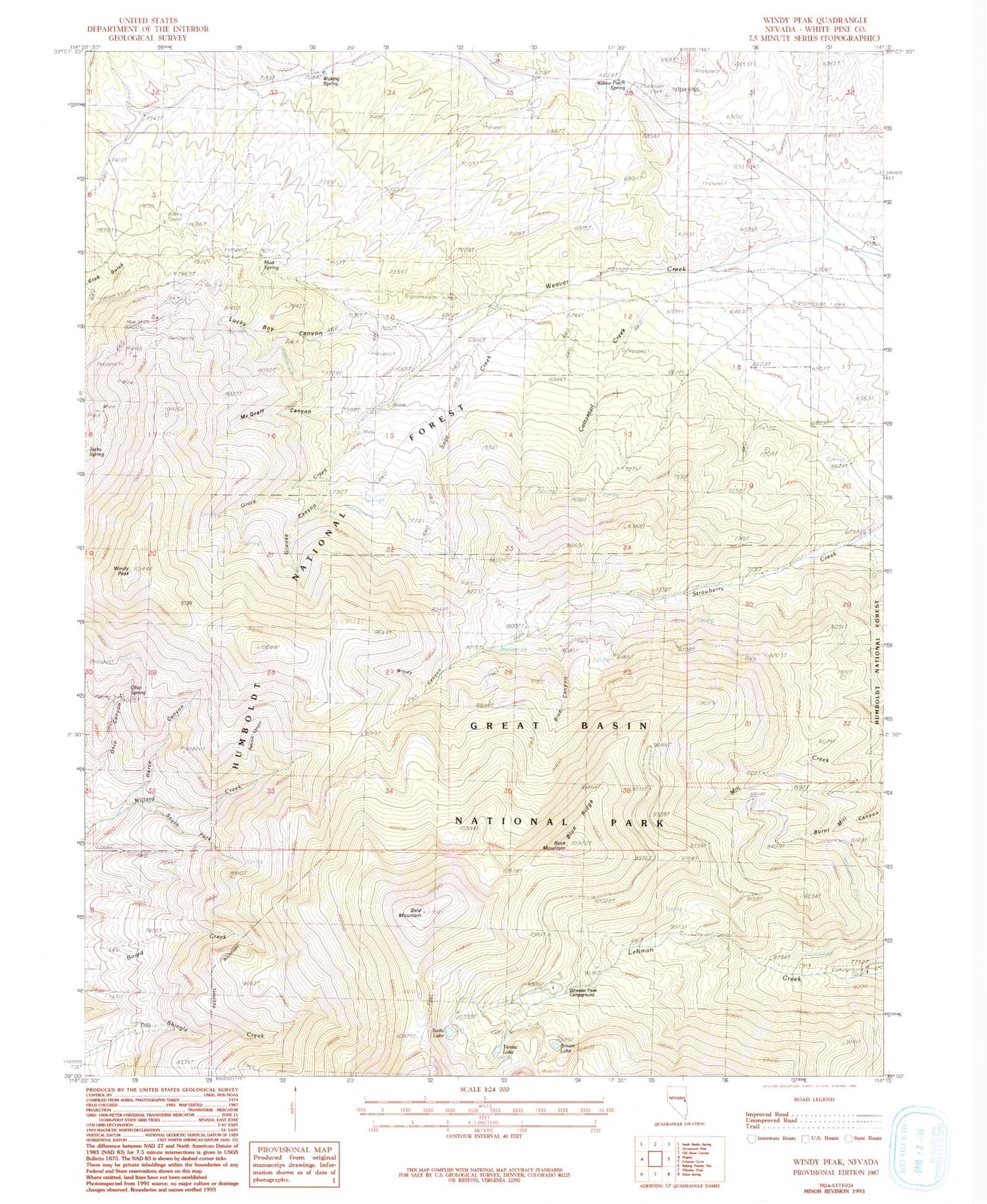
Classic USGS Windy Peak Nevada 7.5'x7.5' Topo Map
Couldn't load pickup availability
Historical USGS topographic quad map of Windy Peak in the state of Nevada. Typical map scale is 1:24,000, but may vary for certain years, if available. Print size: 24" x 27"
This quadrangle is in the following counties: White Pine.
The map contains contour lines, roads, rivers, towns, and lakes. Printed on high-quality waterproof paper with UV fade-resistant inks, and shipped rolled.
Contains the following named places: Mathis Ranch, Summit Diggings, Star Mine, Pea Ridge Mine, Crescent Mine, Time Check Mine, Cumberland Mine, Exchange Mine, Black Mule Mine, Dirty Shirt Mine, Three Sisters Mine, Osceola Mining District, San Pedro (historical), Bald Mountain, Blue Canyon, Blue Ridge, Board Creek, Brown Lake, Buck Mountain, Cottonwood Creek, Grace Creek, Grouse Canyon, Horse Canyon, Lucky Boy Canyon, McGraff Canyon, Mud Spring, Ohio Canyon, Ohio Spring, Peacock Canyon, Sage Creek, South Fork Willard Creek, Stella Lake, Willow Patch Spring, Windy Canyon, Windy Peak, Watkins Spring, Wheeler Peak Campground, The Willows (historical), Monroe Spring, Red Canon, Seren View Point, Lehman Creek Campground and Trailhead, Osceola Ditch Point of Interest, Solace Loop, Peak View Point, Mill Creek, Teresa Lake, Sanpedro Post Office (historical)


