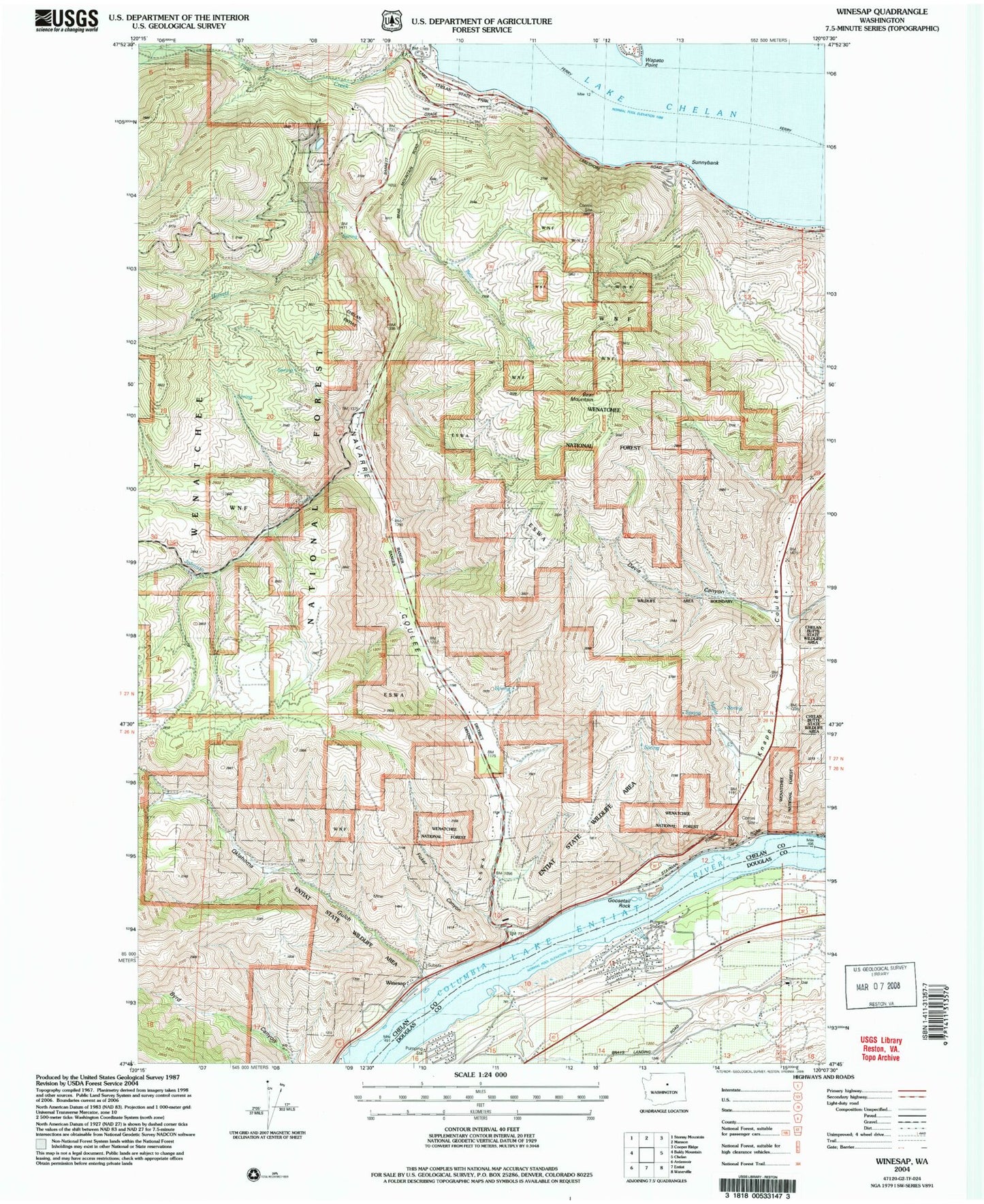
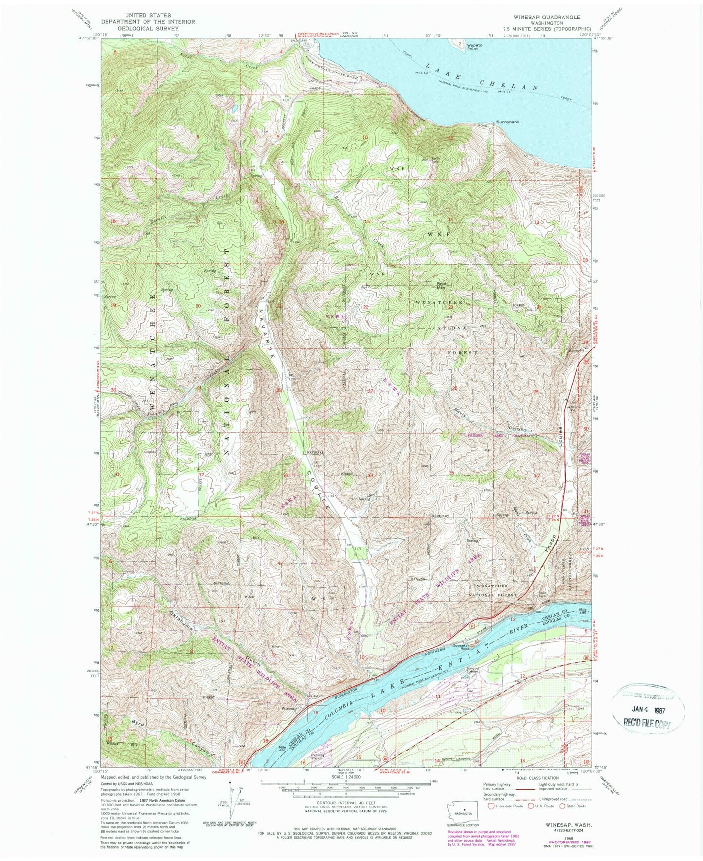
MyTopo
Classic USGS Winesap Washington 7.5'x7.5' Topo Map
Couldn't load pickup availability
Historical USGS topographic quad map of Winesap in the state of Washington. Map scale may vary for some years, but is generally around 1:24,000. Print size is approximately 24" x 27"
This quadrangle is in the following counties: Chelan, Douglas.
The map contains contour lines, roads, rivers, towns, and lakes. Printed on high-quality waterproof paper with UV fade-resistant inks, and shipped rolled.
Contains the following named places: Barrett Creek, Bear Creek, Bear Mountain, Davis Canyon, Entiat State Wildlife Area, Ficher Canyon, Goosetail Rock, Johnson Creek, Knapp Coulee, Knapps Hill Tunnel, Lake Chelan State Park, Lake Entiat, Maple Creek, Maplecreek, Navarre Coulee, Oklahoma Gulch, Rocky Pond Airstrip, Ross Private Strip, South Shore, Sunnybank, Wapato Point, Winesap