MyTopo
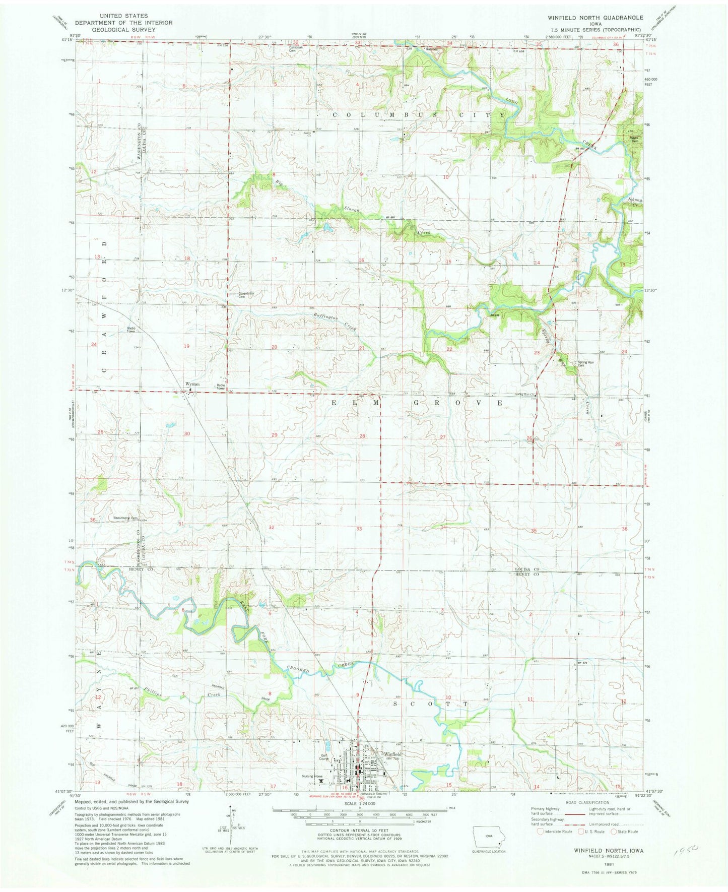
Classic USGS Winfield North Iowa 7.5'x7.5' Topo Map
Couldn't load pickup availability
Historical USGS topographic quad map of Winfield North in the state of Iowa. Map scale may vary for some years, but is generally around 1:24,000. Print size is approximately 24" x 27"
This quadrangle is in the following counties: Henry, Louisa, Washington.
The map contains contour lines, roads, rivers, towns, and lakes. Printed on high-quality waterproof paper with UV fade-resistant inks, and shipped rolled.
Contains the following named places: Beauchamp Cemetery, Big Slough Creek, Bretz Cemetery, Buffington Cemetery, Buffington Creek, Cambrian Cemetery, City of Winfield, Covenantor Cemetery, First Presbyterian Church, Gripple's Quarry Bridge, Hochreider Cemetery, Johnny Creek, May Cemetery, Open Bible Standard Church, Phillips Creek, Richie Cemetery, Salem Church, Spring Run Cemetery, Spring Run Church, Spring Run Creek, Township of Elm Grove, Twin Lakes Country Club, United Methodist Church, Winfield, Winfield - Mount Union Middle / High School, Winfield Elementary School, Winfield Fire and Rescue, Winfield Municipal Library, Winfield Museum, Winfield Post Office, Wyman, Wyman Post Office, ZIP Code: 52659