MyTopo
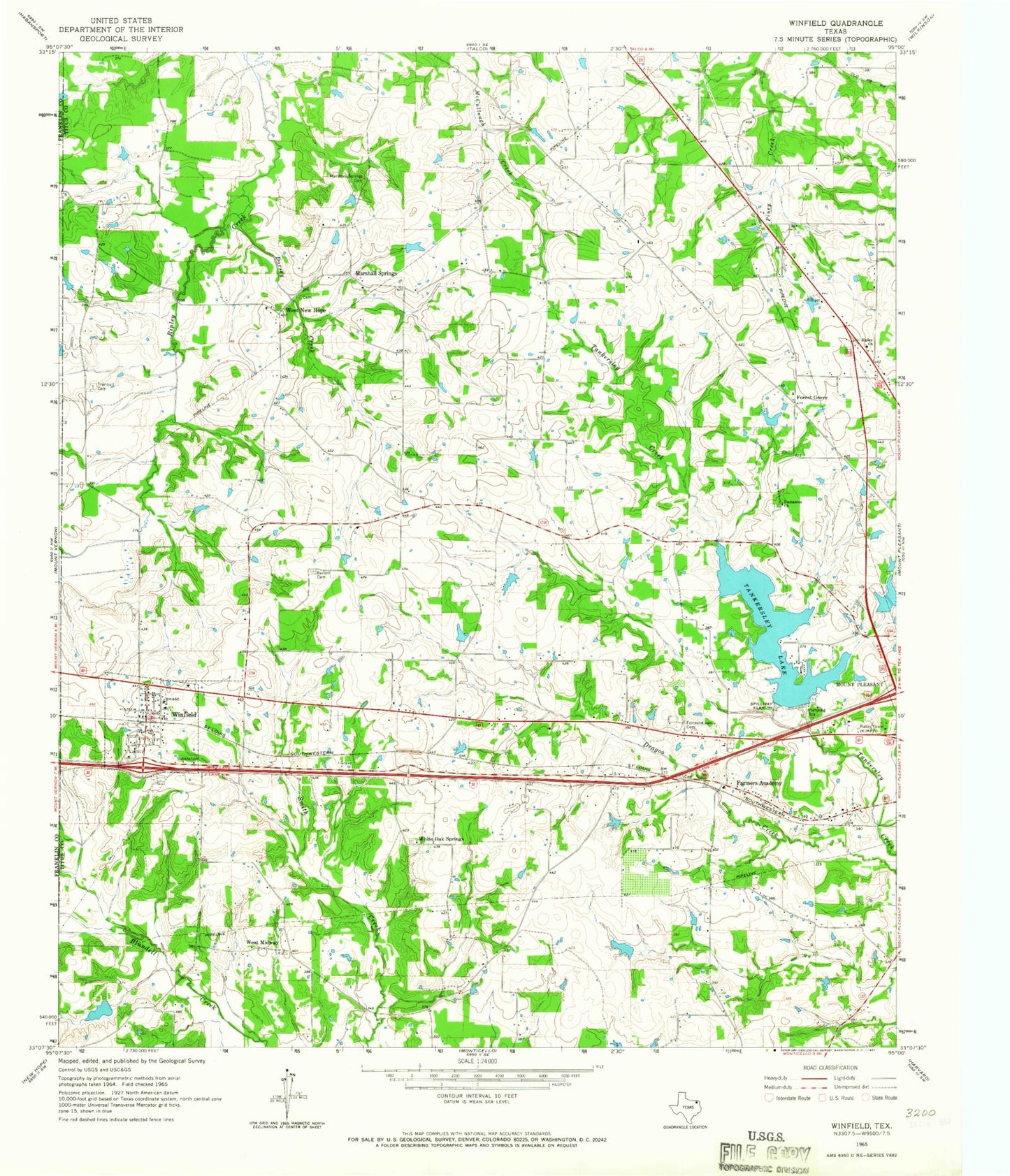
Classic USGS Winfield Texas 7.5'x7.5' Topo Map
Couldn't load pickup availability
Historical USGS topographic quad map of Winfield in the state of Texas. Map scale may vary for some years, but is generally around 1:24,000. Print size is approximately 24" x 27"
This quadrangle is in the following counties: Franklin, Titus.
The map contains contour lines, roads, rivers, towns, and lakes. Printed on high-quality waterproof paper with UV fade-resistant inks, and shipped rolled.
Contains the following named places: Barrett Cemetery, City of Winfield, Damascus Church, Davis Newsom Dam, Davis Newsom Lake, Dorsey Creek, Farmers Academy, Forest Grove, Forrest Lawn Cemetery, Glover Airport, John B Stephens Junior Lake, John B Stephens Junior Lake Dam, John W May Lake, John W May Lake Dam, KALK-FM (Winfield), KIMP-AM (Mount Pleasant), Marshall Springs, Marshall Springs Cemetery, Millers Cove, Ripley Church, Sam Parker Field, Tankersley Dam, Tankersley Lake, Town of Miller's Cove, Tranquil Cemetery, Trinity Baptist Church, West Midway, West New Hope, White Oak Springs, Winfield, Winfield City Hall, Winfield Division, Winfield Police Department, Winfield Post Office, ZIP Code: 75493