MyTopo
Classic USGS Winigan Missouri 7.5'x7.5' Topo Map
Couldn't load pickup availability
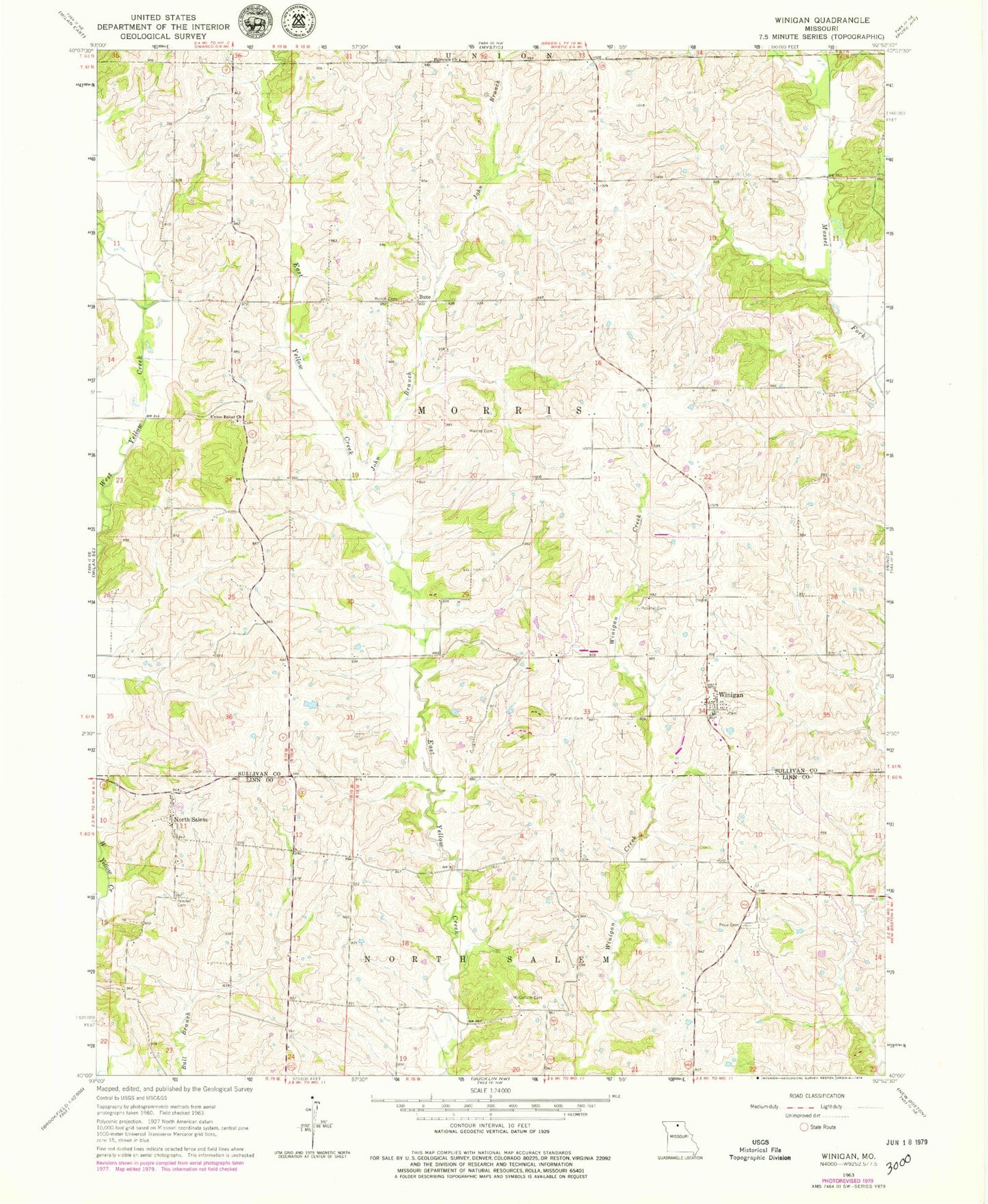
Historical USGS topographic quad map of Winigan in the state of Missouri. Map scale may vary for some years, but is generally around 1:24,000. Print size is approximately 24" x 27"
This quadrangle is in the following counties: Linn, Sullivan.
The map contains contour lines, roads, rivers, towns, and lakes. Printed on high-quality waterproof paper with UV fade-resistant inks, and shipped rolled.
Contains the following named places: Brantner Lake Dam, Bunch Cemetery, Bute, Chaplin School, East Winigan School, Fairview Church, Haines Cemetery, John Branch, Lone Star School, McCollum Cemetery, Mononame 43 Lake, Morris School, Mount Olive School, North Salem, North Salem Cemetery, North Salem School, Peavler Cemetery, Pickerel Cemetery, Price Cemetery, Rose Hill School, Sedgwick, Sedgwick Post Office, Tallman Cemetery, Township of Morris, Township of North Salem, Union Baker Church, Winigan, Winigan Census Designated Place, Winigan Post Office, Winigan Rural Fire Department, ZIP Code: 63566