MyTopo
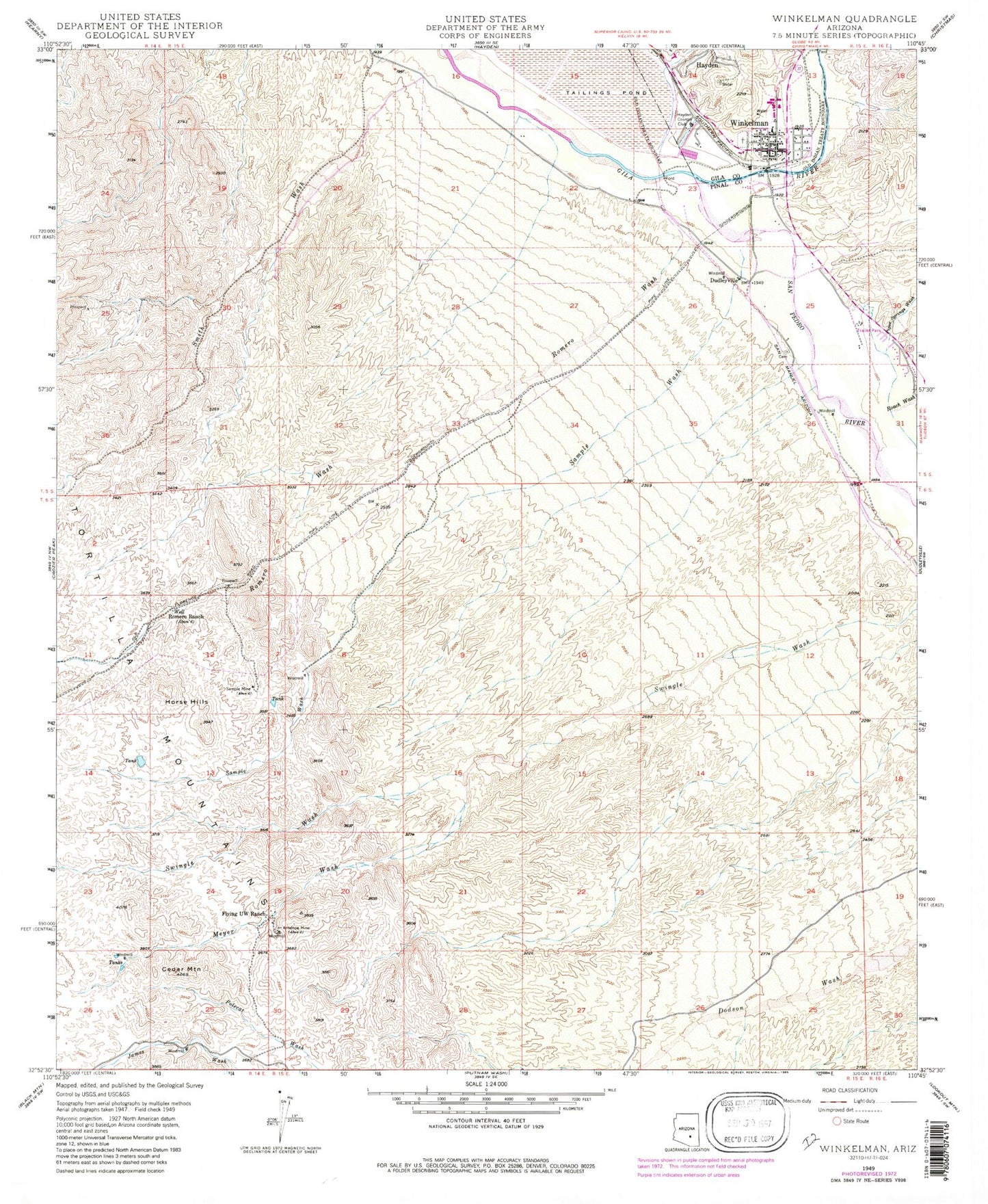
Classic USGS Winkelman Arizona 7.5'x7.5' Topo Map
Couldn't load pickup availability
Historical USGS topographic quad map of Winkelman in the state of Arizona. Map scale may vary for some years, but is generally around 1:24,000. Print size is approximately 24" x 27"
This quadrangle is in the following counties: Gila, Pinal.
The map contains contour lines, roads, rivers, towns, and lakes. Printed on high-quality waterproof paper with UV fade-resistant inks, and shipped rolled.
Contains the following named places: Antelope Mine, Cedar Mountain, Dudleyville Cemetery, Dudleyville Census Designated Place, Flying UW Ranch, Hayden Country Club, Hayden High School, Hayden Unified School, Horse Hills, James Wash, Leonor Hambly Middle School, Meyer Wash, Piper Springs Wash, Roach Wash, Romero Ranch, Romero Wash, Sample Mine, Sample Wash, San Pedro River, Town of Hayden, Town of Winkelman, Town of Winkleman Wastewater Treatment Facility, Winkelman, Winkelman Elementary School, Winkelman Intermediate School, Winkelman Post Office, Winkelman Volunteer Fire Department