MyTopo
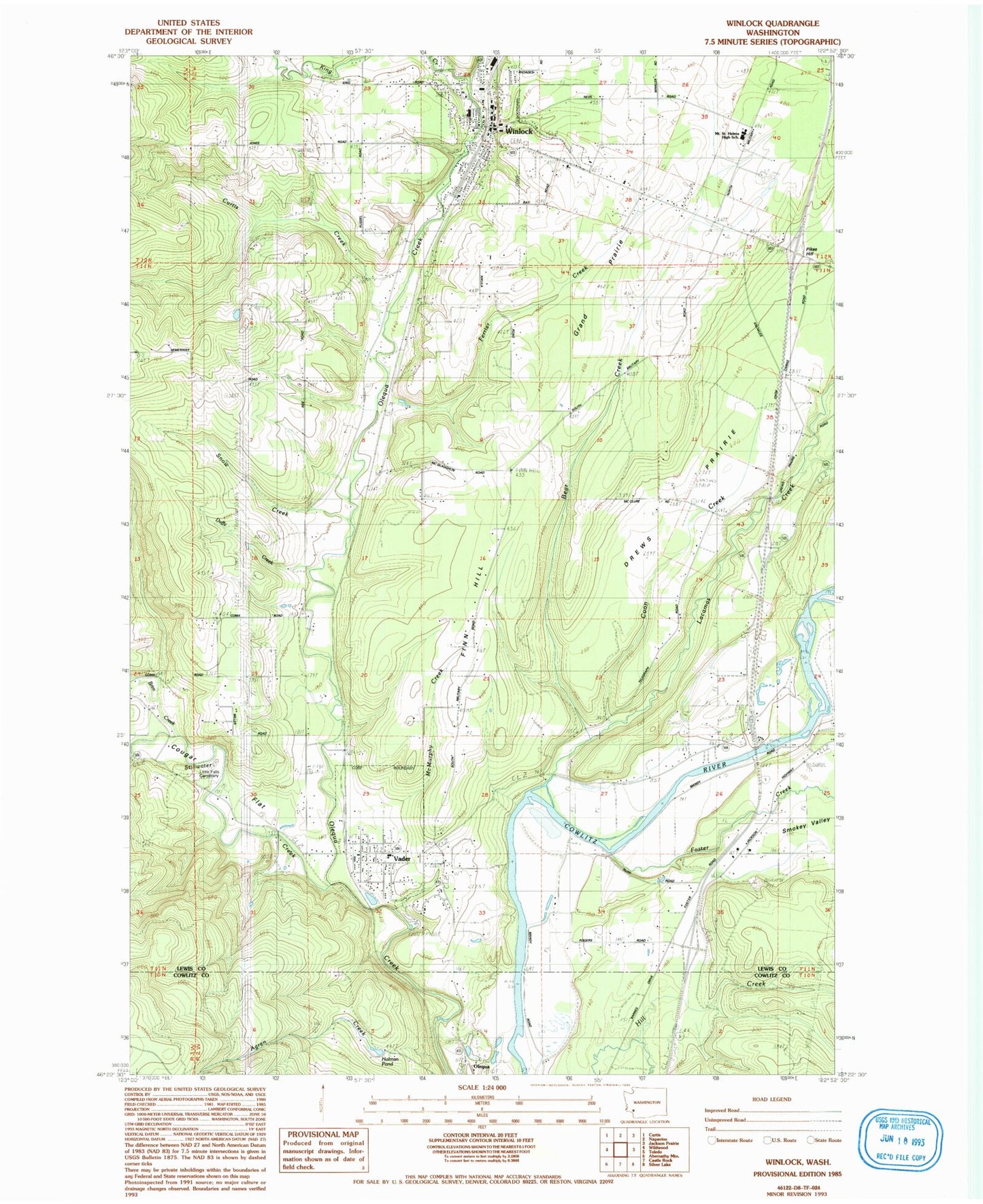
Classic USGS Winlock Washington 7.5'x7.5' Topo Map
Couldn't load pickup availability
Historical USGS topographic quad map of Winlock in the state of Washington. Map scale may vary for some years, but is generally around 1:24,000. Print size is approximately 24" x 27"
This quadrangle is in the following counties: Cowlitz, Lewis.
The map contains contour lines, roads, rivers, towns, and lakes. Printed on high-quality waterproof paper with UV fade-resistant inks, and shipped rolled.
Contains the following named places: Agren Creek, Bear Creek, Brim Creek, Brim Creek School, City of Vader, City of Winlock, Coon Creek, Cougar Flat Grange, Curtis Creek, Drews Prairie, Duffy Creek, Ferrier Creek, Finn Hill, Foster Creek, Grand Prairie, King Creek, Lacamas Creek, Lewis County Fire District 15 Station 1, Lewis County Fire District 15 Station 2, Lewis County Fire District 7, Little Falls Cemetery, McMurphy Creek, Mickelsen Dairy, Mount Saint Helens High School, Pikes Hill, Smokey Valley, Snow Creek, Stillwater Creek, Toledo-Vader Division, Vader, Vader Elementary School, Vader Junction, Vader Post Office, Vista Mobile Estate Airport, Winlock, Winlock Cemetery, Winlock Middle School, Winlock Miller Elementary School, Winlock Post Office, Winlock Senior High School, ZIP Code: 98596